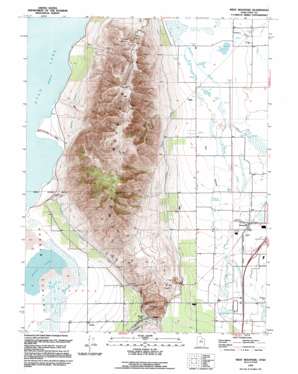
West Mountain Topo Map Utah
To zoom in, hover over the map of West Mountain
USGS Topo Quad 40111a7 - 1:24,000 scale
| Topo Map Name: | West Mountain |
| USGS Topo Quad ID: | 40111a7 |
| Print Size: | ca. 21 1/4" wide x 27" high |
| Southeast Coordinates: | 40° N latitude / 111.75° W longitude |
| Map Center Coordinates: | 40.0625° N latitude / 111.8125° W longitude |
| U.S. State: | UT |
| Filename: | o40111a7.jpg |
| Download Map JPG Image: | West Mountain topo map 1:24,000 scale |
| Map Type: | Topographic |
| Topo Series: | 7.5´ |
| Map Scale: | 1:24,000 |
| Source of Map Images: | United States Geological Survey (USGS) |
| Alternate Map Versions: |
West Mountain UT 1950, updated 1951 Download PDF Buy paper map West Mountain UT 1950, updated 1971 Download PDF Buy paper map West Mountain UT 1950, updated 1978 Download PDF Buy paper map West Mountain UT 1994, updated 1994 Download PDF Buy paper map West Mountain UT 2011 Download PDF Buy paper map West Mountain UT 2014 Download PDF Buy paper map |
1:24,000 Topo Quads surrounding West Mountain
> Back to 40111a1 at 1:100,000 scale
> Back to 40110a1 at 1:250,000 scale
> Back to U.S. Topo Maps home
West Mountain topo map: Gazetteer
West Mountain: Gaps
Goshen Gap elevation 1456m 4776′West Mountain: Lakes
White Lake elevation 1372m 4501′West Mountain: Mines
Keigley Quarry elevation 1457m 4780′West Mountain: Populated Places
Keigley elevation 1455m 4773′West Mountain elevation 1386m 4547′
West Mountain: Reservoirs
Tanner Reservoir elevation 1388m 4553′West Mountain: Ridges
Long Ridge elevation 1718m 5636′West Mountain: Springs
Holladay Springs elevation 1431m 4694′West Mountain: Streams
Beer Creek elevation 1373m 4504′Spring Creek elevation 1373m 4504′
West Mountain: Summits
West Mountain elevation 2074m 6804′West Mountain: Valleys
Dry Hollow elevation 1372m 4501′Long Canyon elevation 1496m 4908′
West Mountain digital topo map on disk
Buy this West Mountain topo map showing relief, roads, GPS coordinates and other geographical features, as a high-resolution digital map file on DVD:


