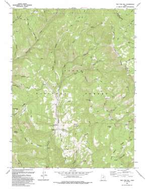
Two Tom Hill Topo Map Utah
To zoom in, hover over the map of Two Tom Hill
USGS Topo Quad 40111b3 - 1:24,000 scale
| Topo Map Name: | Two Tom Hill |
| USGS Topo Quad ID: | 40111b3 |
| Print Size: | ca. 21 1/4" wide x 27" high |
| Southeast Coordinates: | 40.125° N latitude / 111.25° W longitude |
| Map Center Coordinates: | 40.1875° N latitude / 111.3125° W longitude |
| U.S. State: | UT |
| Filename: | o40111b3.jpg |
| Download Map JPG Image: | Two Tom Hill topo map 1:24,000 scale |
| Map Type: | Topographic |
| Topo Series: | 7.5´ |
| Map Scale: | 1:24,000 |
| Source of Map Images: | United States Geological Survey (USGS) |
| Alternate Map Versions: |
Two Tom Hill UT 1967, updated 1969 Download PDF Buy paper map Two Tom Hill UT 1967, updated 1978 Download PDF Buy paper map Two Tom Hill UT 1993, updated 1994 Download PDF Buy paper map Two Tom Hill UT 1998, updated 2000 Download PDF Buy paper map Two Tom Hill UT 2011 Download PDF Buy paper map Two Tom Hill UT 2014 Download PDF Buy paper map |
| FStopo: | US Forest Service topo Two Tom Hill is available: Download FStopo PDF Download FStopo TIF |
1:24,000 Topo Quads surrounding Two Tom Hill
> Back to 40111a1 at 1:100,000 scale
> Back to 40110a1 at 1:250,000 scale
> Back to U.S. Topo Maps home
Two Tom Hill topo map: Gazetteer
Two Tom Hill: Forests
Uinta National Forest elevation 2422m 7946′Two Tom Hill: Pillars
Ruby Christensen Memorial Youth Forest elevation 2357m 7732′Two Tom Hill: Populated Places
West Portal elevation 2275m 7463′Two Tom Hill: Ridges
Fifth Water Ridge elevation 2453m 8047′Pump Ridge elevation 2364m 7755′
Tanner Ridge elevation 2211m 7253′
Two Tom Hill: Slopes
Farmer Slope elevation 2043m 6702′Two Tom Hill: Streams
Chase Creek elevation 2016m 6614′Dip Vat Creek elevation 2132m 6994′
Halls Fork elevation 2005m 6578′
Shingle Mill Fork elevation 2018m 6620′
Yellowjacket Creek elevation 2141m 7024′
Two Tom Hill: Summits
Fifth Water elevation 2530m 8300′Mollies Nipple elevation 2368m 7769′
Pumphouse Hill elevation 2508m 8228′
Red Mountain elevation 2467m 8093′
Timber Mountain elevation 2429m 7969′
Two Tom Hill elevation 2533m 8310′
Two Tom Hill: Valleys
Clark Hollow elevation 1951m 6400′Sawmill Hollow elevation 1891m 6204′
Slab Canyon elevation 2176m 7139′
Thorn Hollow elevation 2165m 7103′
Upper Clark Hollow elevation 2065m 6774′
Two Tom Hill digital topo map on disk
Buy this Two Tom Hill topo map showing relief, roads, GPS coordinates and other geographical features, as a high-resolution digital map file on DVD:


