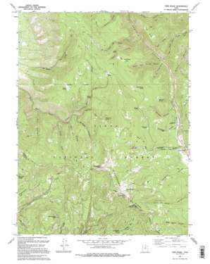
Twin Peaks Topo Map Utah
To zoom in, hover over the map of Twin Peaks
USGS Topo Quad 40111c3 - 1:24,000 scale
| Topo Map Name: | Twin Peaks |
| USGS Topo Quad ID: | 40111c3 |
| Print Size: | ca. 21 1/4" wide x 27" high |
| Southeast Coordinates: | 40.25° N latitude / 111.25° W longitude |
| Map Center Coordinates: | 40.3125° N latitude / 111.3125° W longitude |
| U.S. State: | UT |
| Filename: | o40111c3.jpg |
| Download Map JPG Image: | Twin Peaks topo map 1:24,000 scale |
| Map Type: | Topographic |
| Topo Series: | 7.5´ |
| Map Scale: | 1:24,000 |
| Source of Map Images: | United States Geological Survey (USGS) |
| Alternate Map Versions: |
Twin Peaks UT 1967, updated 1969 Download PDF Buy paper map Twin Peaks UT 1967, updated 1979 Download PDF Buy paper map Twin Peaks UT 1994, updated 1994 Download PDF Buy paper map Twin Peaks UT 1994, updated 1994 Download PDF Buy paper map Twin Peaks UT 1998, updated 2000 Download PDF Buy paper map Twin Peaks UT 2011 Download PDF Buy paper map Twin Peaks UT 2014 Download PDF Buy paper map |
| FStopo: | US Forest Service topo Twin Peaks is available: Download FStopo PDF Download FStopo TIF |
1:24,000 Topo Quads surrounding Twin Peaks
> Back to 40111a1 at 1:100,000 scale
> Back to 40110a1 at 1:250,000 scale
> Back to U.S. Topo Maps home
Twin Peaks topo map: Gazetteer
Twin Peaks: Benches
Row Bench elevation 2408m 7900′Twin Peaks: Canals
Highline Canal elevation 1944m 6377′Twin Peaks: Flats
Big Glade elevation 2645m 8677′Dock Flat elevation 2508m 8228′
Dockweed Flat elevation 2541m 8336′
Twin Peaks: Gaps
Daniels Pass elevation 2435m 7988′Twin Peaks: Populated Places
Independence elevation 2432m 7979′Twin Peaks: Reservoirs
Harris Reservoir elevation 2675m 8776′Twin Peaks: Springs
Buck Spring elevation 2855m 9366′Burnt Stump Spring elevation 2622m 8602′
Cabin Spring elevation 2448m 8031′
Circle Spring elevation 2533m 8310′
Foreman Spring elevation 2642m 8667′
Mule Ear Spring elevation 2475m 8120′
Second Set Spring elevation 2588m 8490′
Shingle Spring elevation 2679m 8789′
Willow Spring elevation 2434m 7985′
Twin Peaks: Streams
Brumley Creek elevation 2085m 6840′Glen Cabin Creek elevation 2263m 7424′
Wheeler Fork elevation 2199m 7214′
Twin Peaks: Summits
Strawberry Peak elevation 2958m 9704′Twin Peaks elevation 2957m 9701′
Wardsworth Peak elevation 2689m 8822′
Twin Peaks: Valleys
Cabin Hollow elevation 2210m 7250′East Fork Three Forks elevation 2181m 7155′
Foreman Hollow elevation 2356m 7729′
McGuire Hollow elevation 2205m 7234′
North Fork Three Forks elevation 2176m 7139′
Pete Canyon elevation 2329m 7641′
Row Hollow elevation 2168m 7112′
Second Set elevation 2291m 7516′
Shingle Hollow elevation 2306m 7565′
South Fork Three Forks elevation 2177m 7142′
Thornton Hollow elevation 2119m 6952′
Twin Peaks digital topo map on disk
Buy this Twin Peaks topo map showing relief, roads, GPS coordinates and other geographical features, as a high-resolution digital map file on DVD:


