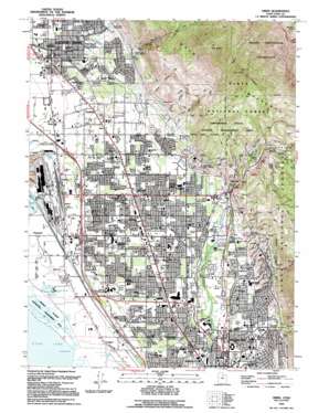
Orem Topo Map Utah
To zoom in, hover over the map of Orem
USGS Topo Quad 40111c6 - 1:24,000 scale
| Topo Map Name: | Orem |
| USGS Topo Quad ID: | 40111c6 |
| Print Size: | ca. 21 1/4" wide x 27" high |
| Southeast Coordinates: | 40.25° N latitude / 111.625° W longitude |
| Map Center Coordinates: | 40.3125° N latitude / 111.6875° W longitude |
| U.S. State: | UT |
| Filename: | o40111c6.jpg |
| Download Map JPG Image: | Orem topo map 1:24,000 scale |
| Map Type: | Topographic |
| Topo Series: | 7.5´ |
| Map Scale: | 1:24,000 |
| Source of Map Images: | United States Geological Survey (USGS) |
| Alternate Map Versions: |
Orem UT 1948, updated 1957 Download PDF Buy paper map Orem UT 1948, updated 1965 Download PDF Buy paper map Orem UT 1948, updated 1971 Download PDF Buy paper map Orem UT 1948, updated 1979 Download PDF Buy paper map Orem UT 1950 Download PDF Buy paper map Orem UT 1994, updated 1994 Download PDF Buy paper map Orem UT 1994, updated 1994 Download PDF Buy paper map Orem UT 1998, updated 2000 Download PDF Buy paper map Orem UT 2011 Download PDF Buy paper map Orem UT 2014 Download PDF Buy paper map |
| FStopo: | US Forest Service topo Orem is available: Download FStopo PDF Download FStopo TIF |
1:24,000 Topo Quads surrounding Orem
> Back to 40111a1 at 1:100,000 scale
> Back to 40110a1 at 1:250,000 scale
> Back to U.S. Topo Maps home
Orem topo map: Gazetteer
Orem: Benches
Provo Bench elevation 1452m 4763′Orem: Canals
Alta Aqueduct elevation 1680m 5511′Lake Bottom Canal elevation 1389m 4557′
North Union Canal elevation 1460m 4790′
Provo Bench Canal elevation 1468m 4816′
Timranogos Canal elevation 1463m 4799′
Union Aqueduct elevation 1564m 5131′
Upper Union Canal elevation 1437m 4714′
West Union Canal elevation 1438m 4717′
Orem: Crossings
Interchange 272 elevation 1391m 4563′Interchange 274 elevation 1403m 4603′
Interchange 275 elevation 1415m 4642′
Interchange 276 elevation 1403m 4603′
Orem: Dams
Battle Creek Debris Basin Dam elevation 1589m 5213′Grove Creek Debris Basin Dam elevation 1525m 5003′
Orem: Parks
Cougar Stadium elevation 1435m 4708′Orem Bench Wildlife Management Area elevation 1799m 5902′
Powell Slough Waterfowl Management Area elevation 1372m 4501′
Orem: Populated Places
Bunker elevation 1391m 4563′Caryhurst elevation 1466m 4809′
Christmas City elevation 1492m 4895′
Curtis elevation 1446m 4744′
Edgemont elevation 1461m 4793′
Geneva elevation 1381m 4530′
Hardy elevation 1384m 4540′
Lakeview elevation 1381m 4530′
Lincoln elevation 1446m 4744′
Lindon elevation 1415m 4642′
Olmstead elevation 1478m 4849′
Orem elevation 1455m 4773′
Orem Station elevation 1450m 4757′
Pleasant Grove elevation 1409m 4622′
Pleasant View elevation 1424m 4671′
Snow elevation 1451m 4760′
Vineyard elevation 1379m 4524′
Wicks elevation 1494m 4901′
Orem: Post Offices
Orem Post Office elevation 1455m 4773′Pleasant Grove Post Office elevation 1407m 4616′
Orem: Reservoirs
Battle Creek Debris Basin Reservoir elevation 1589m 5213′Grove Creek Debris Basin Reservoir elevation 1525m 5003′
Orem: Streams
Battle Creek elevation 1450m 4757′Grove Creek elevation 1453m 4767′
North Fork Battle Creek elevation 1941m 6368′
Orem: Summits
Big Baldy elevation 2662m 8733′Little Baldy elevation 2336m 7664′
Orem: Trails
Indian Trail elevation 2252m 7388′Orem: Valleys
Dry Canyon elevation 1509m 4950′Little Rock Canyon elevation 1484m 4868′
Pole Canyon elevation 1519m 4983′
Provo Canyon elevation 1470m 4822′
Rock Canyon elevation 1487m 4878′
Squaw Hollow elevation 1488m 4881′
Sumac Hollow elevation 1498m 4914′
Orem digital topo map on disk
Buy this Orem topo map showing relief, roads, GPS coordinates and other geographical features, as a high-resolution digital map file on DVD:


