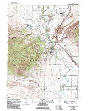
Jordan Narrows Topo Map Utah
To zoom in, hover over the map of Jordan Narrows
USGS Topo Quad 40111d8 - 1:24,000 scale
| Topo Map Name: | Jordan Narrows |
| USGS Topo Quad ID: | 40111d8 |
| Print Size: | ca. 21 1/4" wide x 27" high |
| Southeast Coordinates: | 40.375° N latitude / 111.875° W longitude |
| Map Center Coordinates: | 40.4375° N latitude / 111.9375° W longitude |
| U.S. State: | UT |
| Filename: | o40111d8.jpg |
| Download Map JPG Image: | Jordan Narrows topo map 1:24,000 scale |
| Map Type: | Topographic |
| Topo Series: | 7.5´ |
| Map Scale: | 1:24,000 |
| Source of Map Images: | United States Geological Survey (USGS) |
| Alternate Map Versions: |
Jordan Narrows UT 1951, updated 1952 Download PDF Buy paper map Jordan Narrows UT 1951, updated 1955 Download PDF Buy paper map Jordan Narrows UT 1951, updated 1966 Download PDF Buy paper map Jones Narrows UT 1951, updated 1971 Download PDF Buy paper map Jordan Narrows UT 1951, updated 1978 Download PDF Buy paper map Jones Narrows UT 1951, updated 1980 Download PDF Buy paper map Jordan Narrows UT 1993, updated 1993 Download PDF Buy paper map Jordan Narrows UT 1999, updated 2001 Download PDF Buy paper map Jordan Narrows UT 2011 Download PDF Buy paper map Jordan Narrows UT 2014 Download PDF Buy paper map |
1:24,000 Topo Quads surrounding Jordan Narrows
> Back to 40111a1 at 1:100,000 scale
> Back to 40110a1 at 1:250,000 scale
> Back to U.S. Topo Maps home
Jordan Narrows topo map: Gazetteer
Jordan Narrows: Airports
Camp Williams Airfield elevation 1499m 4917′Camp Williams Heliport elevation 1515m 4970′
Utah State Prison Heliport elevation 1359m 4458′
Jordan Narrows: Canals
Draper Canal elevation 1392m 4566′Saratoga Canal elevation 1398m 4586′
Utah Lake Distributing Canal elevation 1395m 4576′
Jordan Narrows: Capes
Point of the Mountain elevation 1548m 5078′Jordan Narrows: Crossings
Interchange 287 elevation 1409m 4622′Interchange 291 elevation 1401m 4596′
Jordan Narrows: Dams
Jordan Valley Water Purification Dam elevation 1464m 4803′Jordan Narrows: Gaps
Jordan Narrows elevation 1378m 4520′Jordan Narrows: Populated Places
Avalon Estates elevation 1376m 4514′Bluffdale elevation 1352m 4435′
Clinton elevation 1427m 4681′
Country Living elevation 1411m 4629′
Gardiner Estates elevation 1427m 4681′
Johnson Anderson elevation 1389m 4557′
Jordan elevation 1362m 4468′
Lewis Estates elevation 1362m 4468′
Moyal Anderson elevation 1356m 4448′
Nash elevation 1371m 4498′
Olivers elevation 1361m 4465′
Plaza Condominiums elevation 1377m 4517′
South Bluff Estates elevation 1398m 4586′
Wood Hollow Ranchettes elevation 1402m 4599′
Jordan Narrows: Ranges
Traverse Mountains elevation 1649m 5410′Jordan Narrows: Reservoirs
Jordan Valley Water Purification Reservoir elevation 1464m 4803′Jordan Narrows: Summits
Cedar Point elevation 1958m 6423′Steep Mountain elevation 1877m 6158′
Jordan Narrows: Valleys
Beef Hollow elevation 1400m 4593′Oak Hollow elevation 1378m 4520′
Wood Hollow elevation 1438m 4717′
Jordan Narrows digital topo map on disk
Buy this Jordan Narrows topo map showing relief, roads, GPS coordinates and other geographical features, as a high-resolution digital map file on DVD:


