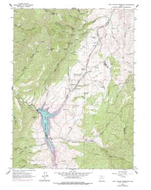
East Canyon Reservoir Topo Map Utah
To zoom in, hover over the map of East Canyon Reservoir
USGS Topo Quad 40111h5 - 1:24,000 scale
| Topo Map Name: | East Canyon Reservoir |
| USGS Topo Quad ID: | 40111h5 |
| Print Size: | ca. 21 1/4" wide x 27" high |
| Southeast Coordinates: | 40.875° N latitude / 111.5° W longitude |
| Map Center Coordinates: | 40.9375° N latitude / 111.5625° W longitude |
| U.S. State: | UT |
| Filename: | o40111h5.jpg |
| Download Map JPG Image: | East Canyon Reservoir topo map 1:24,000 scale |
| Map Type: | Topographic |
| Topo Series: | 7.5´ |
| Map Scale: | 1:24,000 |
| Source of Map Images: | United States Geological Survey (USGS) |
| Alternate Map Versions: |
East Canyon Reservoir UT 1961, updated 1963 Download PDF Buy paper map East Canyon Reservoir UT 1961, updated 1975 Download PDF Buy paper map East Canyon Reservoir UT 1997, updated 2001 Download PDF Buy paper map East Canyon Reservoir UT 2011 Download PDF Buy paper map East Canyon Reservoir UT 2014 Download PDF Buy paper map |
1:24,000 Topo Quads surrounding East Canyon Reservoir
> Back to 40111e1 at 1:100,000 scale
> Back to 40110a1 at 1:250,000 scale
> Back to U.S. Topo Maps home
East Canyon Reservoir topo map: Gazetteer
East Canyon Reservoir: Dams
East Canyon Dam elevation 1739m 5705′East Canyon Reservoir: Parks
East Canyon State Park elevation 1739m 5705′East Canyon Reservoir: Reservoirs
East Canyon Reservoir elevation 1740m 5708′East Canyon Reservoir: Ridges
Rocky Ridge elevation 2227m 7306′East Canyon Reservoir: Springs
Clark Spring elevation 2053m 6735′Dixie Hollow Springs elevation 1874m 6148′
Dixie Spring elevation 1808m 5931′
Jack Beard Spring elevation 1805m 5921′
Tom Porter Springs elevation 1925m 6315′
East Canyon Reservoir: Streams
Big Tree Creek elevation 1813m 5948′Dry Pine Creek elevation 1739m 5705′
Hunts Meadow Creek elevation 1934m 6345′
Monument Creek elevation 1742m 5715′
Sawtooth Creek elevation 1742m 5715′
East Canyon Reservoir: Summits
Hogback Summit elevation 1905m 6250′Redrock Peak elevation 2483m 8146′
Saddle Rock elevation 1950m 6397′
East Canyon Reservoir: Trails
Route of Donner-Reed Party and Mormon Pioneers elevation 1871m 6138′East Canyon Reservoir: Valleys
Bishops Canyon elevation 1871m 6138′Broad Hollow elevation 1790m 5872′
Cottonwood Canyon elevation 1785m 5856′
Dead Ox Canyon elevation 1748m 5734′
Deer Fly Hollow elevation 1748m 5734′
Dip Hollow elevation 1746m 5728′
Dixie Hollow elevation 1739m 5705′
Hells Canyon elevation 1977m 6486′
Hillman Hollow elevation 1878m 6161′
Jodes Hollow elevation 1827m 5994′
Left Fork Taylor Hollow elevation 1863m 6112′
Lone Tree Canyon elevation 1745m 5725′
Mardiths Canyon elevation 1865m 6118′
Owens Meadow Hollow elevation 1712m 5616′
Parker Hollow elevation 1704m 5590′
Pollicks Canyon elevation 1703m 5587′
Rabbit Hollow elevation 1760m 5774′
Right Fork Taylor Hollow elevation 1860m 6102′
Right Hand Fork Pollicks Canyon elevation 1786m 5859′
Rocky Canyon elevation 1739m 5705′
Rocky Hollow elevation 1826m 5990′
Spring Hollow elevation 1749m 5738′
Taylor Hollow elevation 1739m 5705′
Thomas Canyon elevation 1827m 5994′
Tucson Hollow elevation 1690m 5544′
Woodtick Hollow elevation 1880m 6167′
East Canyon Reservoir digital topo map on disk
Buy this East Canyon Reservoir topo map showing relief, roads, GPS coordinates and other geographical features, as a high-resolution digital map file on DVD:


