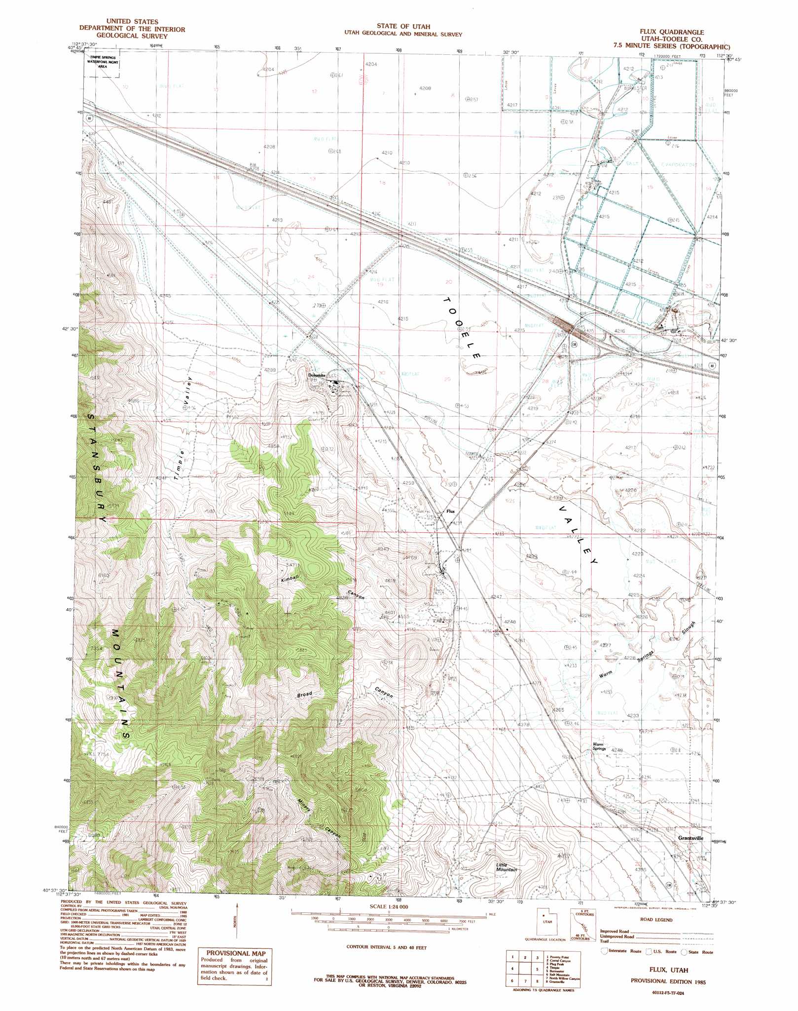
Flux Topo Map Utah
To zoom in, hover over the map of Flux
USGS Topo Quad 40112f5 - 1:24,000 scale
| Topo Map Name: | Flux |
| USGS Topo Quad ID: | 40112f5 |
| Print Size: | ca. 21 1/4" wide x 27" high |
| Southeast Coordinates: | 40.625° N latitude / 112.5° W longitude |
| Map Center Coordinates: | 40.6875° N latitude / 112.5625° W longitude |
| U.S. State: | UT |
| Filename: | o40112f5.jpg |
| Download Map JPG Image: | Flux topo map 1:24,000 scale |
| Map Type: | Topographic |
| Topo Series: | 7.5´ |
| Map Scale: | 1:24,000 |
| Source of Map Images: | United States Geological Survey (USGS) |
| Alternate Map Versions: |
Flux UT 1985, updated 1985 Download PDF Buy paper map Flux UT 2011 Download PDF Buy paper map Flux UT 2014 Download PDF Buy paper map |
1:24,000 Topo Quads surrounding Flux
Craner Peak |
Badger Island Nw |
Badger Island |
Plug Peak Nw |
Plug Peak Ne |
Delle |
Poverty Point |
Corral Canyon |
Plug Peak |
Plug Peak Se |
Hastings Pass Ne |
Timpie |
Flux |
Burmester |
Mills Junction |
Hastings Pass Se |
Salt Mountain |
North Willow Canyon |
Grantsville |
Tooele |
Hickman Knolls |
Deseret Peak West |
Deseret Peak East |
South Mountain |
Stockton |
> Back to 40112e1 at 1:100,000 scale
> Back to 40112a1 at 1:250,000 scale
> Back to U.S. Topo Maps home
Flux topo map: Gazetteer
Flux: Mines
Monte Carlo Mine elevation 2249m 7378′Utah Bunker Hill Mine elevation 2003m 6571′
Flux: Populated Places
Dolomite elevation 1295m 4248′Flux elevation 1294m 4245′
Flux: Springs
Warm Springs elevation 1297m 4255′Flux: Summits
Little Mountain elevation 1553m 5095′Flux: Valleys
Broad Canyon elevation 1377m 4517′Kimball Canyon elevation 1327m 4353′
Miners Canyon elevation 1562m 5124′
Timpie Valley elevation 1298m 4258′
Tooele Valley elevation 1284m 4212′
Flux digital topo map on disk
Buy this Flux topo map showing relief, roads, GPS coordinates and other geographical features, as a high-resolution digital map file on DVD: