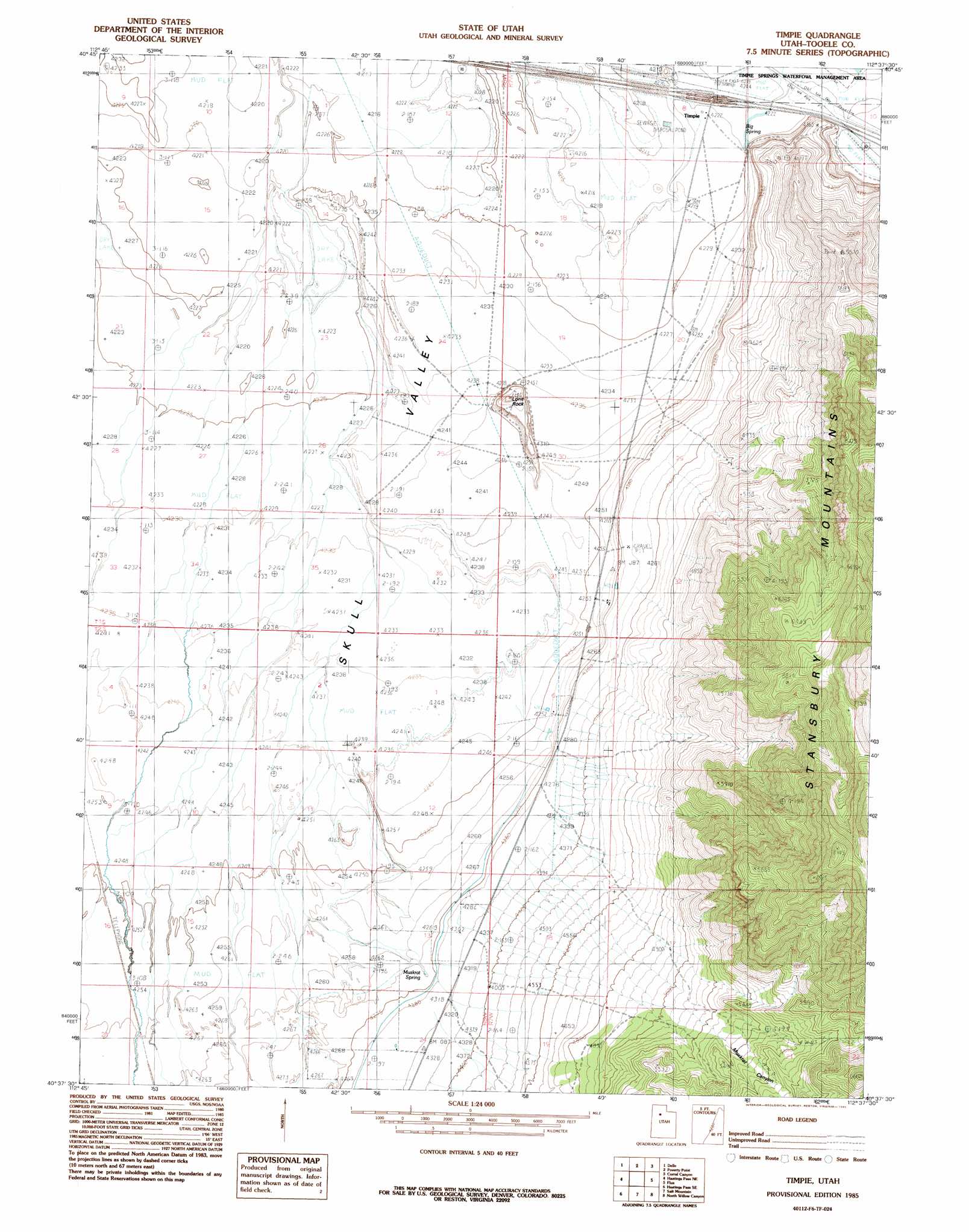
Timpie Topo Map Utah
To zoom in, hover over the map of Timpie
USGS Topo Quad 40112f6 - 1:24,000 scale
| Topo Map Name: | Timpie |
| USGS Topo Quad ID: | 40112f6 |
| Print Size: | ca. 21 1/4" wide x 27" high |
| Southeast Coordinates: | 40.625° N latitude / 112.625° W longitude |
| Map Center Coordinates: | 40.6875° N latitude / 112.6875° W longitude |
| U.S. State: | UT |
| Filename: | o40112f6.jpg |
| Download Map JPG Image: | Timpie topo map 1:24,000 scale |
| Map Type: | Topographic |
| Topo Series: | 7.5´ |
| Map Scale: | 1:24,000 |
| Source of Map Images: | United States Geological Survey (USGS) |
| Alternate Map Versions: |
Timpie UT 1985, updated 1985 Download PDF Buy paper map Timpie UT 2011 Download PDF Buy paper map Timpie UT 2014 Download PDF Buy paper map |
1:24,000 Topo Quads surrounding Timpie
Puddle Valley Knolls |
Craner Peak |
Badger Island Nw |
Badger Island |
Plug Peak Nw |
Low |
Delle |
Poverty Point |
Corral Canyon |
Plug Peak |
Hastings Pass |
Hastings Pass Ne |
Timpie |
Flux |
Burmester |
Quincy Spring |
Hastings Pass Se |
Salt Mountain |
North Willow Canyon |
Grantsville |
Tabbys Peak |
Hickman Knolls |
Deseret Peak West |
Deseret Peak East |
South Mountain |
> Back to 40112e1 at 1:100,000 scale
> Back to 40112a1 at 1:250,000 scale
> Back to U.S. Topo Maps home
Timpie topo map: Gazetteer
Timpie: Basins
Lone Rock Basin elevation 1290m 4232′Long Rock Basin elevation 1405m 4609′
Timpie: Pillars
Lone Rock elevation 1307m 4288′Timpie: Populated Places
Timpie elevation 1287m 4222′Timpie: Springs
Big Spring elevation 1287m 4222′Burnt Spring elevation 1299m 4261′
Muskrat Spring elevation 1305m 4281′
Timpie: Streams
Delle Springs elevation 1287m 4222′Timpie: Valleys
Muskrat Canyon elevation 1588m 5209′Skull Valley elevation 1287m 4222′
Timpie digital topo map on disk
Buy this Timpie topo map showing relief, roads, GPS coordinates and other geographical features, as a high-resolution digital map file on DVD: