Wig Mountain Ne Topo Map Utah
To zoom in, hover over the map of Wig Mountain Ne
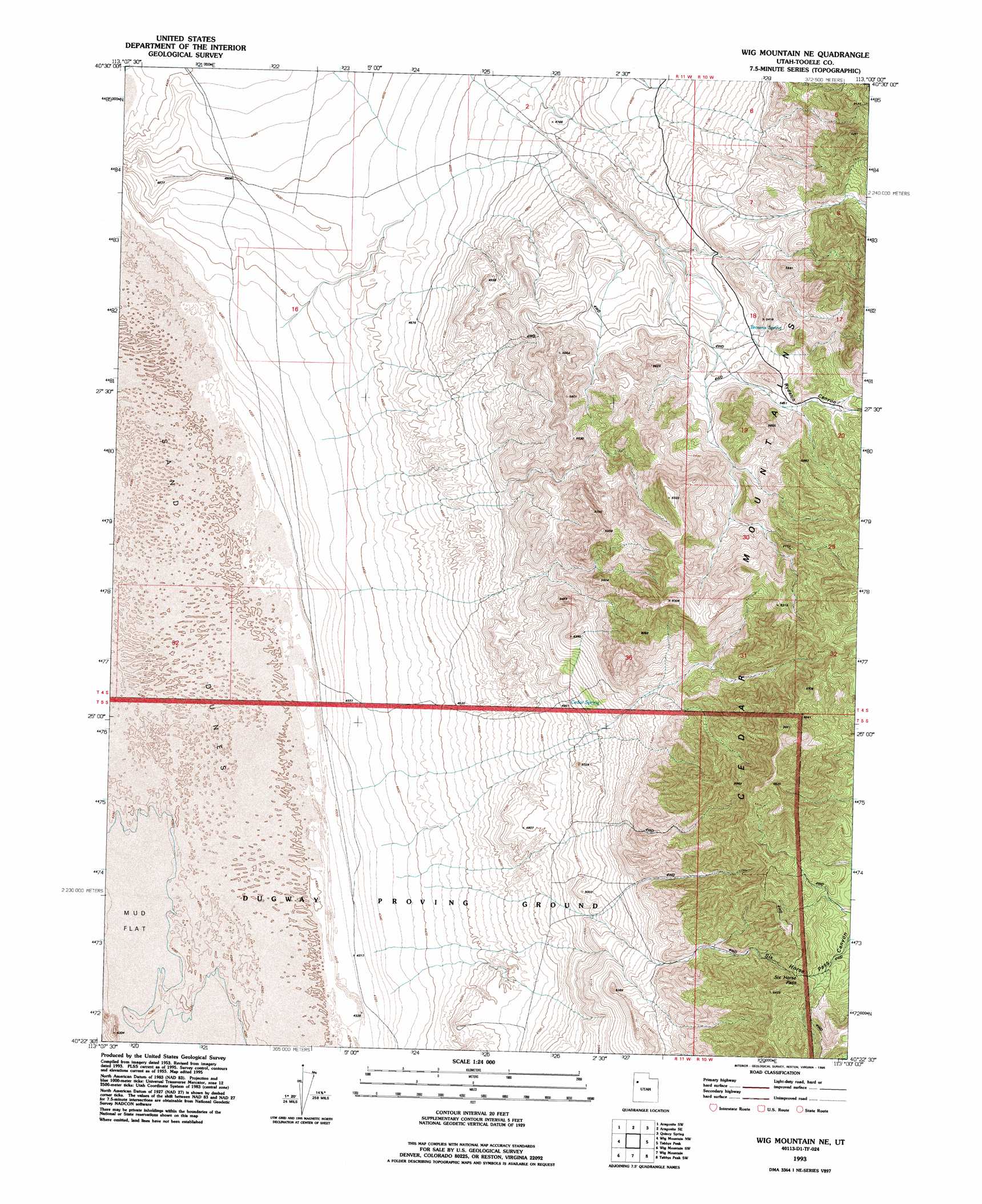
USGS Topo Quad 40113d1 - 1:24,000 scale
| Topo Map Name: | Wig Mountain Ne |
| USGS Topo Quad ID: | 40113d1 |
| Print Size: | ca. 21 1/4" wide x 27" high |
| Southeast Coordinates: | 40.375° N latitude / 113° W longitude |
| Map Center Coordinates: | 40.4375° N latitude / 113.0625° W longitude |
| U.S. State: | UT |
| Filename: | o40113d1.jpg |
| Download Map JPG Image: | Wig Mountain Ne topo map 1:24,000 scale |
| Map Type: | Topographic |
| Topo Series: | 7.5´ |
| Map Scale: | 1:24,000 |
| Source of Map Images: | United States Geological Survey (USGS) |
| Alternate Map Versions: |
Wig Mtn NE UT 1955, updated 1957 Download PDF Buy paper map Wig Mtn NE UT 1955, updated 1957 Download PDF Buy paper map Wig Mtn NE UT 1955, updated 1984 Download PDF Buy paper map Wig Mtn NE UT 1955, updated 1986 Download PDF Buy paper map Wig Mtn NE UT 1993, updated 1996 Download PDF Buy paper map Wig Mountain NE UT 2010 Download PDF Buy paper map Wig Mountain NE UT 2014 Download PDF Buy paper map |
1:24,000 Topo Quads surrounding Wig Mountain Ne
Knolls |
Aragonite Nw |
Aragonite |
Hastings Pass |
Hastings Pass Ne |
Knolls Se |
Aragonite Sw |
Aragonite Se |
Quincy Spring |
Hastings Pass Se |
Wildcat Mountain |
Wig Mountain Nw |
Wig Mountain Ne |
Tabbys Peak |
Hickman Knolls |
Wildcat Mountain Se |
Wig Mountain Sw |
Wig Mountain |
Tabbys Peak Sw |
Tabbys Peak Se |
Granite Peak |
Dugway Proving Ground Nw |
Dugway Proving Ground Ne |
Camels Back Ridge Nw |
Camels Back Ridge Ne |
> Back to 40113a1 at 1:100,000 scale
> Back to 40112a1 at 1:250,000 scale
> Back to U.S. Topo Maps home
Wig Mountain Ne topo map: Gazetteer
Wig Mountain Ne: Gaps
Six Horse Pass elevation 1862m 6108′Wig Mountain Ne: Springs
Browns Spring elevation 1636m 5367′Cedar Spring elevation 1511m 4957′
Wig Mountain Ne: Valleys
Rydalch Canyon elevation 1580m 5183′Six Horse Pass Canyon elevation 1488m 4881′
Wig Mountain Ne digital topo map on disk
Buy this Wig Mountain Ne topo map showing relief, roads, GPS coordinates and other geographical features, as a high-resolution digital map file on DVD: