Goshute Lake Ne Topo Map Nevada
To zoom in, hover over the map of Goshute Lake Ne
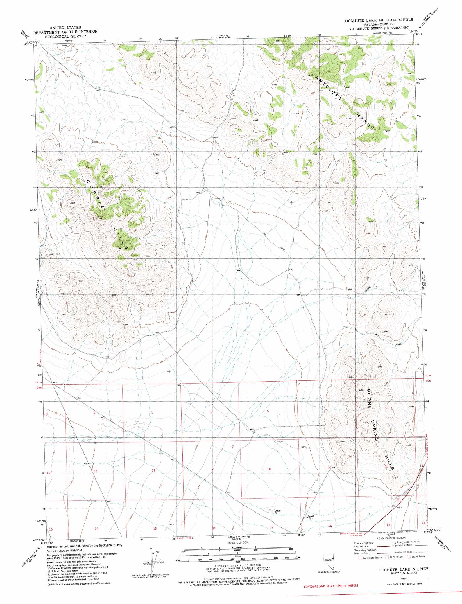
USGS Topo Quad 40114b5 - 1:24,000 scale
| Topo Map Name: | Goshute Lake Ne |
| USGS Topo Quad ID: | 40114b5 |
| Print Size: | ca. 21 1/4" wide x 27" high |
| Southeast Coordinates: | 40.125° N latitude / 114.5° W longitude |
| Map Center Coordinates: | 40.1875° N latitude / 114.5625° W longitude |
| U.S. State: | NV |
| Filename: | o40114b5.jpg |
| Download Map JPG Image: | Goshute Lake Ne topo map 1:24,000 scale |
| Map Type: | Topographic |
| Topo Series: | 7.5´ |
| Map Scale: | 1:24,000 |
| Source of Map Images: | United States Geological Survey (USGS) |
| Alternate Map Versions: |
Goshute Lake NE NV 1982, updated 1982 Download PDF Buy paper map Goshute Lake NE NV 2012 Download PDF Buy paper map Goshute Lake NE NV 2014 Download PDF Buy paper map |
1:24,000 Topo Quads surrounding Goshute Lake Ne
Palomino Ridge |
Mizpah |
Mizpah Point |
White Horse Mountain Nw |
Goshute Peak |
Currie Gardens |
Currie |
Sharp Peak |
Dolly Varden Spring |
White Horse Mountain |
Mcdermid Ranch |
Goshute Lake North |
Goshute Lake Ne |
Boone Canyon |
Kinsley Mountain |
Goshute Creek |
Goshute Lake South |
Lages Station |
Chin Creek Spring |
Chin Creek Reservoir |
Cherry Creek Station |
Cherry Spring |
Becky Peak |
Baldy Peak |
Sunset Reservoir |
> Back to 40114a1 at 1:100,000 scale
> Back to 40114a1 at 1:250,000 scale
> Back to U.S. Topo Maps home
Goshute Lake Ne topo map: Gazetteer
Goshute Lake Ne: Ranges
Currie Hills elevation 2028m 6653′Goshute Lake Ne: Valleys
Waterspout Wash elevation 1815m 5954′Goshute Lake Ne: Wells
Waterspout Well elevation 1824m 5984′Goshute Lake Ne digital topo map on disk
Buy this Goshute Lake Ne topo map showing relief, roads, GPS coordinates and other geographical features, as a high-resolution digital map file on DVD: