Dolly Varden Spring Topo Map Nevada
To zoom in, hover over the map of Dolly Varden Spring
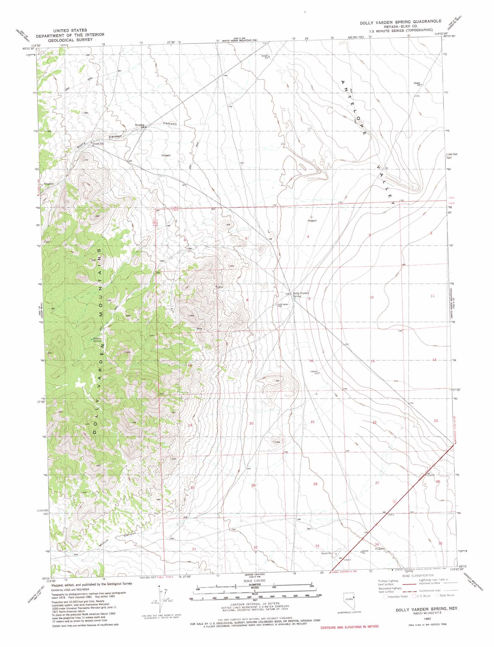
USGS Topo Quad 40114c4 - 1:24,000 scale
| Topo Map Name: | Dolly Varden Spring |
| USGS Topo Quad ID: | 40114c4 |
| Print Size: | ca. 21 1/4" wide x 27" high |
| Southeast Coordinates: | 40.25° N latitude / 114.375° W longitude |
| Map Center Coordinates: | 40.3125° N latitude / 114.4375° W longitude |
| U.S. State: | NV |
| Filename: | o40114c4.jpg |
| Download Map JPG Image: | Dolly Varden Spring topo map 1:24,000 scale |
| Map Type: | Topographic |
| Topo Series: | 7.5´ |
| Map Scale: | 1:24,000 |
| Source of Map Images: | United States Geological Survey (USGS) |
| Alternate Map Versions: |
Dolly Varden Spring NV 1982, updated 1982 Download PDF Buy paper map Dolly Varden Spring NV 2012 Download PDF Buy paper map Dolly Varden Spring NV 2015 Download PDF Buy paper map |
1:24,000 Topo Quads surrounding Dolly Varden Spring
Boone Spring |
Dolly Varden |
Decoy Sw |
Lion Spring |
Spring Gulch |
Mizpah |
Mizpah Point |
White Horse Mountain Nw |
Goshute Peak |
Ferguson Mountain |
Currie |
Sharp Peak |
Dolly Varden Spring |
White Horse Mountain |
White Horse Pass |
Goshute Lake North |
Goshute Lake Ne |
Boone Canyon |
Kinsley Mountain |
Ferber Peak Nw |
Goshute Lake South |
Lages Station |
Chin Creek Spring |
Chin Creek Reservoir |
Ayarbe Spring |
> Back to 40114a1 at 1:100,000 scale
> Back to 40114a1 at 1:250,000 scale
> Back to U.S. Topo Maps home
Dolly Varden Spring topo map: Gazetteer
Dolly Varden Spring: Mines
Bessie Turner Mine elevation 2024m 6640′Bronco Mine elevation 1945m 6381′
Dolly Varden Spring: Springs
Austin Spring elevation 2028m 6653′Dolly Varden Spring elevation 1728m 5669′
Dolly Varden Spring: Summits
Sharp Peak elevation 2049m 6722′Dolly Varden Spring: Valleys
Black Rock Canyon elevation 1851m 6072′Dolly Varden Canyon elevation 1781m 5843′
Millick Canyon elevation 1802m 5912′
Dolly Varden Spring: Wells
Itcaina North Well elevation 1762m 5780′Dolly Varden Spring digital topo map on disk
Buy this Dolly Varden Spring topo map showing relief, roads, GPS coordinates and other geographical features, as a high-resolution digital map file on DVD: