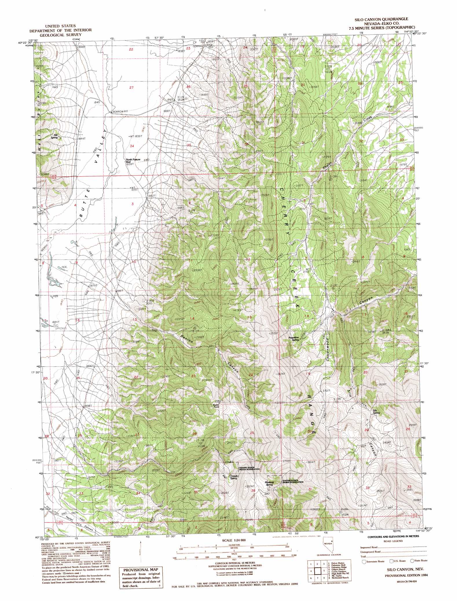
Silo Canyon Topo Map Nevada
To zoom in, hover over the map of Silo Canyon
USGS Topo Quad 40114c8 - 1:24,000 scale
| Topo Map Name: | Silo Canyon |
| USGS Topo Quad ID: | 40114c8 |
| Print Size: | ca. 21 1/4" wide x 27" high |
| Southeast Coordinates: | 40.25° N latitude / 114.875° W longitude |
| Map Center Coordinates: | 40.3125° N latitude / 114.9375° W longitude |
| U.S. State: | NV |
| Filename: | o40114c8.jpg |
| Download Map JPG Image: | Silo Canyon topo map 1:24,000 scale |
| Map Type: | Topographic |
| Topo Series: | 7.5´ |
| Map Scale: | 1:24,000 |
| Source of Map Images: | United States Geological Survey (USGS) |
| Alternate Map Versions: |
Silo Canyon NV 1984, updated 1984 Download PDF Buy paper map Silo Canyon NV 2012 Download PDF Buy paper map Silo Canyon NV 2014 Download PDF Buy paper map |
1:24,000 Topo Quads surrounding Silo Canyon
Smith Well |
Valley Mountain |
Spruce Well |
Spruce Mountain |
Boone Spring |
West Of Delcer Buttes |
Delcer Buttes |
Palomino Well |
Palomino Ridge |
Mizpah |
Medicine Spring |
Odgers Ranch |
Silo Canyon |
Currie Gardens |
Currie |
High Bald Peaks |
High Bald Peaks Ne |
Mount Taylor |
Mcdermid Ranch |
Goshute Lake North |
Pot Spring |
High Bald Peaks Se |
Paris Creek |
Goshute Creek |
Goshute Lake South |
> Back to 40114a1 at 1:100,000 scale
> Back to 40114a1 at 1:250,000 scale
> Back to U.S. Topo Maps home
Silo Canyon topo map: Gazetteer
Silo Canyon: Springs
Augustine Spring elevation 2215m 7267′Hill Spring elevation 1899m 6230′
Mustang Spring elevation 2504m 8215′
Picnic Spring elevation 2387m 7831′
Silo Spring elevation 2275m 7463′
Trough Spring elevation 2356m 7729′
Silo Canyon: Streams
Taylor Canyon Creek elevation 1951m 6400′Silo Canyon: Summits
Rocky Point elevation 2475m 8120′Silo Canyon: Valleys
Denton Canyon elevation 2010m 6594′Silo Canyon elevation 2100m 6889′
Silo Canyon: Wells
North Pasture Well elevation 1841m 6040′Silo Canyon digital topo map on disk
Buy this Silo Canyon topo map showing relief, roads, GPS coordinates and other geographical features, as a high-resolution digital map file on DVD: