Spruce Well Topo Map Nevada
To zoom in, hover over the map of Spruce Well
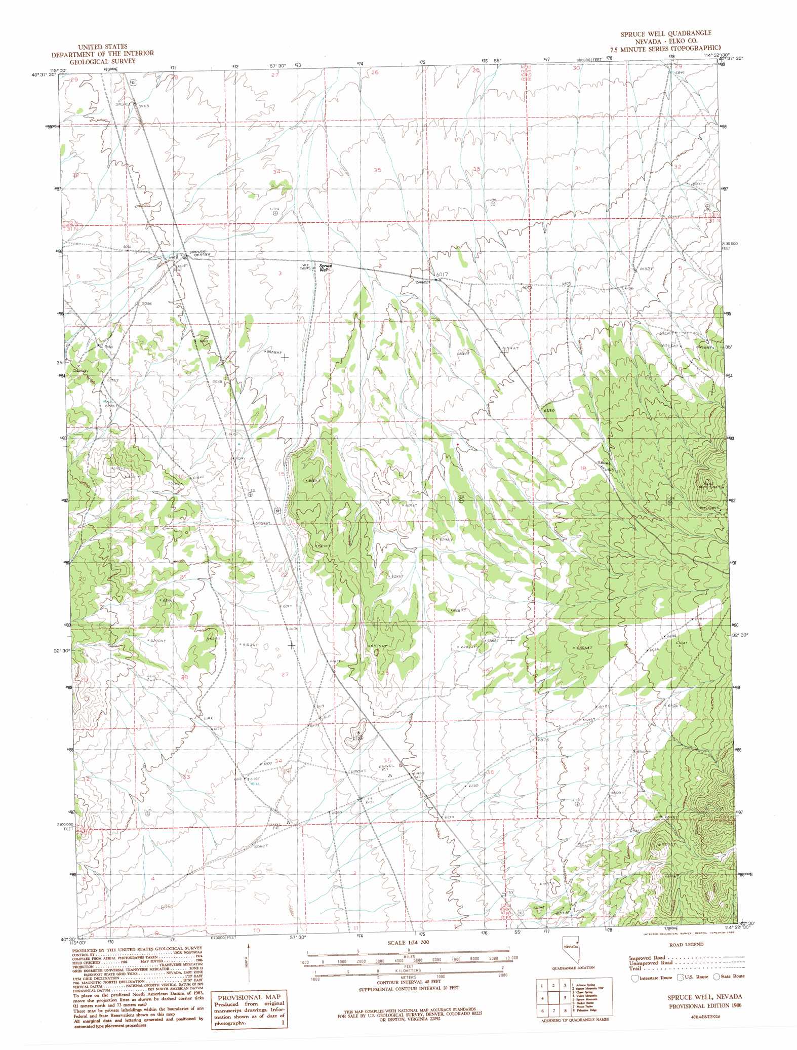
USGS Topo Quad 40114e8 - 1:24,000 scale
| Topo Map Name: | Spruce Well |
| USGS Topo Quad ID: | 40114e8 |
| Print Size: | ca. 21 1/4" wide x 27" high |
| Southeast Coordinates: | 40.5° N latitude / 114.875° W longitude |
| Map Center Coordinates: | 40.5625° N latitude / 114.9375° W longitude |
| U.S. State: | NV |
| Filename: | o40114e8.jpg |
| Download Map JPG Image: | Spruce Well topo map 1:24,000 scale |
| Map Type: | Topographic |
| Topo Series: | 7.5´ |
| Map Scale: | 1:24,000 |
| Source of Map Images: | United States Geological Survey (USGS) |
| Alternate Map Versions: |
Spruce Well NV 1986, updated 1986 Download PDF Buy paper map Spruce Well NV 2012 Download PDF Buy paper map Spruce Well NV 2014 Download PDF Buy paper map |
1:24,000 Topo Quads surrounding Spruce Well
Secret Valley |
Gordon Creek |
Snow Water Lake |
Ventosa |
Independence Valley Sw |
Ruby City Creek |
Arizona Spring |
Spruce Mountain Nw |
Chase Spring |
Ninemile Canyon |
Smith Well |
Valley Mountain |
Spruce Well |
Spruce Mountain |
Boone Spring |
West Of Delcer Buttes |
Delcer Buttes |
Palomino Well |
Palomino Ridge |
Mizpah |
Medicine Spring |
Odgers Ranch |
Silo Canyon |
Currie Gardens |
Currie |
> Back to 40114e1 at 1:100,000 scale
> Back to 40114a1 at 1:250,000 scale
> Back to U.S. Topo Maps home
Spruce Well topo map: Gazetteer
Spruce Well: Wells
Liza Jane Well elevation 1862m 6108′Spruce Well elevation 1797m 5895′
Spruce Well digital topo map on disk
Buy this Spruce Well topo map showing relief, roads, GPS coordinates and other geographical features, as a high-resolution digital map file on DVD: