Pilot Topo Map Nevada
To zoom in, hover over the map of Pilot
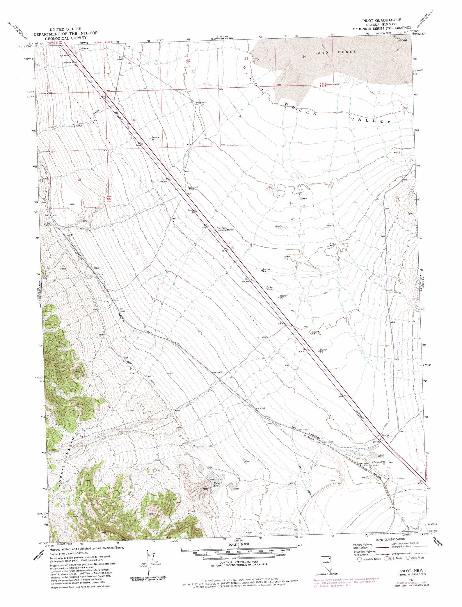
USGS Topo Quad 40114g2 - 1:24,000 scale
| Topo Map Name: | Pilot |
| USGS Topo Quad ID: | 40114g2 |
| Print Size: | ca. 21 1/4" wide x 27" high |
| Southeast Coordinates: | 40.75° N latitude / 114.125° W longitude |
| Map Center Coordinates: | 40.8125° N latitude / 114.1875° W longitude |
| U.S. State: | NV |
| Filename: | o40114g2.jpg |
| Download Map JPG Image: | Pilot topo map 1:24,000 scale |
| Map Type: | Topographic |
| Topo Series: | 7.5´ |
| Map Scale: | 1:24,000 |
| Source of Map Images: | United States Geological Survey (USGS) |
| Alternate Map Versions: |
Pilot NV 1971, updated 1974 Download PDF Buy paper map Pilot NV 1971, updated 1983 Download PDF Buy paper map Pilot NV 2012 Download PDF Buy paper map Pilot NV 2014 Download PDF Buy paper map |
1:24,000 Topo Quads surrounding Pilot
Cobre |
Cobre Se |
Pilot Peak Sw |
Pilot Peak |
Crater Island Sw |
Hardy Creek |
Silver Zone Pass |
Leppy Peak Nw |
Miners Canyon |
Silver Island Pass |
Shafter |
West Morris Basin |
Pilot |
Leppy Peak |
Tetzlaff Peak |
Decoy |
Morgan Pass |
Ola |
Wendover |
Silsbee |
Decoy Sw |
Lion Spring |
Spring Gulch |
Wendover Se |
Salduro Sw |
> Back to 40114e1 at 1:100,000 scale
> Back to 40114a1 at 1:250,000 scale
> Back to U.S. Topo Maps home
Pilot topo map: Gazetteer
Pilot: Parks
Pilot Peak Historical Marker elevation 1414m 4639′Pilot: Populated Places
Pilot elevation 1561m 5121′Pilot: Reservoirs
Playa Reservoir elevation 1584m 5196′Pilot: Wells
Pilot Well elevation 1373m 4504′Pilot digital topo map on disk
Buy this Pilot topo map showing relief, roads, GPS coordinates and other geographical features, as a high-resolution digital map file on DVD: