Snow Water Lake Topo Map Nevada
To zoom in, hover over the map of Snow Water Lake
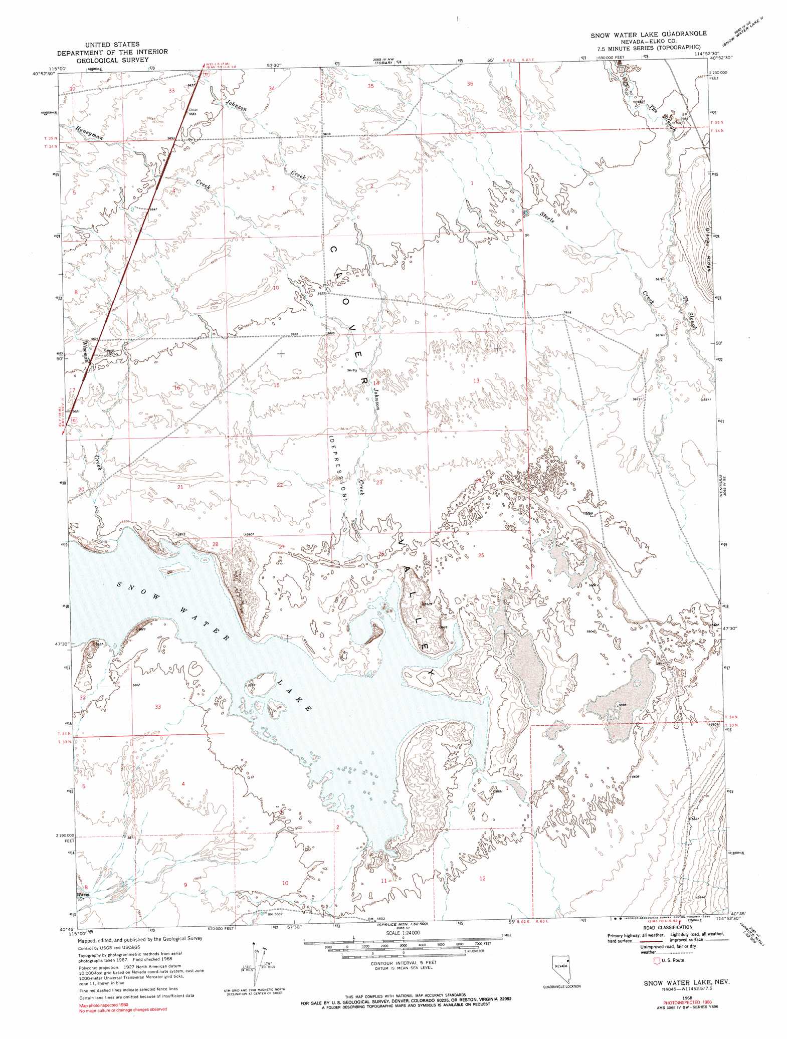
USGS Topo Quad 40114g8 - 1:24,000 scale
| Topo Map Name: | Snow Water Lake |
| USGS Topo Quad ID: | 40114g8 |
| Print Size: | ca. 21 1/4" wide x 27" high |
| Southeast Coordinates: | 40.75° N latitude / 114.875° W longitude |
| Map Center Coordinates: | 40.8125° N latitude / 114.9375° W longitude |
| U.S. State: | NV |
| Filename: | o40114g8.jpg |
| Download Map JPG Image: | Snow Water Lake topo map 1:24,000 scale |
| Map Type: | Topographic |
| Topo Series: | 7.5´ |
| Map Scale: | 1:24,000 |
| Source of Map Images: | United States Geological Survey (USGS) |
| Alternate Map Versions: |
Snow Water Lake NV 1968, updated 1971 Download PDF Buy paper map Snow Water Lake NV 1968, updated 1990 Download PDF Buy paper map Snow Water Lake NV 2012 Download PDF Buy paper map Snow Water Lake NV 2015 Download PDF Buy paper map |
1:24,000 Topo Quads surrounding Snow Water Lake
Herder Creek |
Welcome |
Wells |
Moor Summit |
Pequop Summit Sw |
Tent Mountain |
Humboldt Peak |
Tobar |
Snow Water Lake Ne |
Independence Valley Nw |
Secret Valley |
Gordon Creek |
Snow Water Lake |
Ventosa |
Independence Valley Sw |
Ruby City Creek |
Arizona Spring |
Spruce Mountain Nw |
Chase Spring |
Ninemile Canyon |
Smith Well |
Valley Mountain |
Spruce Well |
Spruce Mountain |
Boone Spring |
> Back to 40114e1 at 1:100,000 scale
> Back to 40114a1 at 1:250,000 scale
> Back to U.S. Topo Maps home
Snow Water Lake topo map: Gazetteer
Snow Water Lake: Basins
Clover Valley elevation 1711m 5613′Snow Water Lake: Lakes
Snow Water Lake elevation 1705m 5593′Snow Water Lake: Populated Places
Warm Creek (historical) elevation 1711m 5613′Snow Water Lake: Post Offices
Warm Creek Post Office (historical) elevation 1711m 5613′Snow Water Lake: Reservoirs
Tobar Reservoir elevation 1715m 5626′Weeks Reservoir elevation 1720m 5643′
Snow Water Lake: Streams
Honeyman Creek elevation 1712m 5616′Johnson Creek elevation 1706m 5597′
Steele Creek elevation 1709m 5606′
Warm Creek elevation 1714m 5623′
Wiseman Creek elevation 1707m 5600′
Snow Water Lake digital topo map on disk
Buy this Snow Water Lake topo map showing relief, roads, GPS coordinates and other geographical features, as a high-resolution digital map file on DVD: