Hardy Creek Topo Map Nevada
To zoom in, hover over the map of Hardy Creek
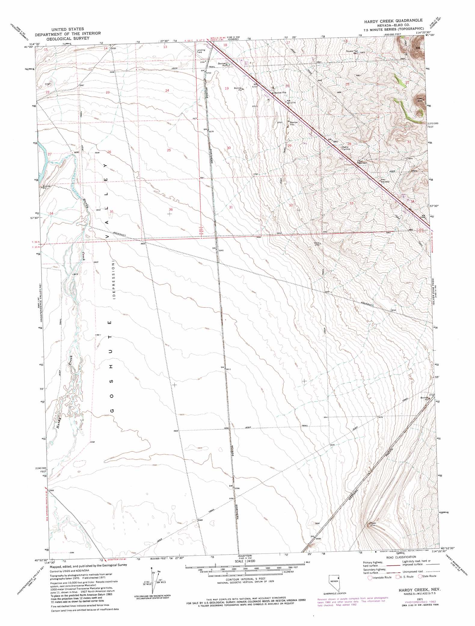
USGS Topo Quad 40114h4 - 1:24,000 scale
| Topo Map Name: | Hardy Creek |
| USGS Topo Quad ID: | 40114h4 |
| Print Size: | ca. 21 1/4" wide x 27" high |
| Southeast Coordinates: | 40.875° N latitude / 114.375° W longitude |
| Map Center Coordinates: | 40.9375° N latitude / 114.4375° W longitude |
| U.S. State: | NV |
| Filename: | o40114h4.jpg |
| Download Map JPG Image: | Hardy Creek topo map 1:24,000 scale |
| Map Type: | Topographic |
| Topo Series: | 7.5´ |
| Map Scale: | 1:24,000 |
| Source of Map Images: | United States Geological Survey (USGS) |
| Alternate Map Versions: |
Hardy Creek NV 1971, updated 1974 Download PDF Buy paper map Hardy Creek NV 1971, updated 1983 Download PDF Buy paper map Hardy Creek NV 2012 Download PDF Buy paper map Hardy Creek NV 2014 Download PDF Buy paper map |
1:24,000 Topo Quads surrounding Hardy Creek
Holborn |
Pequop |
Valley Pass |
Loray |
Pilot Peak Nw |
Pequop Summit Sw |
Pequop Summit |
Cobre |
Cobre Se |
Pilot Peak Sw |
Independence Valley Nw |
Independence Valley Ne |
Hardy Creek |
Silver Zone Pass |
Leppy Peak Nw |
Independence Valley Sw |
Independence Valley Se |
Shafter |
West Morris Basin |
Pilot |
Ninemile Canyon |
Flowery Lake |
Decoy |
Morgan Pass |
Ola |
> Back to 40114e1 at 1:100,000 scale
> Back to 40114a1 at 1:250,000 scale
> Back to U.S. Topo Maps home
Hardy Creek topo map: Gazetteer
Hardy Creek: Streams
Nanny Creek elevation 1721m 5646′Sixmile Creek elevation 1743m 5718′
Hardy Creek: Wells
Squaw Flat Well elevation 1803m 5915′Hardy Creek digital topo map on disk
Buy this Hardy Creek topo map showing relief, roads, GPS coordinates and other geographical features, as a high-resolution digital map file on DVD: