West Of Railroad Pass Topo Map Nevada
To zoom in, hover over the map of West Of Railroad Pass
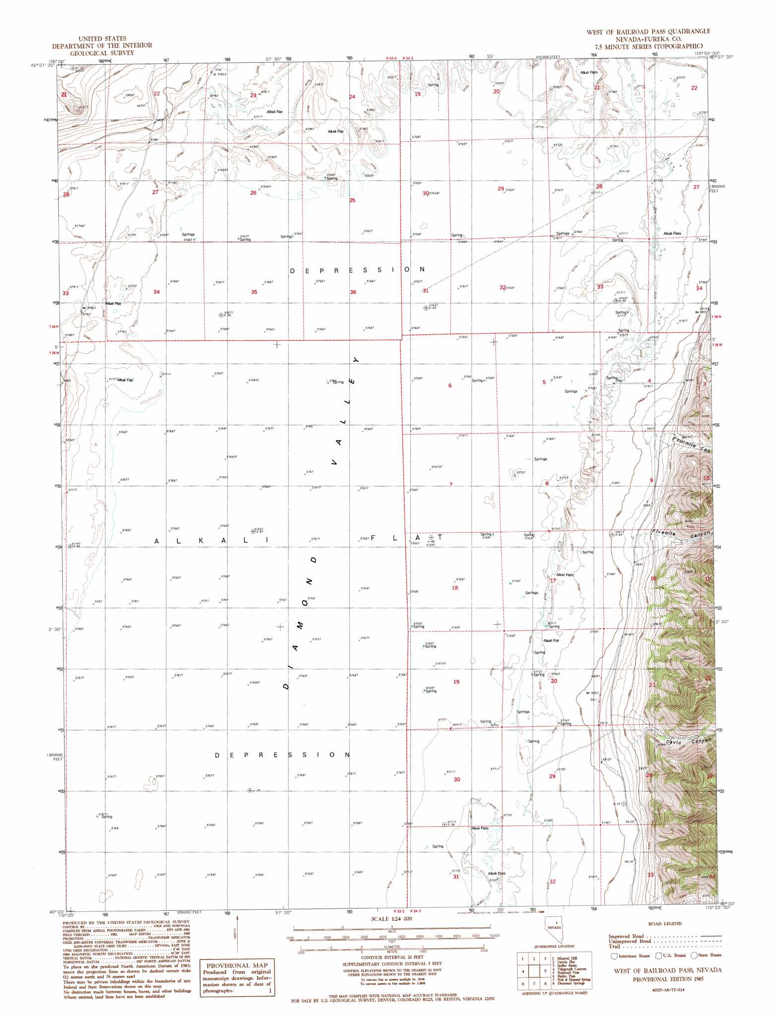
USGS Topo Quad 40115a8 - 1:24,000 scale
| Topo Map Name: | West Of Railroad Pass |
| USGS Topo Quad ID: | 40115a8 |
| Print Size: | ca. 21 1/4" wide x 27" high |
| Southeast Coordinates: | 40° N latitude / 115.875° W longitude |
| Map Center Coordinates: | 40.0625° N latitude / 115.9375° W longitude |
| U.S. State: | NV |
| Filename: | o40115a8.jpg |
| Download Map JPG Image: | West Of Railroad Pass topo map 1:24,000 scale |
| Map Type: | Topographic |
| Topo Series: | 7.5´ |
| Map Scale: | 1:24,000 |
| Source of Map Images: | United States Geological Survey (USGS) |
| Alternate Map Versions: |
West of Railroad Pass NV 1985, updated 1986 Download PDF Buy paper map West of Railroad Pass NV 2012 Download PDF Buy paper map West of Railroad Pass NV 2014 Download PDF Buy paper map |
1:24,000 Topo Quads surrounding West Of Railroad Pass
West Of Coffin Mountain |
Coffin Mountain |
Bailey Mountain |
East Of Bailey Mountain |
Frost Creek |
Mineral Hill Nw |
Mineral Hill |
Garcia Flat |
Sadler Basin |
Belmont Creek |
Mineral Hill Sw |
Telegraph Canyon |
West Of Railroad Pass |
Railroad Pass |
Walker Canyon |
Frazier Creek |
Bailey Pass |
West Of Diamond Springs |
Diamond Springs |
Cold Creek Ranch Nw |
Garden Pass |
Tule Dam Spring |
West Of Christina Peak |
Christina Peak |
Cold Creek Ranch |
> Back to 40115a1 at 1:100,000 scale
> Back to 40114a1 at 1:250,000 scale
> Back to U.S. Topo Maps home
West Of Railroad Pass topo map: Gazetteer
West Of Railroad Pass: Populated Places
Corwin elevation 1771m 5810′West Of Railroad Pass: Post Offices
Corwin Post Office (historical) elevation 1771m 5810′West Of Railroad Pass: Valleys
Davis Canyon elevation 1779m 5836′Fivemile Canyon elevation 1779m 5836′
Fourmile Canyon elevation 1779m 5836′
West Of Railroad Pass digital topo map on disk
Buy this West Of Railroad Pass topo map showing relief, roads, GPS coordinates and other geographical features, as a high-resolution digital map file on DVD: