Ruby Lake Ne Topo Map Nevada
To zoom in, hover over the map of Ruby Lake Ne
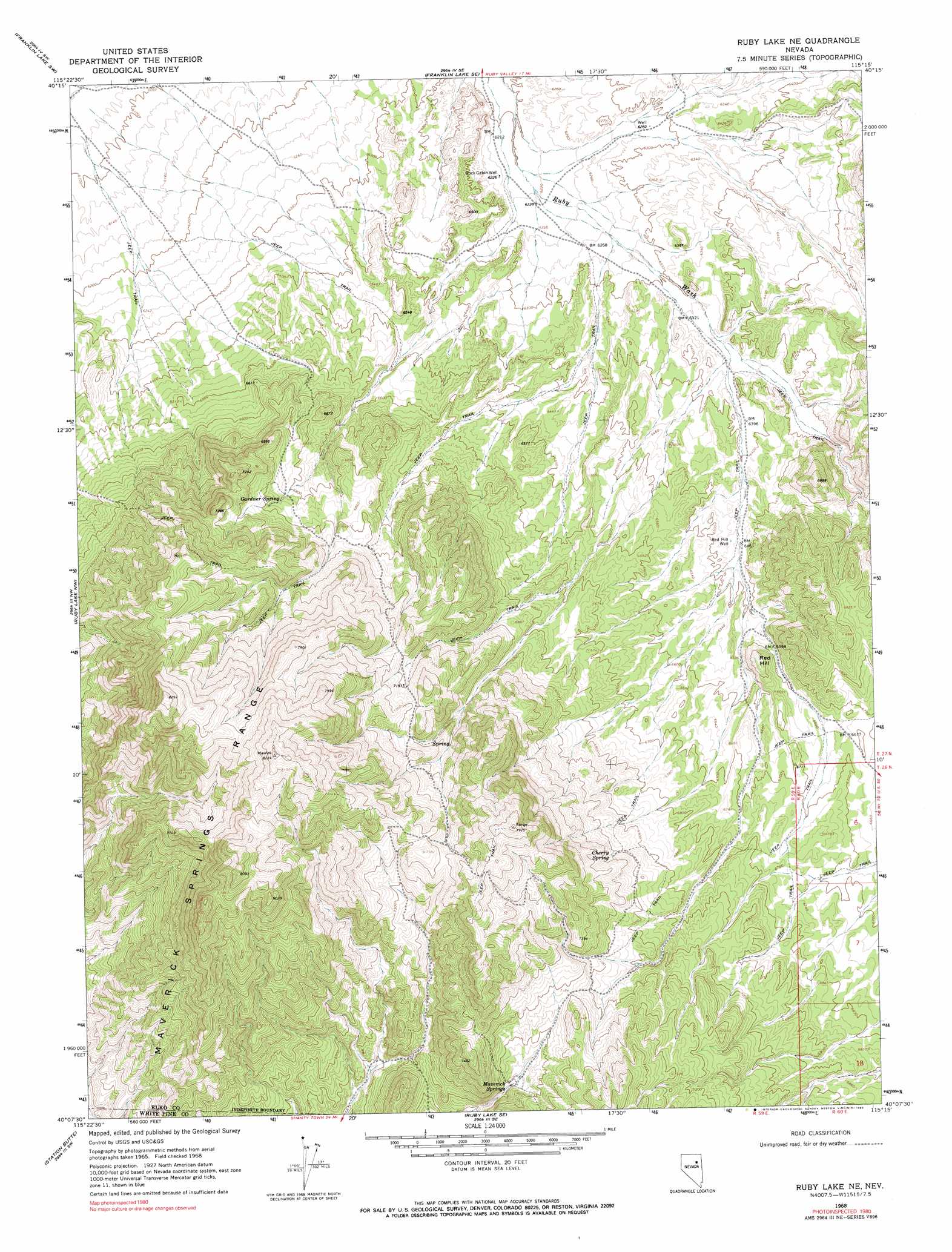
USGS Topo Quad 40115b3 - 1:24,000 scale
| Topo Map Name: | Ruby Lake Ne |
| USGS Topo Quad ID: | 40115b3 |
| Print Size: | ca. 21 1/4" wide x 27" high |
| Southeast Coordinates: | 40.125° N latitude / 115.25° W longitude |
| Map Center Coordinates: | 40.1875° N latitude / 115.3125° W longitude |
| U.S. State: | NV |
| Filename: | o40115b3.jpg |
| Download Map JPG Image: | Ruby Lake Ne topo map 1:24,000 scale |
| Map Type: | Topographic |
| Topo Series: | 7.5´ |
| Map Scale: | 1:24,000 |
| Source of Map Images: | United States Geological Survey (USGS) |
| Alternate Map Versions: |
Ruby Lake NE NV 1968, updated 1971 Download PDF Buy paper map Ruby Lake NE NV 1968, updated 1990 Download PDF Buy paper map Ruby Lake NE NV 2012 Download PDF Buy paper map Ruby Lake NE NV 2014 Download PDF Buy paper map |
1:24,000 Topo Quads surrounding Ruby Lake Ne
Green Mountain |
Franklin Lake Nw |
Franklin Lake Ne |
West Of Delcer Buttes |
Delcer Buttes |
Harrison Pass |
Franklin Lake Sw |
Franklin Lake Se |
Medicine Spring |
Odgers Ranch |
Pearl Peak |
Ruby Lake Nw |
Ruby Lake Ne |
High Bald Peaks |
High Bald Peaks Ne |
Sherman Mountain |
Station Butte |
Ruby Lake Se |
Pot Spring |
High Bald Peaks Se |
Big Bald Mountain |
Tognini Spring |
Junction Well |
Ninemile Well Nw |
Ninemile Well |
> Back to 40115a1 at 1:100,000 scale
> Back to 40114a1 at 1:250,000 scale
> Back to U.S. Topo Maps home
Ruby Lake Ne topo map: Gazetteer
Ruby Lake Ne: Springs
Cherry Spring elevation 2144m 7034′Gardner Spring elevation 2089m 6853′
Maverick Springs elevation 2128m 6981′
Willow Springs elevation 2190m 7185′
Ruby Lake Ne: Summits
Red Hill elevation 2061m 6761′Ruby Lake Ne: Wells
Red Hill Well elevation 1975m 6479′Rock Cabin Well elevation 1902m 6240′
Ruby Wash Well elevation 1968m 6456′
Ruby Lake Ne digital topo map on disk
Buy this Ruby Lake Ne topo map showing relief, roads, GPS coordinates and other geographical features, as a high-resolution digital map file on DVD: