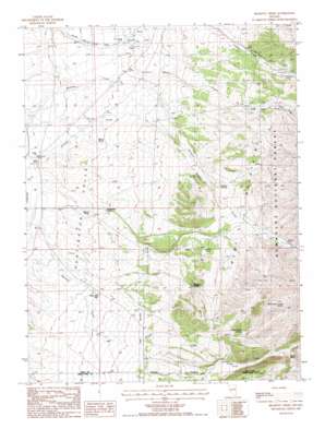
Belmont Creek Topo Map Nevada
To zoom in, hover over the map of Belmont Creek
USGS Topo Quad 40115b6 - 1:24,000 scale
| Topo Map Name: | Belmont Creek |
| USGS Topo Quad ID: | 40115b6 |
| Print Size: | ca. 21 1/4" wide x 27" high |
| Southeast Coordinates: | 40.125° N latitude / 115.625° W longitude |
| Map Center Coordinates: | 40.1875° N latitude / 115.6875° W longitude |
| U.S. State: | NV |
| Filename: | o40115b6.jpg |
| Download Map JPG Image: | Belmont Creek topo map 1:24,000 scale |
| Map Type: | Topographic |
| Topo Series: | 7.5´ |
| Map Scale: | 1:24,000 |
| Source of Map Images: | United States Geological Survey (USGS) |
| Alternate Map Versions: |
Belmont Creek NV 1985, updated 1986 Download PDF Buy paper map Belmont Creek NV 2012 Download PDF Buy paper map Belmont Creek NV 2015 Download PDF Buy paper map |
| FStopo: | US Forest Service topo Belmont Creek is available: Download FStopo PDF Download FStopo TIF |
1:24,000 Topo Quads surrounding Belmont Creek
> Back to 40115a1 at 1:100,000 scale
> Back to 40114a1 at 1:250,000 scale
> Back to U.S. Topo Maps home
Belmont Creek topo map: Gazetteer
Belmont Creek: Populated Places
Sherman (historical) elevation 1967m 6453′Belmont Creek: Post Offices
Sherman Post Office elevation 1967m 6453′Belmont Creek: Springs
Belmont Springs elevation 1908m 6259′Brown Spring elevation 1760m 5774′
Cherry Spring elevation 1939m 6361′
Dames Spring elevation 2108m 6916′
Hellman Spring elevation 1749m 5738′
Homestead Springs elevation 1760m 5774′
North School Creek Spring elevation 2186m 7171′
School Creek Spring elevation 2065m 6774′
Washout Spring elevation 1900m 6233′
Belmont Creek: Streams
Belmont Creek elevation 1717m 5633′Cass House Creek elevation 1764m 5787′
North Fork Lindsay Creek elevation 1921m 6302′
School Creek elevation 1823m 5980′
Sherman Creek elevation 1723m 5652′
South Cass House Creek elevation 1916m 6286′
Belmont Creek: Wells
White Pine Well elevation 1783m 5849′Belmont Creek digital topo map on disk
Buy this Belmont Creek topo map showing relief, roads, GPS coordinates and other geographical features, as a high-resolution digital map file on DVD:


