Franklin Lake Se Topo Map Nevada
To zoom in, hover over the map of Franklin Lake Se
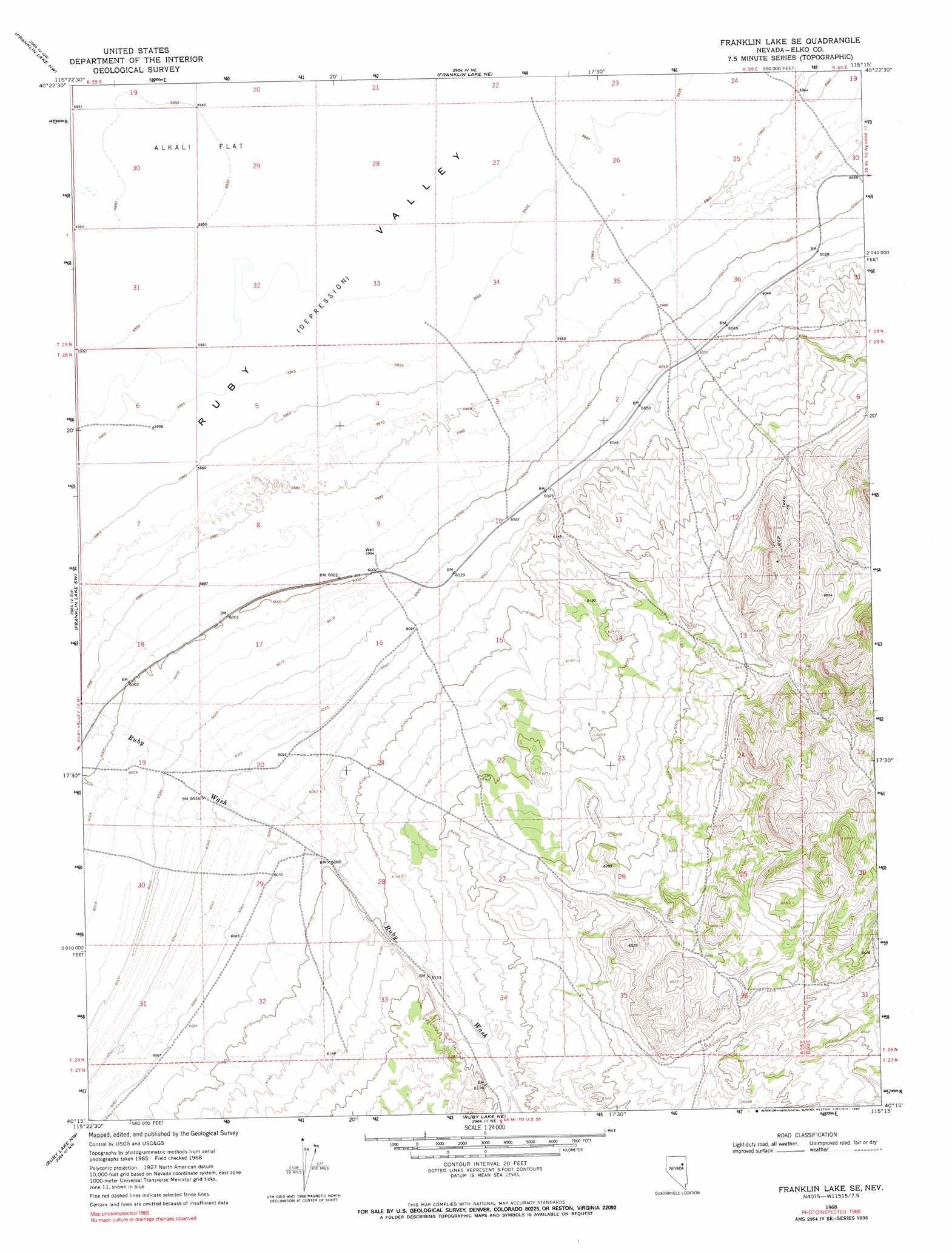
USGS Topo Quad 40115c3 - 1:24,000 scale
| Topo Map Name: | Franklin Lake Se |
| USGS Topo Quad ID: | 40115c3 |
| Print Size: | ca. 21 1/4" wide x 27" high |
| Southeast Coordinates: | 40.25° N latitude / 115.25° W longitude |
| Map Center Coordinates: | 40.3125° N latitude / 115.3125° W longitude |
| U.S. State: | NV |
| Filename: | o40115c3.jpg |
| Download Map JPG Image: | Franklin Lake Se topo map 1:24,000 scale |
| Map Type: | Topographic |
| Topo Series: | 7.5´ |
| Map Scale: | 1:24,000 |
| Source of Map Images: | United States Geological Survey (USGS) |
| Alternate Map Versions: |
Franklin Lake SE NV 1968, updated 1971 Download PDF Buy paper map Franklin Lake SE NV 1968, updated 1990 Download PDF Buy paper map Franklin Lake SE NV 2012 Download PDF Buy paper map Franklin Lake SE NV 2015 Download PDF Buy paper map |
1:24,000 Topo Quads surrounding Franklin Lake Se
Lee |
Ruby Dome |
Ruby Valley School |
Smith Well |
Valley Mountain |
Green Mountain |
Franklin Lake Nw |
Franklin Lake Ne |
West Of Delcer Buttes |
Delcer Buttes |
Harrison Pass |
Franklin Lake Sw |
Franklin Lake Se |
Medicine Spring |
Odgers Ranch |
Pearl Peak |
Ruby Lake Nw |
Ruby Lake Ne |
High Bald Peaks |
High Bald Peaks Ne |
Sherman Mountain |
Station Butte |
Ruby Lake Se |
Pot Spring |
High Bald Peaks Se |
> Back to 40115a1 at 1:100,000 scale
> Back to 40114a1 at 1:250,000 scale
> Back to U.S. Topo Maps home
No gazetteer data is available for the Franklin Lake Se topo map sheet.
Franklin Lake Se digital topo map on disk
Buy this Franklin Lake Se topo map showing relief, roads, GPS coordinates and other geographical features, as a high-resolution digital map file on DVD: