Harrison Pass Topo Map Nevada
To zoom in, hover over the map of Harrison Pass
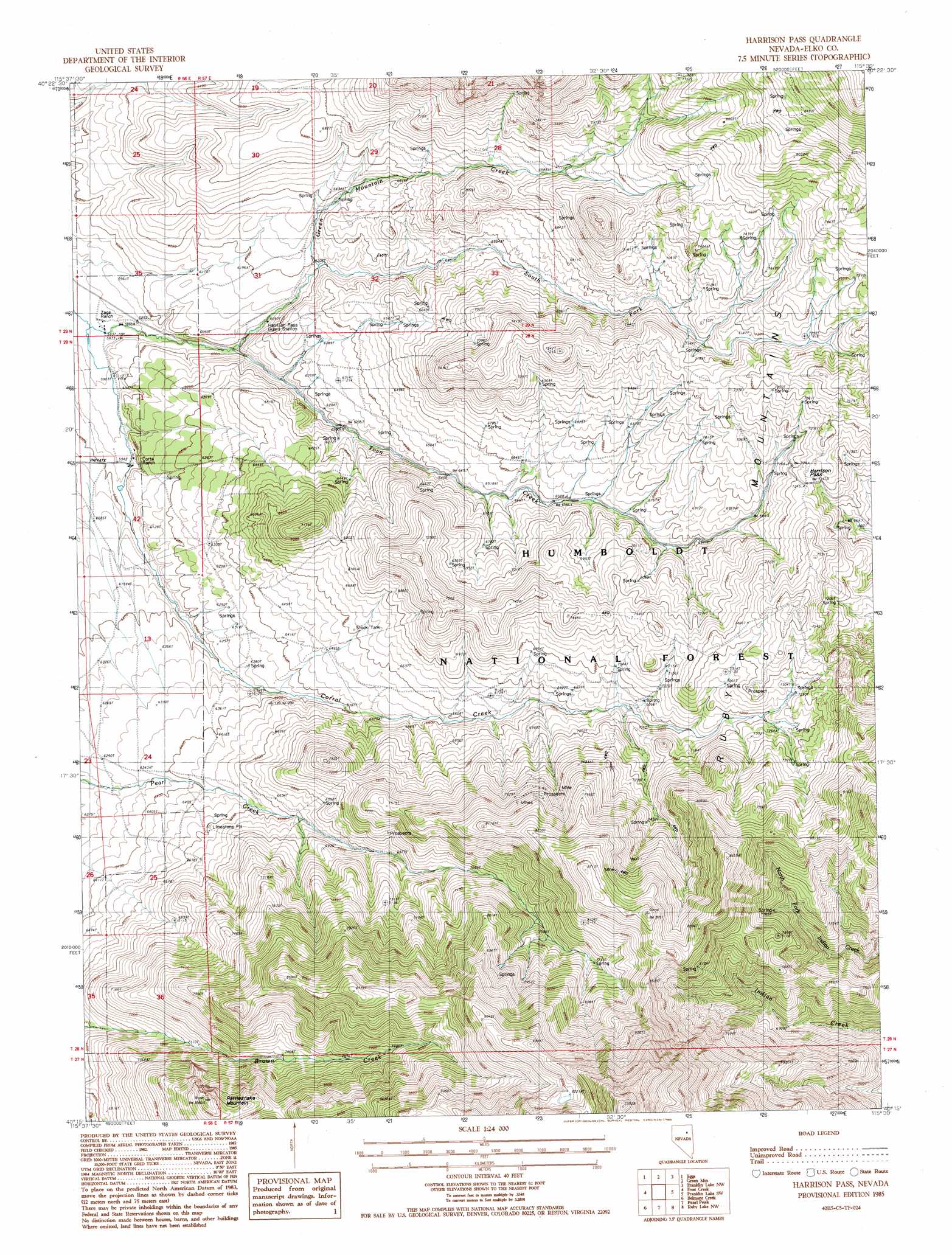
USGS Topo Quad 40115c5 - 1:24,000 scale
| Topo Map Name: | Harrison Pass |
| USGS Topo Quad ID: | 40115c5 |
| Print Size: | ca. 21 1/4" wide x 27" high |
| Southeast Coordinates: | 40.25° N latitude / 115.5° W longitude |
| Map Center Coordinates: | 40.3125° N latitude / 115.5625° W longitude |
| U.S. State: | NV |
| Filename: | o40115c5.jpg |
| Download Map JPG Image: | Harrison Pass topo map 1:24,000 scale |
| Map Type: | Topographic |
| Topo Series: | 7.5´ |
| Map Scale: | 1:24,000 |
| Source of Map Images: | United States Geological Survey (USGS) |
| Alternate Map Versions: |
Harrison Pass NV 1985, updated 1985 Download PDF Buy paper map Harrison Pass NV 2012 Download PDF Buy paper map Harrison Pass NV 2014 Download PDF Buy paper map |
| FStopo: | US Forest Service topo Harrison Pass is available: Download FStopo PDF Download FStopo TIF |
1:24,000 Topo Quads surrounding Harrison Pass
Red Spring |
West Of Lee |
Lee |
Ruby Dome |
Ruby Valley School |
Cedar Ridge |
Jiggs |
Green Mountain |
Franklin Lake Nw |
Franklin Lake Ne |
East Of Bailey Mountain |
Frost Creek |
Harrison Pass |
Franklin Lake Sw |
Franklin Lake Se |
Sadler Basin |
Belmont Creek |
Pearl Peak |
Ruby Lake Nw |
Ruby Lake Ne |
Railroad Pass |
Walker Canyon |
Sherman Mountain |
Station Butte |
Ruby Lake Se |
> Back to 40115a1 at 1:100,000 scale
> Back to 40114a1 at 1:250,000 scale
> Back to U.S. Topo Maps home
Harrison Pass topo map: Gazetteer
Harrison Pass: Gaps
Harrison Pass elevation 2209m 7247′Harrison Pass: Streams
Green Mountain Creek elevation 1827m 5994′South Fork Green Mountain Creek elevation 1889m 6197′
Toyn Creek elevation 1777m 5830′
Harrison Pass: Summits
Rattlesnake Mountain elevation 2598m 8523′Harrison Pass digital topo map on disk
Buy this Harrison Pass topo map showing relief, roads, GPS coordinates and other geographical features, as a high-resolution digital map file on DVD: