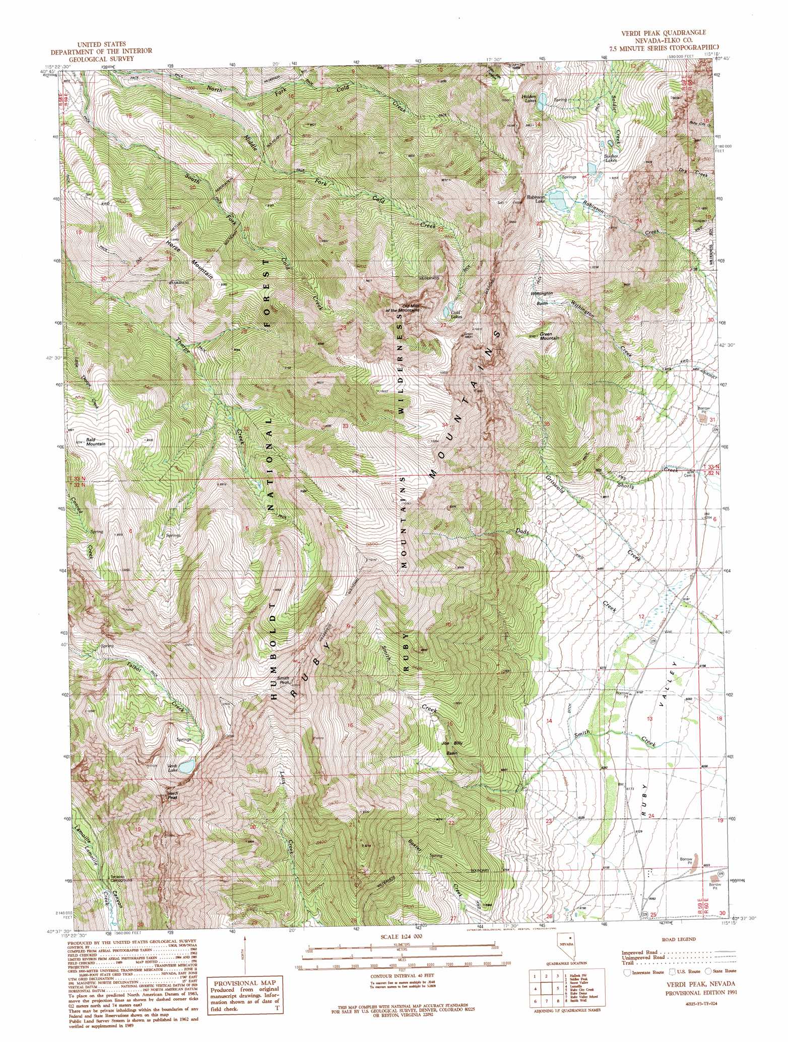
Verdi Peak Topo Map Nevada
To zoom in, hover over the map of Verdi Peak
USGS Topo Quad 40115f3 - 1:24,000 scale
| Topo Map Name: | Verdi Peak |
| USGS Topo Quad ID: | 40115f3 |
| Print Size: | ca. 21 1/4" wide x 27" high |
| Southeast Coordinates: | 40.625° N latitude / 115.25° W longitude |
| Map Center Coordinates: | 40.6875° N latitude / 115.3125° W longitude |
| U.S. State: | NV |
| Filename: | o40115f3.jpg |
| Download Map JPG Image: | Verdi Peak topo map 1:24,000 scale |
| Map Type: | Topographic |
| Topo Series: | 7.5´ |
| Map Scale: | 1:24,000 |
| Source of Map Images: | United States Geological Survey (USGS) |
| Alternate Map Versions: |
Verdi Peak NV 1991, updated 1991 Download PDF Buy paper map Verdi Peak NV 2012 Download PDF Buy paper map Verdi Peak NV 2014 Download PDF Buy paper map |
| FStopo: | US Forest Service topo Verdi Peak is available: Download FStopo PDF Download FStopo TIF |
1:24,000 Topo Quads surrounding Verdi Peak
Ryndon |
Halleck |
Heelfly Creek |
Tent Mountain |
Humboldt Peak |
Boyd Reservoir |
Halleck Sw |
Soldier Peak |
Secret Valley |
Gordon Creek |
Noon Rock |
Lamoille |
Verdi Peak |
Ruby City Creek |
Arizona Spring |
Lee |
Ruby Dome |
Ruby Valley School |
Smith Well |
Valley Mountain |
Green Mountain |
Franklin Lake Nw |
Franklin Lake Ne |
West Of Delcer Buttes |
Delcer Buttes |
> Back to 40115e1 at 1:100,000 scale
> Back to 40114a1 at 1:250,000 scale
> Back to U.S. Topo Maps home
Verdi Peak topo map: Gazetteer
Verdi Peak: Basins
Joe Billy Basin elevation 2271m 7450′Withington Basin elevation 2589m 8494′
Verdi Peak: Lakes
Cold Lakes elevation 3017m 9898′Hidden Lakes elevation 2894m 9494′
Robinson Lake elevation 2775m 9104′
Soldier Lakes elevation 2779m 9117′
Verdi Lake elevation 3104m 10183′
Verdi Peak: Summits
Bald Mountain elevation 2810m 9219′Green Mountain elevation 2794m 9166′
Horse Mountain elevation 2585m 8480′
Old Man of the Mountain elevation 3216m 10551′
Smith Peak elevation 3236m 10616′
Verdi Peak elevation 3368m 11049′
Verdi Peak digital topo map on disk
Buy this Verdi Peak topo map showing relief, roads, GPS coordinates and other geographical features, as a high-resolution digital map file on DVD: