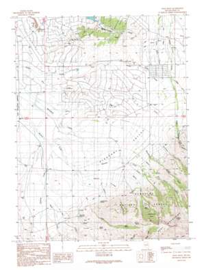
Noon Rock Topo Map Nevada
To zoom in, hover over the map of Noon Rock
USGS Topo Quad 40115f5 - 1:24,000 scale
| Topo Map Name: | Noon Rock |
| USGS Topo Quad ID: | 40115f5 |
| Print Size: | ca. 21 1/4" wide x 27" high |
| Southeast Coordinates: | 40.625° N latitude / 115.5° W longitude |
| Map Center Coordinates: | 40.6875° N latitude / 115.5625° W longitude |
| U.S. State: | NV |
| Filename: | o40115f5.jpg |
| Download Map JPG Image: | Noon Rock topo map 1:24,000 scale |
| Map Type: | Topographic |
| Topo Series: | 7.5´ |
| Map Scale: | 1:24,000 |
| Source of Map Images: | United States Geological Survey (USGS) |
| Alternate Map Versions: |
Noon Rock NV 1990, updated 1991 Download PDF Buy paper map Noon Rock NV 2012 Download PDF Buy paper map Noon Rock NV 2014 Download PDF Buy paper map |
| FStopo: | US Forest Service topo Noon Rock is available: Download FStopo PDF Download FStopo TIF |
1:24,000 Topo Quads surrounding Noon Rock
> Back to 40115e1 at 1:100,000 scale
> Back to 40114a1 at 1:250,000 scale
> Back to U.S. Topo Maps home
Noon Rock topo map: Gazetteer
Noon Rock: Basins
Cottonwood Basin elevation 2564m 8412′Pleasant Valley elevation 1794m 5885′
Noon Rock: Canals
Swamp Ditch elevation 1791m 5875′Noon Rock: Dams
Spring Creek Dam Number One elevation 1670m 5479′Noon Rock: Islands
The Island elevation 2336m 7664′Noon Rock: Pillars
Noon Rock elevation 2930m 9612′Noon Rock: Populated Places
Brennen Ranch elevation 1811m 5941′Pleasant Valley elevation 1786m 5859′
Spring Creek elevation 1725m 5659′
Noon Rock: Post Offices
Blaine Post Office (historical) elevation 1811m 5941′Spring Creek Rural Branch Post Office (historical) elevation 1663m 5456′
Noon Rock: Reservoirs
Dry Farm Reservoir elevation 1826m 5990′Spring Creek Reservoir elevation 1670m 5479′
Noon Rock: Springs
Basin Spring elevation 2303m 7555′Big Spring elevation 1970m 6463′
Brennen Spring elevation 2594m 8510′
Cherry Spring elevation 1978m 6489′
Cottonwood Spring elevation 1839m 6033′
Noon Rock: Streams
Brennen Creek elevation 1718m 5636′Chimney Creek elevation 1681m 5515′
Dry Creek elevation 1671m 5482′
Haw Creek elevation 1732m 5682′
Ogilvie Creek elevation 1781m 5843′
Owl Creek elevation 1718m 5636′
Peterson Creek elevation 1718m 5636′
Sheep Creek elevation 1723m 5652′
Thompson Creek elevation 1828m 5997′
Young Creek elevation 1864m 6115′
Noon Rock: Valleys
Hennen Canyon elevation 1956m 6417′Seitz Canyon elevation 1907m 6256′
V Canyon elevation 1846m 6056′
Noon Rock digital topo map on disk
Buy this Noon Rock topo map showing relief, roads, GPS coordinates and other geographical features, as a high-resolution digital map file on DVD:


