Hunter Topo Map Nevada
To zoom in, hover over the map of Hunter
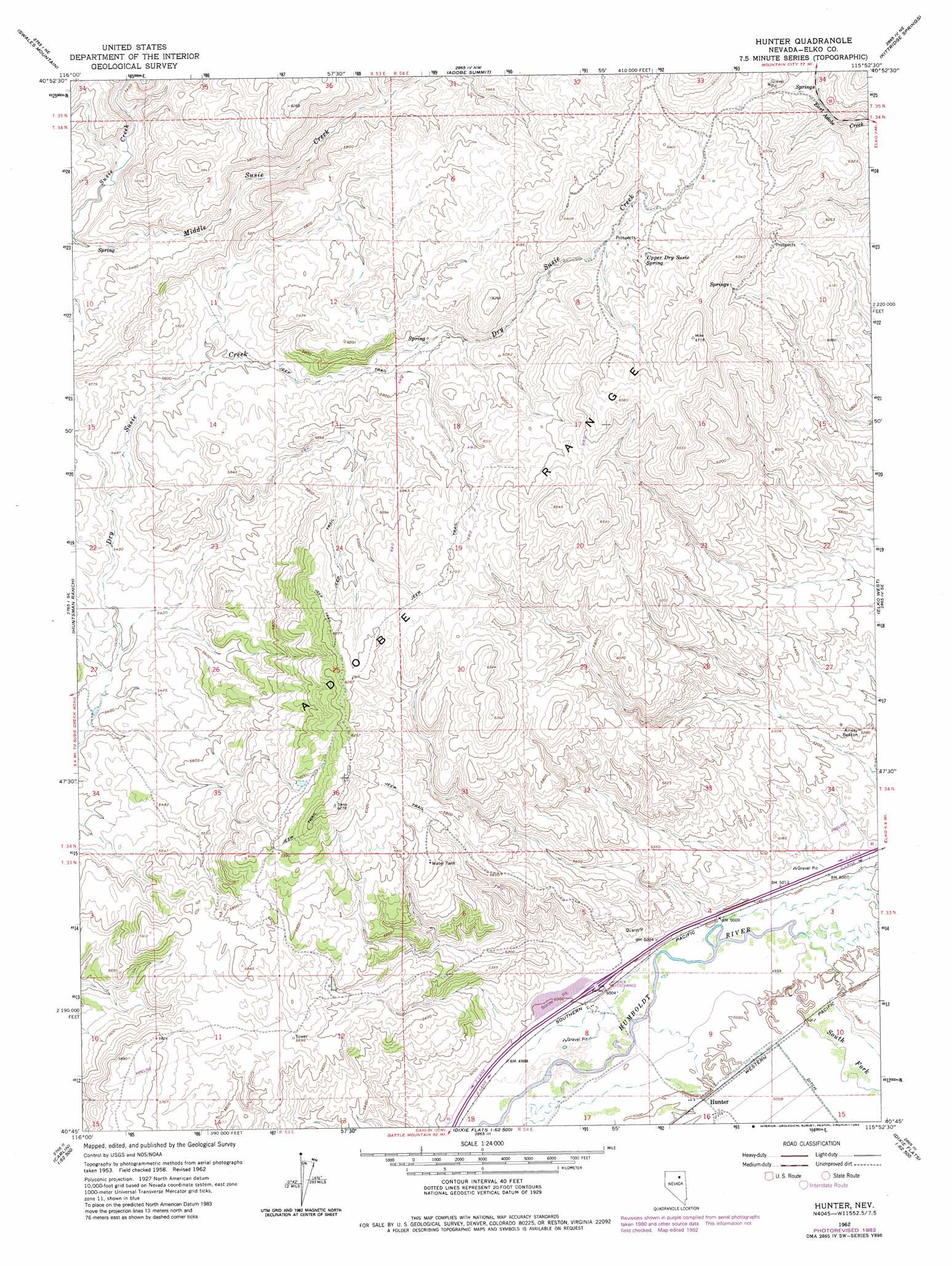
USGS Topo Quad 40115g8 - 1:24,000 scale
| Topo Map Name: | Hunter |
| USGS Topo Quad ID: | 40115g8 |
| Print Size: | ca. 21 1/4" wide x 27" high |
| Southeast Coordinates: | 40.75° N latitude / 115.875° W longitude |
| Map Center Coordinates: | 40.8125° N latitude / 115.9375° W longitude |
| U.S. State: | NV |
| Filename: | o40115g8.jpg |
| Download Map JPG Image: | Hunter topo map 1:24,000 scale |
| Map Type: | Topographic |
| Topo Series: | 7.5´ |
| Map Scale: | 1:24,000 |
| Source of Map Images: | United States Geological Survey (USGS) |
| Alternate Map Versions: |
Hunter NV 1958, updated 1960 Download PDF Buy paper map Hunter NV 1962, updated 1965 Download PDF Buy paper map Hunter NV 1962, updated 1983 Download PDF Buy paper map Hunter NV 1978, updated 1978 Download PDF Buy paper map Hunter NV 2012 Download PDF Buy paper map Hunter NV 2014 Download PDF Buy paper map |
1:24,000 Topo Quads surrounding Hunter
Beaver Creek |
Blue Basin |
Singletree Creek |
Dinner Station |
The Buttes |
Swales Mountain Nw |
Swales Mountain |
Adobe Summit |
Kittridge Springs |
Osino |
Schroeder Mountain |
Huntsman Ranch |
Hunter |
Elko West |
Elko East |
Carlin West |
Carlin East |
Grindstone Mountain |
White Flats |
Te-Moak Well |
Palisade |
Ravens Nest |
Bullion |
Red Spring |
West Of Lee |
> Back to 40115e1 at 1:100,000 scale
> Back to 40114a1 at 1:250,000 scale
> Back to U.S. Topo Maps home
Hunter topo map: Gazetteer
Hunter: Crossings
Hunter Interchange elevation 1528m 5013′Hunter: Populated Places
Hunter elevation 1525m 5003′Hunter: Springs
Upper Dry Susie Spring elevation 1891m 6204′Hunter: Streams
South Fork Humboldt River elevation 1523m 4996′Hunter digital topo map on disk
Buy this Hunter topo map showing relief, roads, GPS coordinates and other geographical features, as a high-resolution digital map file on DVD: