Ryndon Topo Map Nevada
To zoom in, hover over the map of Ryndon
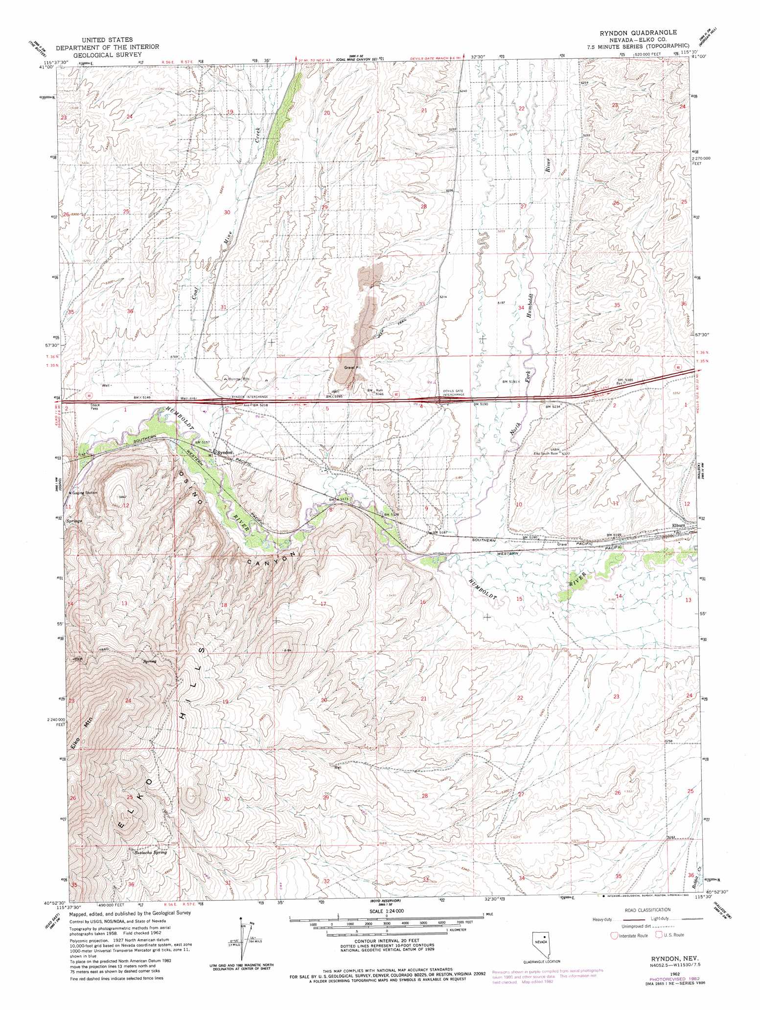
USGS Topo Quad 40115h5 - 1:24,000 scale
| Topo Map Name: | Ryndon |
| USGS Topo Quad ID: | 40115h5 |
| Print Size: | ca. 21 1/4" wide x 27" high |
| Southeast Coordinates: | 40.875° N latitude / 115.5° W longitude |
| Map Center Coordinates: | 40.9375° N latitude / 115.5625° W longitude |
| U.S. State: | NV |
| Filename: | o40115h5.jpg |
| Download Map JPG Image: | Ryndon topo map 1:24,000 scale |
| Map Type: | Topographic |
| Topo Series: | 7.5´ |
| Map Scale: | 1:24,000 |
| Source of Map Images: | United States Geological Survey (USGS) |
| Alternate Map Versions: |
Ryndon NV 1962, updated 1964 Download PDF Buy paper map Ryndon NV 1962, updated 1978 Download PDF Buy paper map Ryndon NV 1962, updated 1983 Download PDF Buy paper map Ryndon NV 2012 Download PDF Buy paper map Ryndon NV 2014 Download PDF Buy paper map |
1:24,000 Topo Quads surrounding Ryndon
Wieland Flat |
Coal Mine Basin |
The Narrows |
Peko Peak |
Twin Buttes |
Dinner Station |
The Buttes |
Coal Mine Canyon Se |
Morgan Hill |
Deeth |
Kittridge Springs |
Osino |
Ryndon |
Halleck |
Heelfly Creek |
Elko West |
Elko East |
Boyd Reservoir |
Halleck Sw |
Soldier Peak |
White Flats |
Te-Moak Well |
Noon Rock |
Lamoille |
Verdi Peak |
> Back to 40115e1 at 1:100,000 scale
> Back to 40114a1 at 1:250,000 scale
> Back to U.S. Topo Maps home
Ryndon topo map: Gazetteer
Ryndon: Crossings
Devils Gate Interchange elevation 1586m 5203′Ryndon Interchange elevation 1580m 5183′
Ryndon: Parks
Humboldt Park elevation 1585m 5200′Ryndon: Populated Places
Elburz elevation 1588m 5209′Ryndon elevation 1577m 5173′
Ryndon: Post Offices
Ryndon Post Office (historical) elevation 1577m 5173′Ryndon: Springs
Sustacha Spring elevation 1852m 6076′Ryndon: Streams
Coal Mine Creek elevation 1569m 5147′North Fork Humboldt River elevation 1577m 5173′
Ryndon: Summits
East Peak elevation 1888m 6194′Ryndon digital topo map on disk
Buy this Ryndon topo map showing relief, roads, GPS coordinates and other geographical features, as a high-resolution digital map file on DVD: