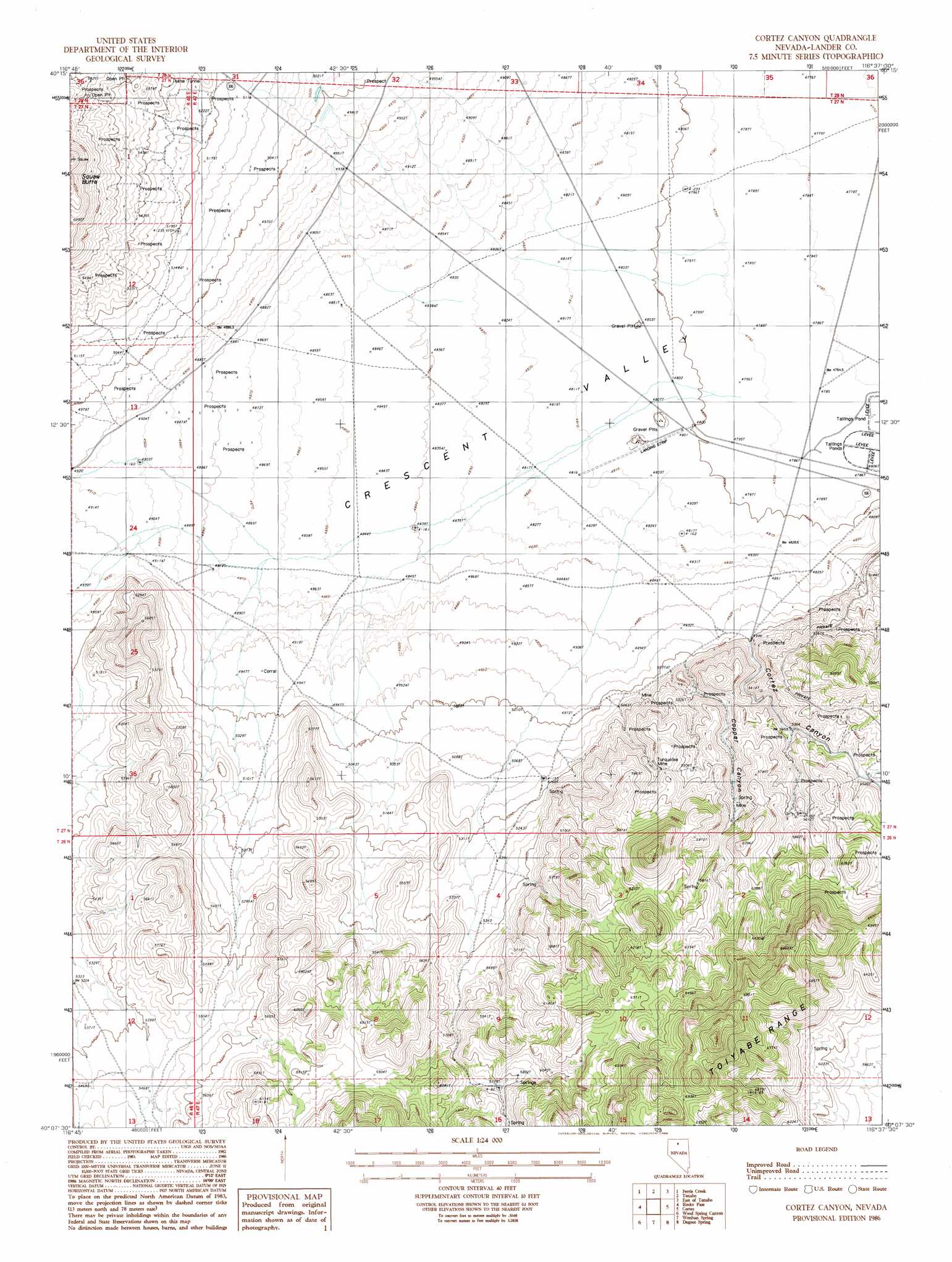
Cortez Canyon Topo Map Nevada
To zoom in, hover over the map of Cortez Canyon
USGS Topo Quad 40116b6 - 1:24,000 scale
| Topo Map Name: | Cortez Canyon |
| USGS Topo Quad ID: | 40116b6 |
| Print Size: | ca. 21 1/4" wide x 27" high |
| Southeast Coordinates: | 40.125° N latitude / 116.625° W longitude |
| Map Center Coordinates: | 40.1875° N latitude / 116.6875° W longitude |
| U.S. State: | NV |
| Filename: | o40116b6.jpg |
| Download Map JPG Image: | Cortez Canyon topo map 1:24,000 scale |
| Map Type: | Topographic |
| Topo Series: | 7.5´ |
| Map Scale: | 1:24,000 |
| Source of Map Images: | United States Geological Survey (USGS) |
| Alternate Map Versions: |
Cortez Canyon NV 1986, updated 1986 Download PDF Buy paper map Cortez Canyon NV 2012 Download PDF Buy paper map Cortez Canyon NV 2014 Download PDF Buy paper map |
1:24,000 Topo Quads surrounding Cortez Canyon
Crippen Canyon |
Mount Lewis |
Mud Spring Gulch |
Crescent Valley |
Tumbleweed Flat |
Goat Peak |
Ferris Creek |
Tenabo |
East Of Tenabo |
Hand-Me-Down Creek |
Carico Lake North |
Rocky Pass |
Cortez Canyon |
Cortez |
Buckhorn Mine |
Carico Lake South |
Wood Spring Canyon |
Wenban Spring |
Dugout Spring |
Rocky Hills |
Hall Creek North |
Corral Canyon |
Little Hot Springs |
Walti Hot Springs |
Tonkin Summit |
> Back to 40116a1 at 1:100,000 scale
> Back to 40116a1 at 1:250,000 scale
> Back to U.S. Topo Maps home
Cortez Canyon topo map: Gazetteer
Cortez Canyon: Airports
Cortez Airstrip elevation 1460m 4790′Cortez Canyon: Mines
Lone Pine Mine elevation 1683m 5521′Turquoise Fifty Mine elevation 1619m 5311′
Turquoise Mine elevation 1742m 5715′
Valley View Mine elevation 1556m 5104′
White Horse Mine elevation 1685m 5528′
Cortez Canyon: Valleys
Copper Canyon elevation 1527m 5009′Cortez Canyon elevation 1503m 4931′
Cortez Canyon digital topo map on disk
Buy this Cortez Canyon topo map showing relief, roads, GPS coordinates and other geographical features, as a high-resolution digital map file on DVD: