Papoose Canyon Topo Map Nevada
To zoom in, hover over the map of Papoose Canyon
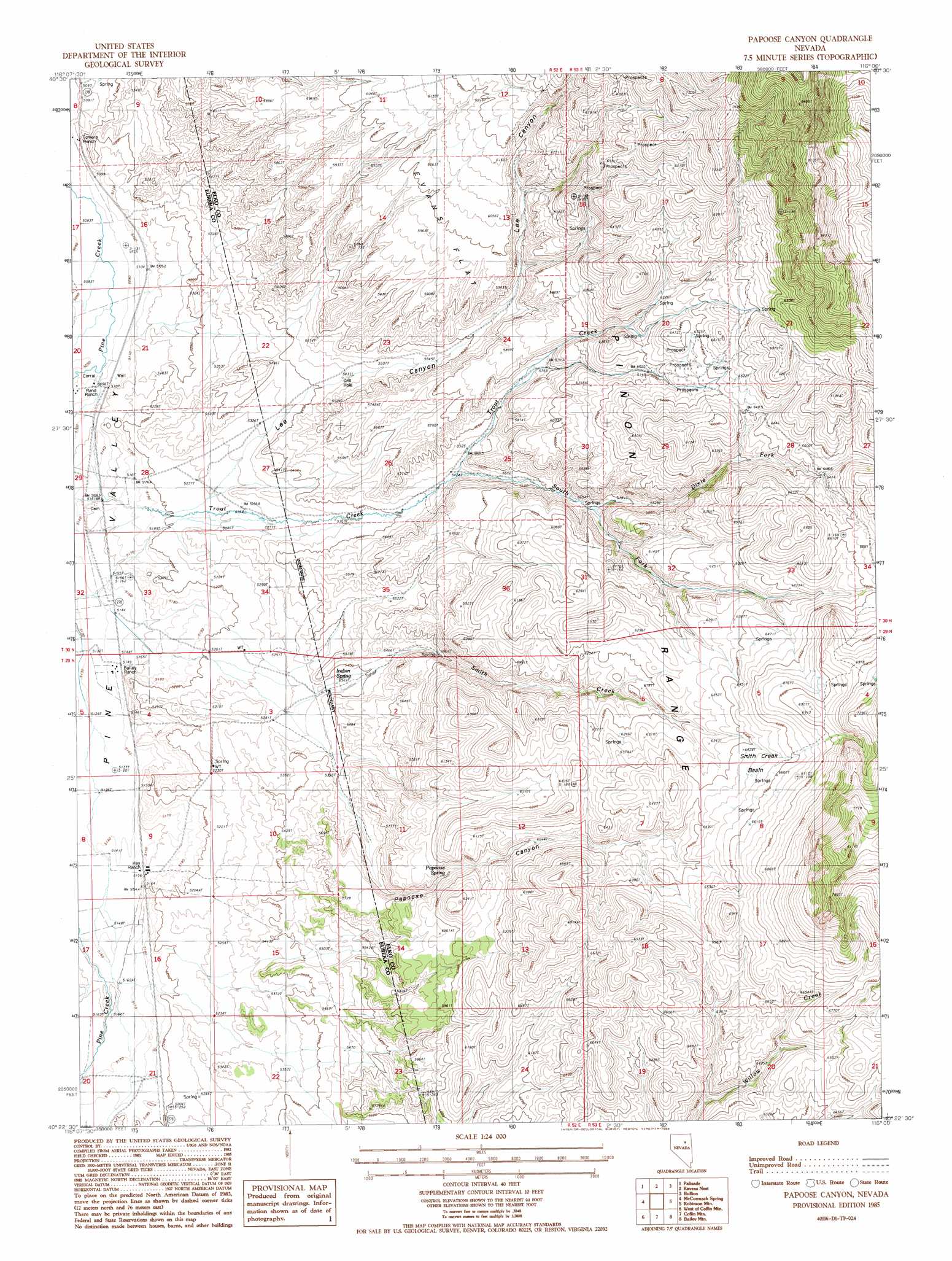
USGS Topo Quad 40116d1 - 1:24,000 scale
| Topo Map Name: | Papoose Canyon |
| USGS Topo Quad ID: | 40116d1 |
| Print Size: | ca. 21 1/4" wide x 27" high |
| Southeast Coordinates: | 40.375° N latitude / 116° W longitude |
| Map Center Coordinates: | 40.4375° N latitude / 116.0625° W longitude |
| U.S. State: | NV |
| Filename: | o40116d1.jpg |
| Download Map JPG Image: | Papoose Canyon topo map 1:24,000 scale |
| Map Type: | Topographic |
| Topo Series: | 7.5´ |
| Map Scale: | 1:24,000 |
| Source of Map Images: | United States Geological Survey (USGS) |
| Alternate Map Versions: |
Papoose Canyon NV 1985, updated 1986 Download PDF Buy paper map Papoose Canyon NV 2012 Download PDF Buy paper map Papoose Canyon NV 2014 Download PDF Buy paper map |
1:24,000 Topo Quads surrounding Papoose Canyon
Emigrant Pass |
Carlin West |
Carlin East |
Grindstone Mountain |
White Flats |
Scotts Gulch |
Palisade |
Ravens Nest |
Bullion |
Red Spring |
Frenchie Flat |
Mccormack Spring |
Papoose Canyon |
Robinson Mountain |
Cedar Ridge |
Thatcher Spring |
West Of Coffin Mountain |
Coffin Mountain |
Bailey Mountain |
East Of Bailey Mountain |
Curlow Flat |
Mineral Hill Nw |
Mineral Hill |
Garcia Flat |
Sadler Basin |
> Back to 40116a1 at 1:100,000 scale
> Back to 40116a1 at 1:250,000 scale
> Back to U.S. Topo Maps home
Papoose Canyon topo map: Gazetteer
Papoose Canyon: Basins
Smith Creek Basin elevation 1996m 6548′Papoose Canyon: Flats
Evans Flat elevation 1819m 5967′Papoose Canyon: Springs
Indian Spring elevation 1634m 5360′Papoose Spring elevation 1797m 5895′
Papoose Canyon: Streams
Dixie Fork Trout Creek elevation 1733m 5685′Front Creek elevation 1557m 5108′
Smith Creek elevation 1574m 5164′
South Fork Trout Creek elevation 1668m 5472′
Willow Creek elevation 1582m 5190′
Papoose Canyon: Valleys
Lee Canyon elevation 1600m 5249′Papoose Canyon elevation 1649m 5410′
Papoose Canyon digital topo map on disk
Buy this Papoose Canyon topo map showing relief, roads, GPS coordinates and other geographical features, as a high-resolution digital map file on DVD: