Tumbleweed Flat Topo Map Nevada
To zoom in, hover over the map of Tumbleweed Flat
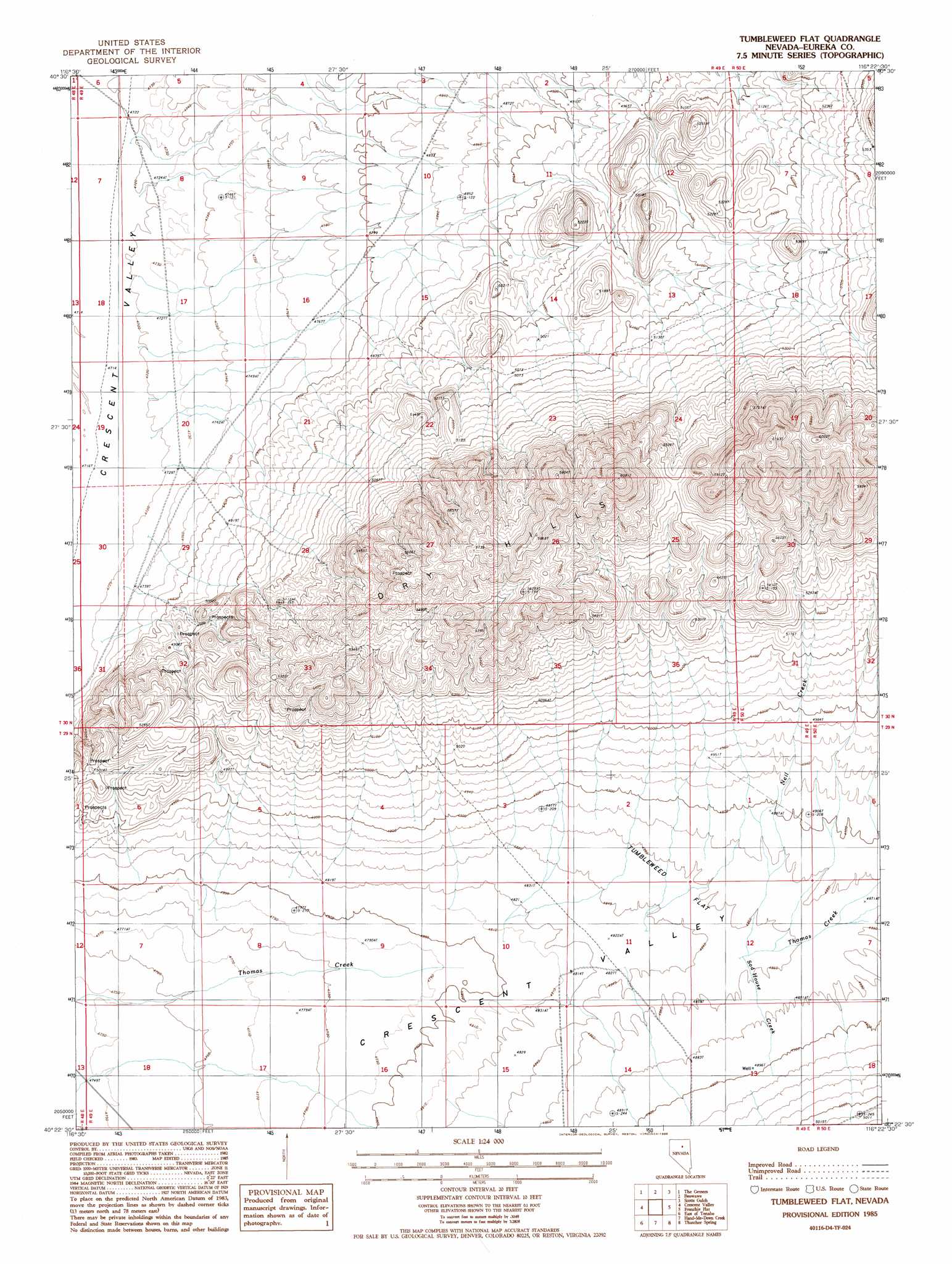
USGS Topo Quad 40116d4 - 1:24,000 scale
| Topo Map Name: | Tumbleweed Flat |
| USGS Topo Quad ID: | 40116d4 |
| Print Size: | ca. 21 1/4" wide x 27" high |
| Southeast Coordinates: | 40.375° N latitude / 116.375° W longitude |
| Map Center Coordinates: | 40.4375° N latitude / 116.4375° W longitude |
| U.S. State: | NV |
| Filename: | o40116d4.jpg |
| Download Map JPG Image: | Tumbleweed Flat topo map 1:24,000 scale |
| Map Type: | Topographic |
| Topo Series: | 7.5´ |
| Map Scale: | 1:24,000 |
| Source of Map Images: | United States Geological Survey (USGS) |
| Alternate Map Versions: |
Tumbleweed Flat NV 1985, updated 1986 Download PDF Buy paper map Tumbleweed Flat NV 2012 Download PDF Buy paper map Tumbleweed Flat NV 2014 Download PDF Buy paper map |
1:24,000 Topo Quads surrounding Tumbleweed Flat
Argenta |
Dunphy |
Bobs Flat |
Emigrant Pass |
Carlin West |
Mule Canyon |
The Geysers |
Beowawe |
Scotts Gulch |
Palisade |
Mud Spring Gulch |
Crescent Valley |
Tumbleweed Flat |
Frenchie Flat |
Mccormack Spring |
Tenabo |
East Of Tenabo |
Hand-Me-Down Creek |
Thatcher Spring |
West Of Coffin Mountain |
Cortez Canyon |
Cortez |
Buckhorn Mine |
Curlow Flat |
Mineral Hill Nw |
> Back to 40116a1 at 1:100,000 scale
> Back to 40116a1 at 1:250,000 scale
> Back to U.S. Topo Maps home
Tumbleweed Flat topo map: Gazetteer
Tumbleweed Flat: Flats
Tumbleweed Flat elevation 1482m 4862′Tumbleweed Flat: Streams
Neil Creek elevation 1476m 4842′Sod House Creek elevation 1476m 4842′
Thomas Creek elevation 1449m 4753′
Tumbleweed Flat digital topo map on disk
Buy this Tumbleweed Flat topo map showing relief, roads, GPS coordinates and other geographical features, as a high-resolution digital map file on DVD: