Crescent Valley Topo Map Nevada
To zoom in, hover over the map of Crescent Valley
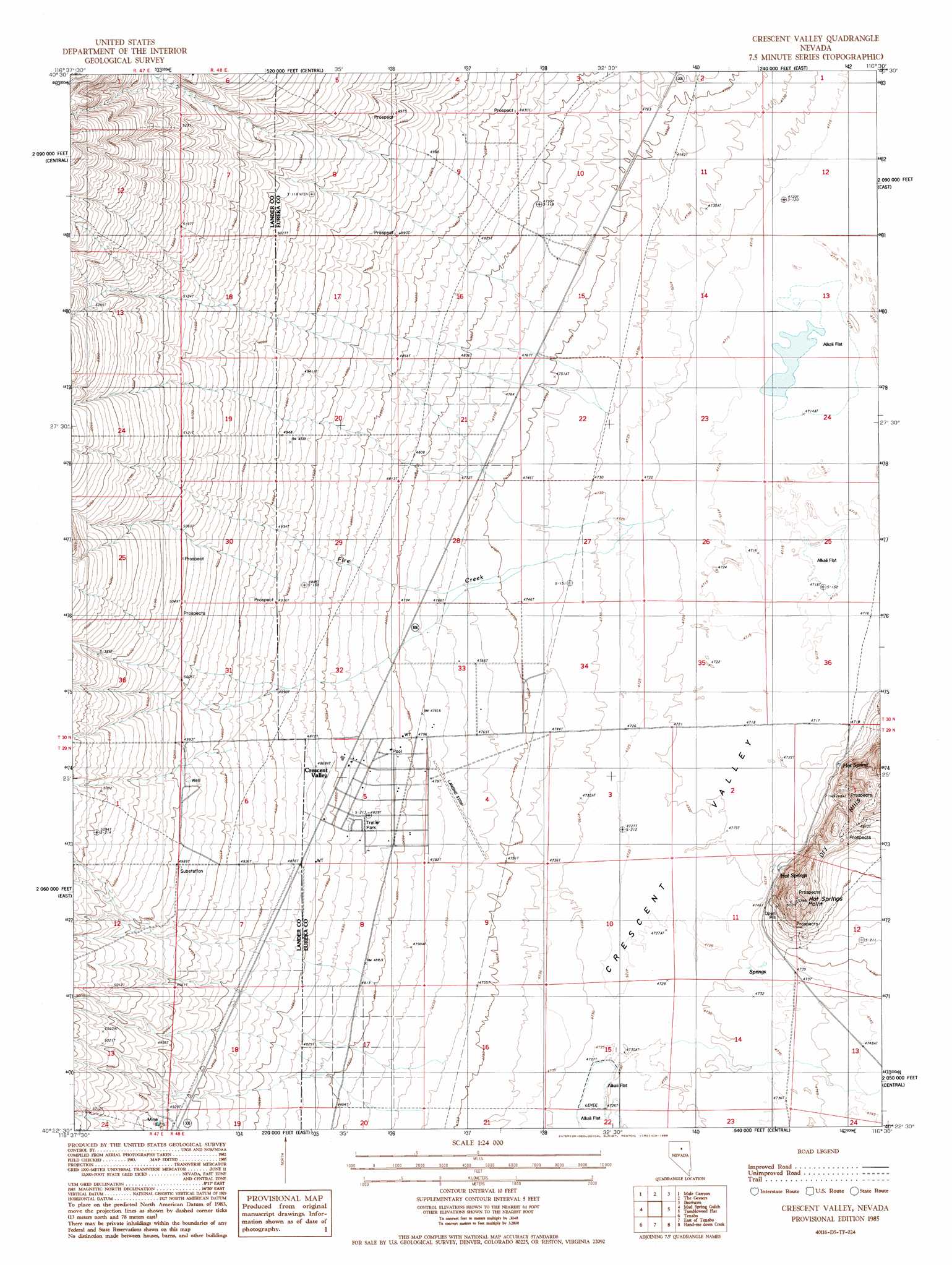
USGS Topo Quad 40116d5 - 1:24,000 scale
| Topo Map Name: | Crescent Valley |
| USGS Topo Quad ID: | 40116d5 |
| Print Size: | ca. 21 1/4" wide x 27" high |
| Southeast Coordinates: | 40.375° N latitude / 116.5° W longitude |
| Map Center Coordinates: | 40.4375° N latitude / 116.5625° W longitude |
| U.S. State: | NV |
| Filename: | o40116d5.jpg |
| Download Map JPG Image: | Crescent Valley topo map 1:24,000 scale |
| Map Type: | Topographic |
| Topo Series: | 7.5´ |
| Map Scale: | 1:24,000 |
| Source of Map Images: | United States Geological Survey (USGS) |
| Alternate Map Versions: |
Crescent Valley NV 1985, updated 1986 Download PDF Buy paper map Crescent Valley NV 2012 Download PDF Buy paper map Crescent Valley NV 2015 Download PDF Buy paper map |
1:24,000 Topo Quads surrounding Crescent Valley
Stony Point |
Argenta |
Dunphy |
Bobs Flat |
Emigrant Pass |
Bateman Spring |
Mule Canyon |
The Geysers |
Beowawe |
Scotts Gulch |
Mount Lewis |
Mud Spring Gulch |
Crescent Valley |
Tumbleweed Flat |
Frenchie Flat |
Ferris Creek |
Tenabo |
East Of Tenabo |
Hand-Me-Down Creek |
Thatcher Spring |
Rocky Pass |
Cortez Canyon |
Cortez |
Buckhorn Mine |
Curlow Flat |
> Back to 40116a1 at 1:100,000 scale
> Back to 40116a1 at 1:250,000 scale
> Back to U.S. Topo Maps home
Crescent Valley topo map: Gazetteer
Crescent Valley: Airports
Crescent Valley Landing Strip elevation 1452m 4763′Crescent Valley: Mines
Hot Springs Point Mine elevation 1471m 4826′Crescent Valley: Populated Places
Crescent Valley elevation 1468m 4816′Crescent Valley: Post Offices
Crescent Valley Rural Branch Post Office elevation 1476m 4842′Crescent Valley: Springs
Crescent Valley Hot Springs elevation 1451m 4760′Crescent Valley: Streams
Fire Creek elevation 1438m 4717′Crescent Valley: Summits
Hot Springs Point elevation 1532m 5026′Crescent Valley: Wells
Well Number Eight elevation 1443m 4734′Crescent Valley digital topo map on disk
Buy this Crescent Valley topo map showing relief, roads, GPS coordinates and other geographical features, as a high-resolution digital map file on DVD: