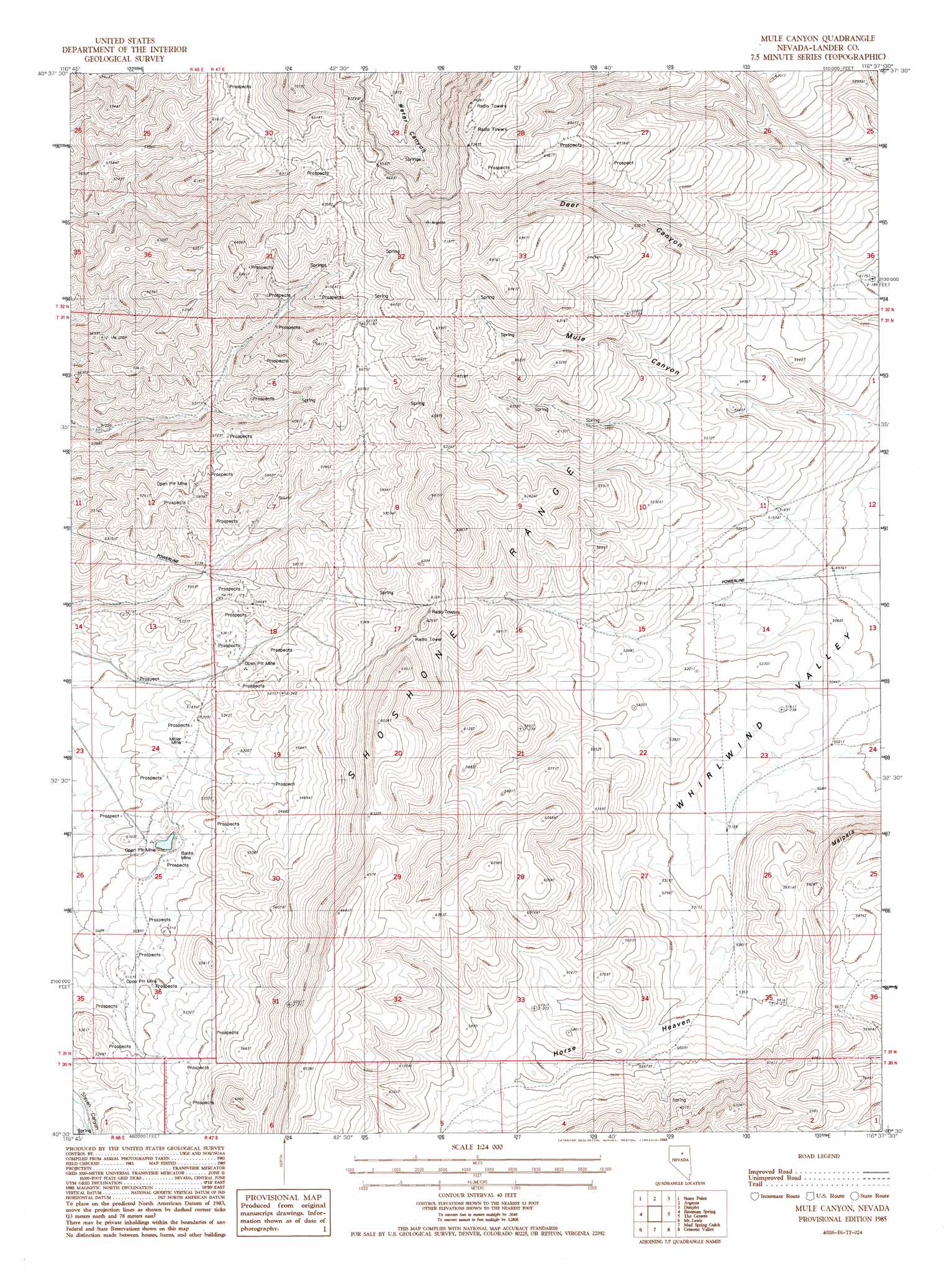
Mule Canyon Topo Map Nevada
To zoom in, hover over the map of Mule Canyon
USGS Topo Quad 40116e6 - 1:24,000 scale
| Topo Map Name: | Mule Canyon |
| USGS Topo Quad ID: | 40116e6 |
| Print Size: | ca. 21 1/4" wide x 27" high |
| Southeast Coordinates: | 40.5° N latitude / 116.625° W longitude |
| Map Center Coordinates: | 40.5625° N latitude / 116.6875° W longitude |
| U.S. State: | NV |
| Filename: | o40116e6.jpg |
| Download Map JPG Image: | Mule Canyon topo map 1:24,000 scale |
| Map Type: | Topographic |
| Topo Series: | 7.5´ |
| Map Scale: | 1:24,000 |
| Source of Map Images: | United States Geological Survey (USGS) |
| Alternate Map Versions: |
Mule Canyon NV 1985, updated 1986 Download PDF Buy paper map Mule Canyon NV 2012 Download PDF Buy paper map Mule Canyon NV 2014 Download PDF Buy paper map |
1:24,000 Topo Quads surrounding Mule Canyon
Russells |
Izzenhood Spring |
Sheep Creek Range Sw |
Sheep Creek Range Se |
Rodeo Creek Sw |
Battle Mountain |
Stony Point |
Argenta |
Dunphy |
Bobs Flat |
Blossom Spring |
Bateman Spring |
Mule Canyon |
The Geysers |
Beowawe |
Crippen Canyon |
Mount Lewis |
Mud Spring Gulch |
Crescent Valley |
Tumbleweed Flat |
Goat Peak |
Ferris Creek |
Tenabo |
East Of Tenabo |
Hand-Me-Down Creek |
> Back to 40116e1 at 1:100,000 scale
> Back to 40116a1 at 1:250,000 scale
> Back to U.S. Topo Maps home
Mule Canyon topo map: Gazetteer
Mule Canyon: Cliffs
Malpais elevation 1746m 5728′Mule Canyon: Flats
Horse Heaven elevation 1687m 5534′Mule Canyon: Mines
A C Barite Mine elevation 1918m 6292′Bante Mine elevation 1523m 4996′
Dolezal Mine elevation 1612m 5288′
Miller Mine elevation 1570m 5150′
Mule Canyon: Valleys
Deer Canyon elevation 1716m 5629′Mule Canyon digital topo map on disk
Buy this Mule Canyon topo map showing relief, roads, GPS coordinates and other geographical features, as a high-resolution digital map file on DVD: