Carlin West Topo Map Nevada
To zoom in, hover over the map of Carlin West
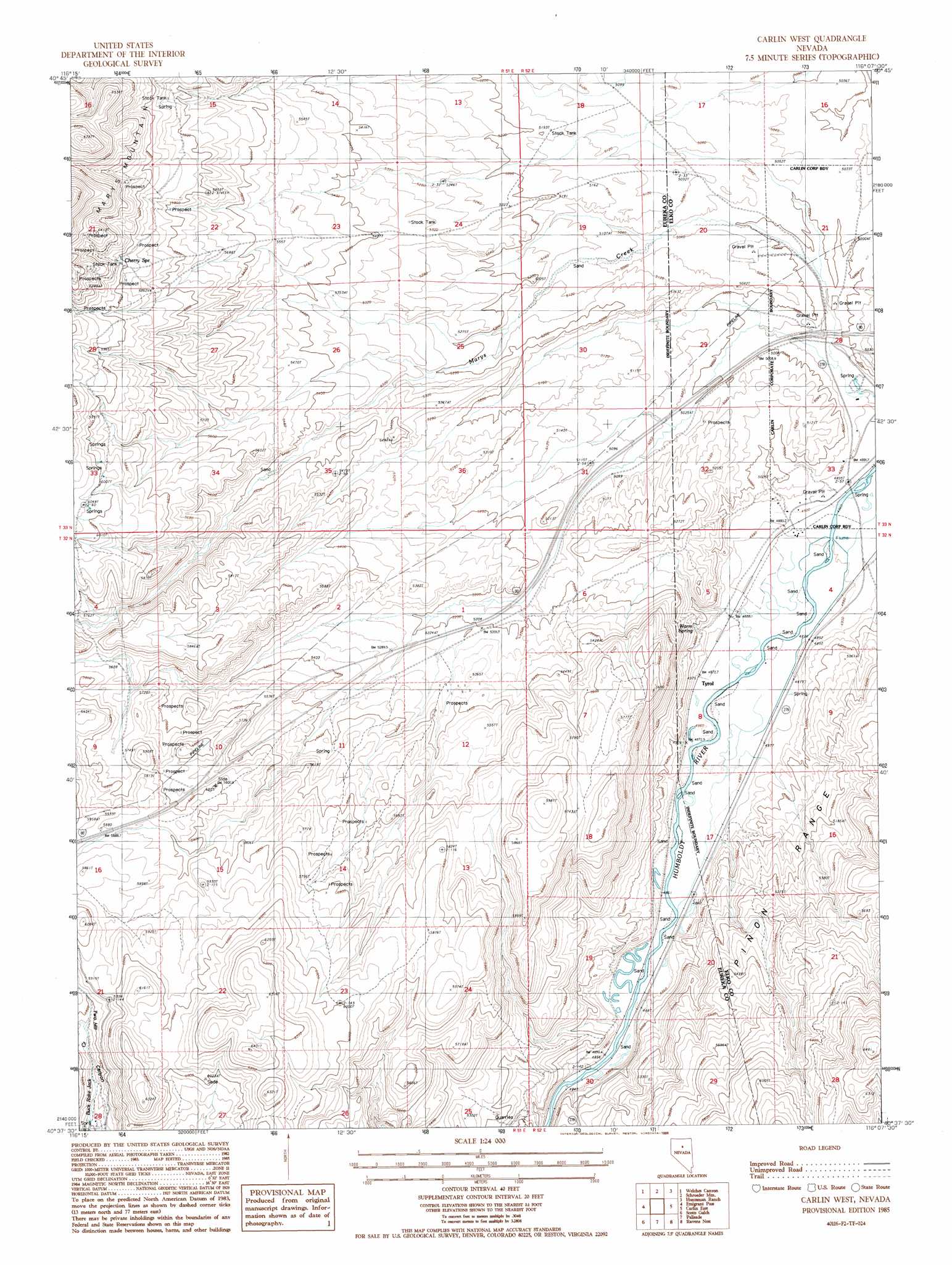
USGS Topo Quad 40116f2 - 1:24,000 scale
| Topo Map Name: | Carlin West |
| USGS Topo Quad ID: | 40116f2 |
| Print Size: | ca. 21 1/4" wide x 27" high |
| Southeast Coordinates: | 40.625° N latitude / 116.125° W longitude |
| Map Center Coordinates: | 40.6875° N latitude / 116.1875° W longitude |
| U.S. State: | NV |
| Filename: | o40116f2.jpg |
| Download Map JPG Image: | Carlin West topo map 1:24,000 scale |
| Map Type: | Topographic |
| Topo Series: | 7.5´ |
| Map Scale: | 1:24,000 |
| Source of Map Images: | United States Geological Survey (USGS) |
| Alternate Map Versions: |
Carlin West NV 1985, updated 1986 Download PDF Buy paper map Carlin West NV 2012 Download PDF Buy paper map Carlin West NV 2014 Download PDF Buy paper map |
1:24,000 Topo Quads surrounding Carlin West
Rodeo Creek Nw |
Rodeo Creek Ne |
Swales Mountain Nw |
Swales Mountain |
Adobe Summit |
Rodeo Creek Sw |
Welches Canyon |
Schroeder Mountain |
Huntsman Ranch |
Hunter |
Bobs Flat |
Emigrant Pass |
Carlin West |
Carlin East |
Grindstone Mountain |
Beowawe |
Scotts Gulch |
Palisade |
Ravens Nest |
Bullion |
Tumbleweed Flat |
Frenchie Flat |
Mccormack Spring |
Papoose Canyon |
Robinson Mountain |
> Back to 40116e1 at 1:100,000 scale
> Back to 40116a1 at 1:250,000 scale
> Back to U.S. Topo Maps home
Carlin West topo map: Gazetteer
Carlin West: Areas
Stampede elevation 1540m 5052′Carlin West: Crossings
Carlin West Interchange elevation 1513m 4963′Carlin West: Populated Places
Tyrol elevation 1489m 4885′Carlin West: Springs
Cherry Spring elevation 1836m 6023′Warm Spring elevation 1520m 4986′
Carlin West: Streams
Woodruff Creek elevation 1493m 4898′Carlin West digital topo map on disk
Buy this Carlin West topo map showing relief, roads, GPS coordinates and other geographical features, as a high-resolution digital map file on DVD: