Sou Hot Springs Topo Map Nevada
To zoom in, hover over the map of Sou Hot Springs
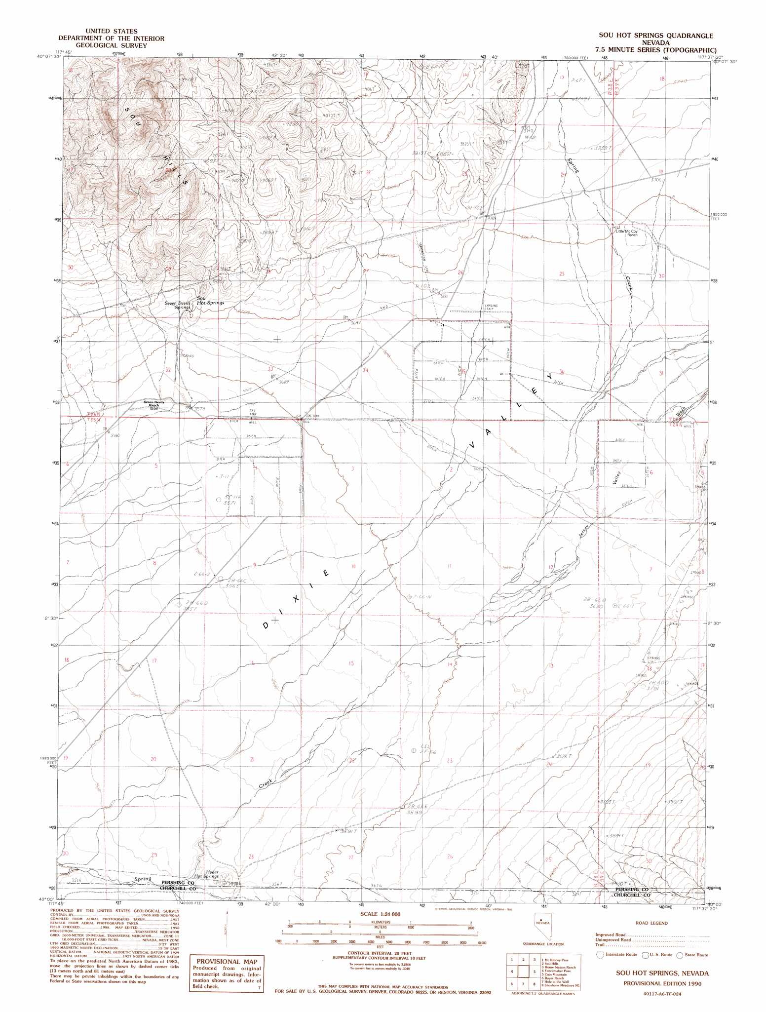
USGS Topo Quad 40117a6 - 1:24,000 scale
| Topo Map Name: | Sou Hot Springs |
| USGS Topo Quad ID: | 40117a6 |
| Print Size: | ca. 21 1/4" wide x 27" high |
| Southeast Coordinates: | 40° N latitude / 117.625° W longitude |
| Map Center Coordinates: | 40.0625° N latitude / 117.6875° W longitude |
| U.S. State: | NV |
| Filename: | o40117a6.jpg |
| Download Map JPG Image: | Sou Hot Springs topo map 1:24,000 scale |
| Map Type: | Topographic |
| Topo Series: | 7.5´ |
| Map Scale: | 1:24,000 |
| Source of Map Images: | United States Geological Survey (USGS) |
| Alternate Map Versions: |
Sou Hot Springs NV 1990, updated 1990 Download PDF Buy paper map Sou Hot Springs NV 2011 Download PDF Buy paper map Sou Hot Springs NV 2014 Download PDF Buy paper map |
1:24,000 Topo Quads surrounding Sou Hot Springs
Kyle Hot Springs Sw |
Granite Mountain |
Kennedy Canyon |
Needle Peak |
Jersey Summit |
West Of Mckinney Pass |
Mckinney Pass |
Sou Hills |
Home Station Ranch |
Mount Moses |
Logan Peak |
Fencemaker Pass |
Sou Hot Springs |
Cain Mountain |
Home Station Gap |
Bolivia |
Boyer Ranch |
Hole In The Wall |
Shoshone Meadows Ne |
Gilbert Creek Nw |
Humboldt Salt Marsh |
Bernice Canyon |
Shoshone Meadows |
Shoshone Meadows Se |
Gilbert Creek Sw |
> Back to 40117a1 at 1:100,000 scale
> Back to 40116a1 at 1:250,000 scale
> Back to U.S. Topo Maps home
Sou Hot Springs topo map: Gazetteer
Sou Hot Springs: Springs
Hyder Hot Springs elevation 1078m 3536′Seven Devils Springs elevation 1119m 3671′
Sou Hot Springs elevation 1129m 3704′
Sou Hot Springs: Streams
Jersey Valley Wash elevation 1099m 3605′Sou Hot Springs: Valleys
Sou Canyon elevation 1093m 3585′Sou Hot Springs digital topo map on disk
Buy this Sou Hot Springs topo map showing relief, roads, GPS coordinates and other geographical features, as a high-resolution digital map file on DVD: