Fencemaker Pass Topo Map Nevada
To zoom in, hover over the map of Fencemaker Pass
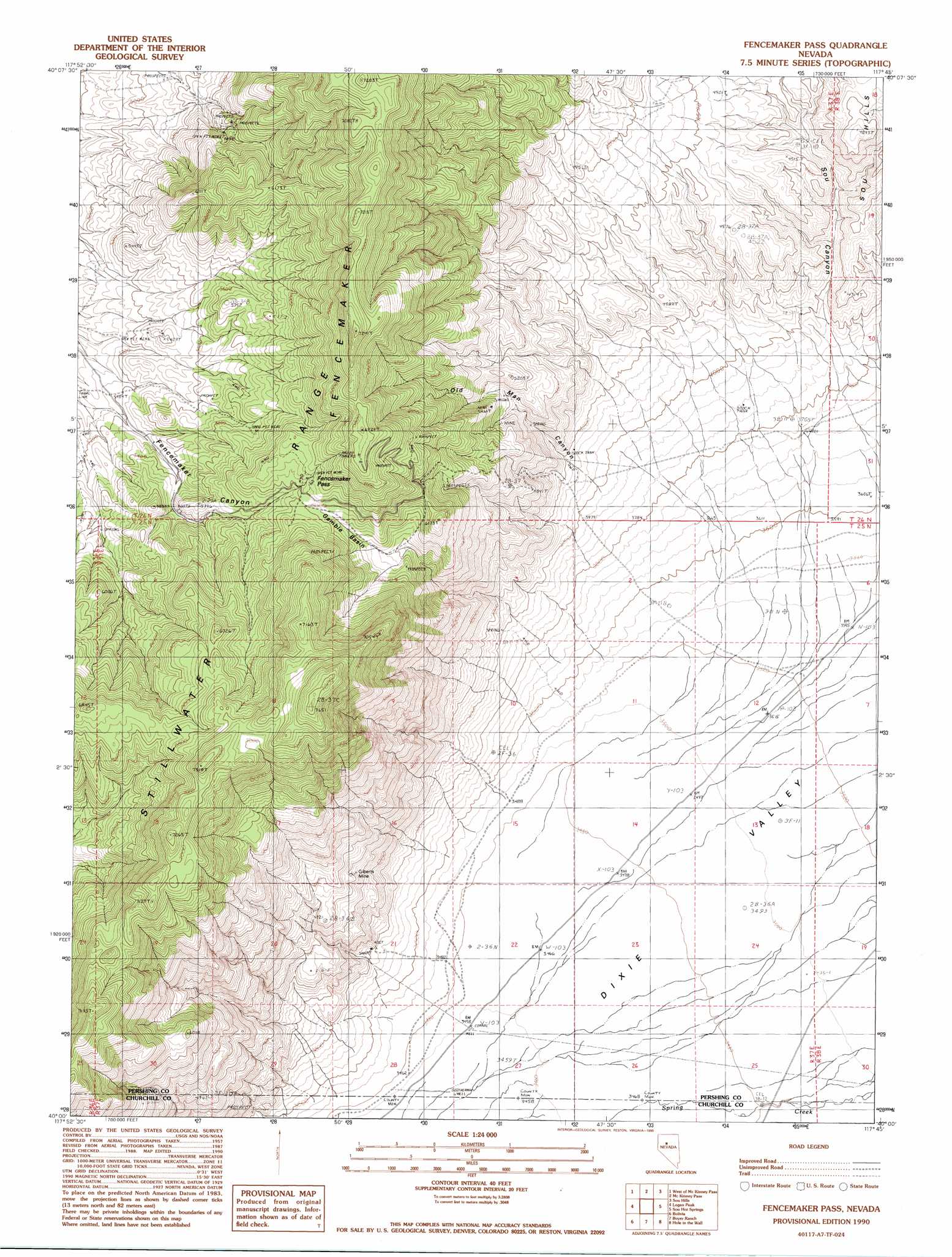
USGS Topo Quad 40117a7 - 1:24,000 scale
| Topo Map Name: | Fencemaker Pass |
| USGS Topo Quad ID: | 40117a7 |
| Print Size: | ca. 21 1/4" wide x 27" high |
| Southeast Coordinates: | 40° N latitude / 117.75° W longitude |
| Map Center Coordinates: | 40.0625° N latitude / 117.8125° W longitude |
| U.S. State: | NV |
| Filename: | o40117a7.jpg |
| Download Map JPG Image: | Fencemaker Pass topo map 1:24,000 scale |
| Map Type: | Topographic |
| Topo Series: | 7.5´ |
| Map Scale: | 1:24,000 |
| Source of Map Images: | United States Geological Survey (USGS) |
| Alternate Map Versions: |
Fencemaker Pass NV 1990, updated 1990 Download PDF Buy paper map Fencemaker Pass NV 2011 Download PDF Buy paper map Fencemaker Pass NV 2014 Download PDF Buy paper map |
1:24,000 Topo Quads surrounding Fencemaker Pass
Fitting |
Kyle Hot Springs Sw |
Granite Mountain |
Kennedy Canyon |
Needle Peak |
Fisher Canyon |
West Of Mckinney Pass |
Mckinney Pass |
Sou Hills |
Home Station Ranch |
Cornish Peak |
Logan Peak |
Fencemaker Pass |
Sou Hot Springs |
Cain Mountain |
Dixie Hot Springs Ne |
Bolivia |
Boyer Ranch |
Hole In The Wall |
Shoshone Meadows Ne |
Dixie Hot Springs |
Humboldt Salt Marsh |
Bernice Canyon |
Shoshone Meadows |
Shoshone Meadows Se |
> Back to 40117a1 at 1:100,000 scale
> Back to 40116a1 at 1:250,000 scale
> Back to U.S. Topo Maps home
Fencemaker Pass topo map: Gazetteer
Fencemaker Pass: Basins
Gamble Basin elevation 1745m 5725′Fencemaker Pass: Gaps
Fencemaker Pass elevation 1831m 6007′Fencemaker Pass: Mines
Fencemaker Mine elevation 1742m 5715′Gilberts Mine elevation 1374m 4507′
Susie Mine elevation 1697m 5567′
Fencemaker Pass: Ridges
Fencemaker elevation 2186m 7171′Fencemaker Pass: Valleys
Fencemaker Canyon elevation 1562m 5124′Old Man Canyon elevation 1217m 3992′
Fencemaker Pass digital topo map on disk
Buy this Fencemaker Pass topo map showing relief, roads, GPS coordinates and other geographical features, as a high-resolution digital map file on DVD: