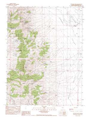
Natchez Pass Topo Map Nevada
To zoom in, hover over the map of Natchez Pass
USGS Topo Quad 40117f7 - 1:24,000 scale
| Topo Map Name: | Natchez Pass |
| USGS Topo Quad ID: | 40117f7 |
| Print Size: | ca. 21 1/4" wide x 27" high |
| Southeast Coordinates: | 40.625° N latitude / 117.75° W longitude |
| Map Center Coordinates: | 40.6875° N latitude / 117.8125° W longitude |
| U.S. State: | NV |
| Filename: | o40117f7.jpg |
| Download Map JPG Image: | Natchez Pass topo map 1:24,000 scale |
| Map Type: | Topographic |
| Topo Series: | 7.5´ |
| Map Scale: | 1:24,000 |
| Source of Map Images: | United States Geological Survey (USGS) |
| Alternate Map Versions: |
Natchez Pass NV 1990, updated 1990 Download PDF Buy paper map Natchez Pass NV 2011 Download PDF Buy paper map Natchez Pass NV 2014 Download PDF Buy paper map |
1:24,000 Topo Quads surrounding Natchez Pass
> Back to 40117e1 at 1:100,000 scale
> Back to 40116a1 at 1:250,000 scale
> Back to U.S. Topo Maps home
Natchez Pass topo map: Gazetteer
Natchez Pass: Gaps
Hayden Pass elevation 1944m 6377′Natchez Pass elevation 1828m 5997′
Natchez Pass: Mines
Blackhawk Mine elevation 1703m 5587′Eclipse Mine elevation 1981m 6499′
Floyds Shaft elevation 1759m 5770′
Four Sisters Mine elevation 1710m 5610′
Gem Mine elevation 1700m 5577′
Little Jupiter Mine elevation 1888m 6194′
Mayflower Mine elevation 1789m 5869′
Stonehouse elevation 1920m 6299′
Sweet Mine elevation 1815m 5954′
Natchez Pass: Populated Places
Bonnie Briar (historical) elevation 1666m 5465′Natchez Pass: Post Offices
Bonnie Briar Post Office (historical) elevation 1666m 5465′Natchez Pass: Ranges
East Range elevation 1906m 6253′Natchez Pass: Springs
Barrel Spring elevation 1959m 6427′Dolly Hayden Spring elevation 1589m 5213′
Highrock Spring elevation 1741m 5711′
McElhany Spring elevation 1566m 5137′
Mustang Spring elevation 1907m 6256′
Point Spring elevation 1453m 4767′
Twin Springs elevation 1513m 4963′
Natchez Pass: Streams
Gem Creek elevation 1355m 4445′Natchez Pass: Summits
Organ Peak elevation 2221m 7286′Rockhill Mountain elevation 2188m 7178′
Natchez Pass: Valleys
Horseshoe Canyon elevation 1653m 5423′Natchez Pass: Wells
Hayden Well elevation 1390m 4560′Natchez Pass digital topo map on disk
Buy this Natchez Pass topo map showing relief, roads, GPS coordinates and other geographical features, as a high-resolution digital map file on DVD:


