Dun Glen Peak Topo Map Nevada
To zoom in, hover over the map of Dun Glen Peak
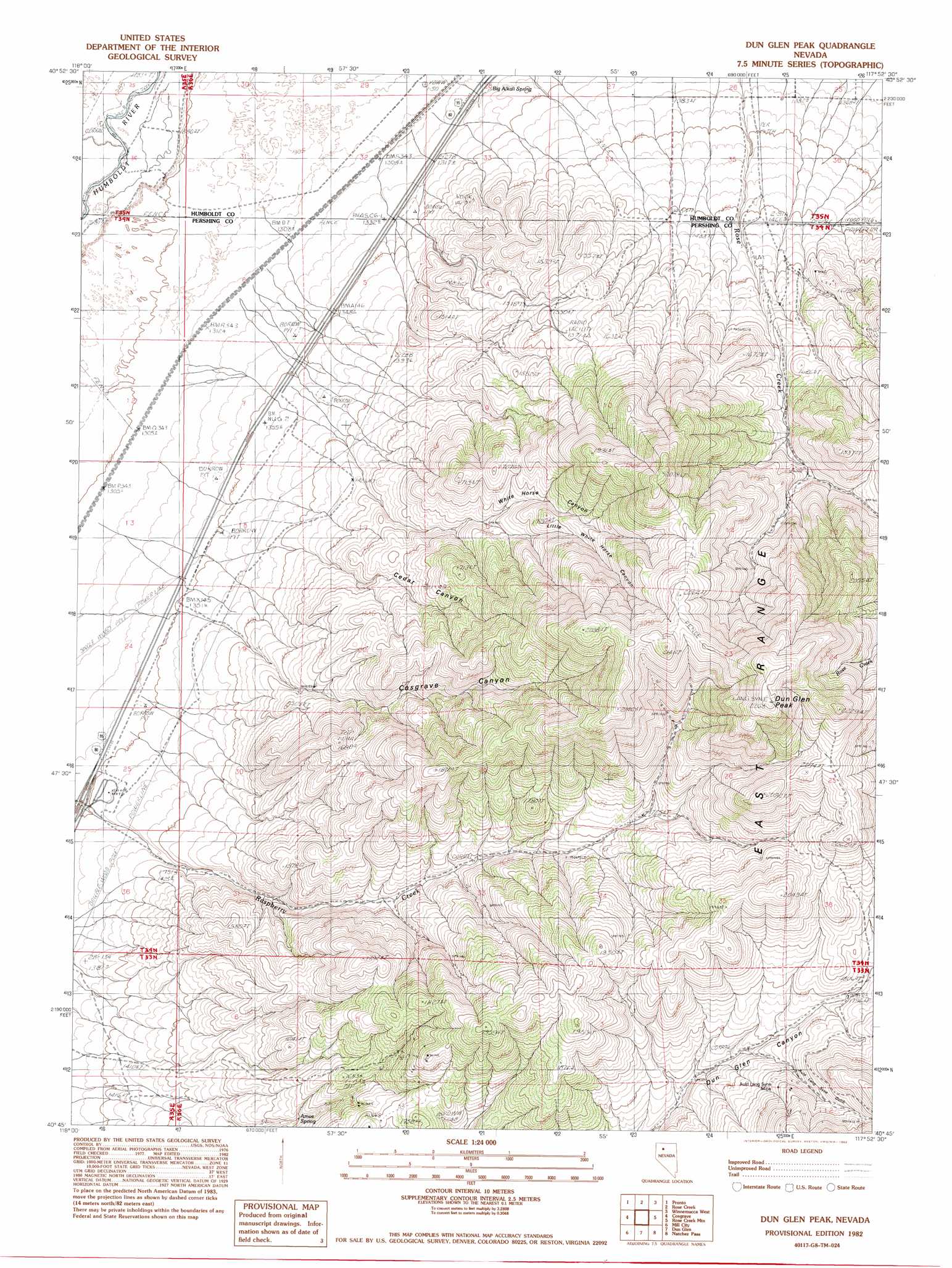
USGS Topo Quad 40117g8 - 1:24,000 scale
| Topo Map Name: | Dun Glen Peak |
| USGS Topo Quad ID: | 40117g8 |
| Print Size: | ca. 21 1/4" wide x 27" high |
| Southeast Coordinates: | 40.75° N latitude / 117.875° W longitude |
| Map Center Coordinates: | 40.8125° N latitude / 117.9375° W longitude |
| U.S. State: | NV |
| Filename: | o40117g8.jpg |
| Download Map JPG Image: | Dun Glen Peak topo map 1:24,000 scale |
| Map Type: | Topographic |
| Topo Series: | 7.5´ |
| Map Scale: | 1:24,000 |
| Source of Map Images: | United States Geological Survey (USGS) |
| Alternate Map Versions: |
Dun Glen Peak NV 1982, updated 1982 Download PDF Buy paper map Dun Glen Peak NV 2011 Download PDF Buy paper map Dun Glen Peak NV 2014 Download PDF Buy paper map |
1:24,000 Topo Quads surrounding Dun Glen Peak
Lay Waterhole |
Mormon Dan Butte |
Barrett Springs |
Winnemucca Mountain |
Weso |
Gaskell |
Pronto |
Rose Creek |
Winnemucca West |
Winnemucca East |
Woody Canyon |
Cosgrave |
Dun Glen Peak |
Rose Creek Mountain |
Sonoma Canyon |
Imlay |
Mill City |
Dun Glen |
Natchez Pass |
Clear Creek Ranch |
Star Peak |
Star Creek Ranch |
Inskip Canyon |
Lee Peak |
Leach Hot Springs |
> Back to 40117e1 at 1:100,000 scale
> Back to 40116a1 at 1:250,000 scale
> Back to U.S. Topo Maps home
Dun Glen Peak topo map: Gazetteer
Dun Glen Peak: Mines
Auld Lang Syne Mine elevation 1850m 6069′Hendra Mines elevation 1896m 6220′
Neptune Tunnel elevation 1777m 5830′
Dun Glen Peak: Springs
Amos Spring elevation 1554m 5098′Big Alkali Spring elevation 1322m 4337′
Rasberry Spring Four elevation 1888m 6194′
Rasberry Spring One elevation 1677m 5501′
Rasberry Spring Three elevation 1780m 5839′
Rasberry Spring Two elevation 1677m 5501′
Dun Glen Peak: Streams
Cedar Creek elevation 1360m 4461′White Horse Creek elevation 1361m 4465′
Dun Glen Peak: Summits
Dun Glen Peak elevation 2255m 7398′Dun Glen Peak: Valleys
Auld Lang Syne Gulch elevation 1732m 5682′Cedar Canyon elevation 1442m 4730′
Cosgrave Canyon elevation 1453m 4767′
Little White Horse Canyon elevation 1566m 5137′
North Fork Raspberry Cañon elevation 1731m 5679′
Osburns Cañon elevation 1522m 4993′
Raspberry Cañon elevation 1361m 4465′
White Horse Canyon elevation 1454m 4770′
Dun Glen Peak digital topo map on disk
Buy this Dun Glen Peak topo map showing relief, roads, GPS coordinates and other geographical features, as a high-resolution digital map file on DVD: