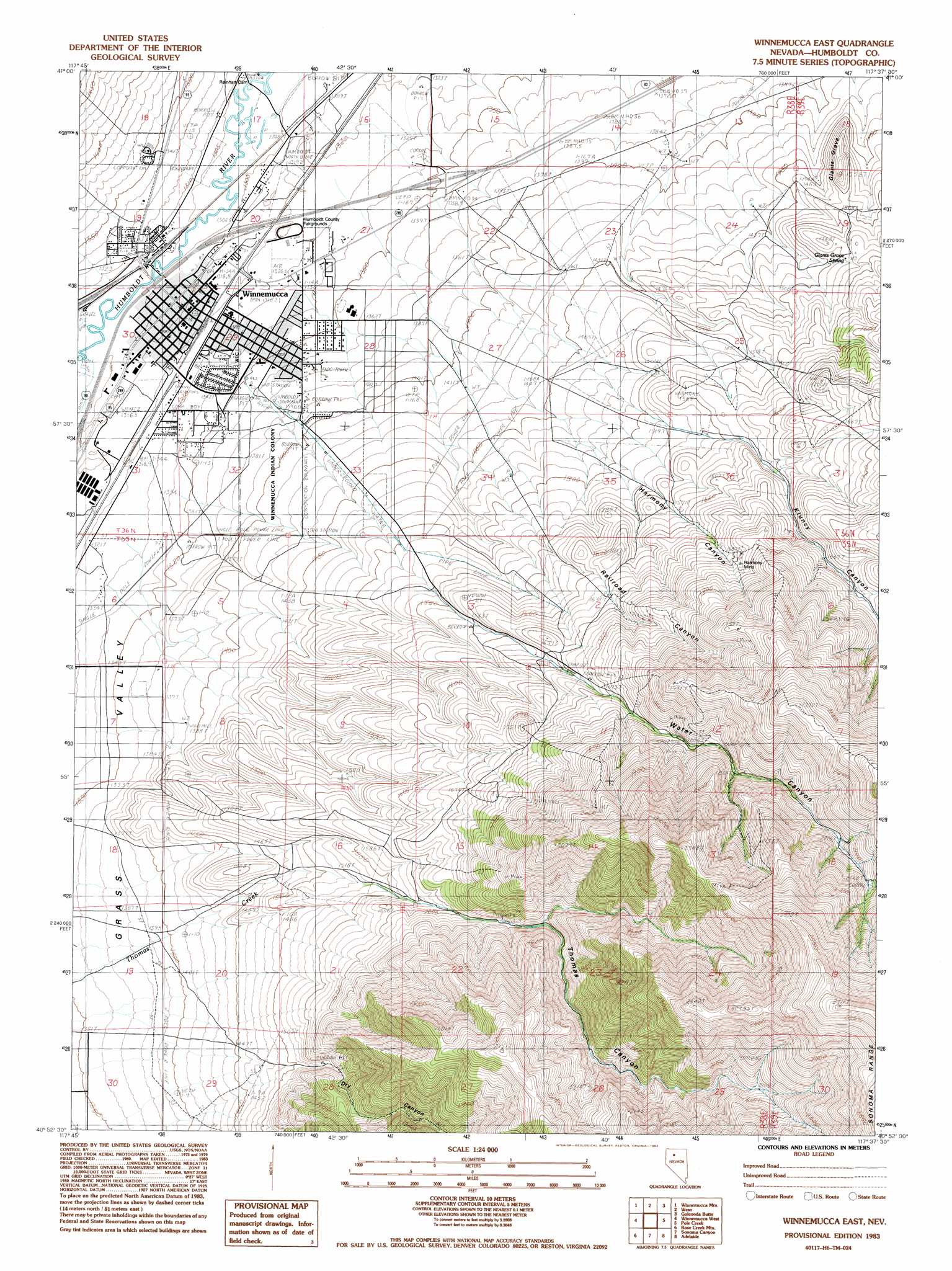
Winnemucca East Topo Map Nevada
To zoom in, hover over the map of Winnemucca East
USGS Topo Quad 40117h6 - 1:24,000 scale
| Topo Map Name: | Winnemucca East |
| USGS Topo Quad ID: | 40117h6 |
| Print Size: | ca. 21 1/4" wide x 27" high |
| Southeast Coordinates: | 40.875° N latitude / 117.625° W longitude |
| Map Center Coordinates: | 40.9375° N latitude / 117.6875° W longitude |
| U.S. State: | NV |
| Filename: | o40117h6.jpg |
| Download Map JPG Image: | Winnemucca East topo map 1:24,000 scale |
| Map Type: | Topographic |
| Topo Series: | 7.5´ |
| Map Scale: | 1:24,000 |
| Source of Map Images: | United States Geological Survey (USGS) |
| Alternate Map Versions: |
Winnemucca NW NV 1975, updated 1980 Download PDF Buy paper map Winnemucca East NV 1983, updated 1983 Download PDF Buy paper map Winnemucca East NV 2011 Download PDF Buy paper map Winnemucca East NV 2014 Download PDF Buy paper map |
1:24,000 Topo Quads surrounding Winnemucca East
Silver State Draw |
Bloody Run Peak |
China Garden |
Gumboot Lake |
Delvada Spring |
Barrett Springs |
Winnemucca Mountain |
Weso |
Golconda Butte |
Anderson Gardens |
Rose Creek |
Winnemucca West |
Winnemucca East |
Pole Creek |
Golconda |
Dun Glen Peak |
Rose Creek Mountain |
Sonoma Canyon |
Adelaide |
Goldrun Creek |
Dun Glen |
Natchez Pass |
Clear Creek Ranch |
Sheep Ranch Canyon |
Smelser Pass |
> Back to 40117e1 at 1:100,000 scale
> Back to 40116a1 at 1:250,000 scale
> Back to U.S. Topo Maps home
Winnemucca East topo map: Gazetteer
Winnemucca East: Crossings
East Winnemucca Interchange elevation 1352m 4435′Winnemucca Boulevard East Interchange elevation 1310m 4297′
Winnemucca East: Dams
Reinhart Dam elevation 1304m 4278′Winnemucca East: Mines
Harmony Mine elevation 1701m 5580′Winnemucca East: Parks
Nixon Park elevation 1310m 4297′Pioneer Park elevation 1323m 4340′
Winnemucca East: Populated Places
Winnemucca elevation 1309m 4294′Winnemucca East: Post Offices
Winnemucca Post Office elevation 1309m 4294′Winnemucca East: Springs
Giants Grave Spring elevation 1523m 4996′Winnemucca East: Streams
Harmony Creek elevation 1319m 4327′North Fork Thomas Creek elevation 1682m 5518′
South Fork Thomas Creek elevation 1682m 5518′
Whites Creek elevation 1350m 4429′
Winnemucca East: Summits
Giants Grave elevation 1555m 5101′Winnemucca East: Valleys
Dry Canyon elevation 1367m 4484′Harmony Canyon elevation 1486m 4875′
Kluncy Canyon elevation 1480m 4855′
Railroad Canyon elevation 1431m 4694′
Thomas Canyon elevation 1544m 5065′
Water Canyon elevation 1573m 5160′
Winnemucca East digital topo map on disk
Buy this Winnemucca East topo map showing relief, roads, GPS coordinates and other geographical features, as a high-resolution digital map file on DVD: