Cornish Peak Topo Map Nevada
To zoom in, hover over the map of Cornish Peak
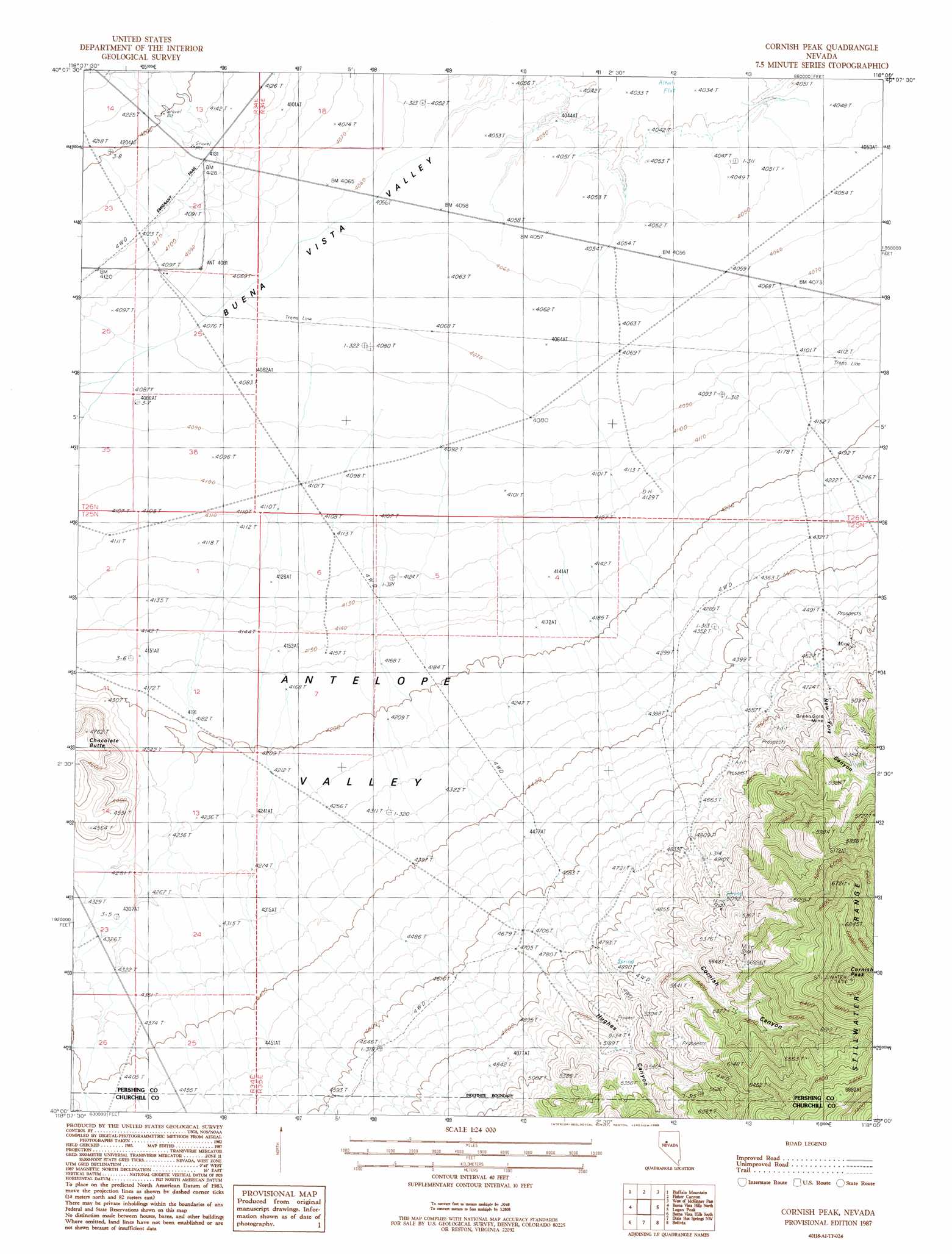
USGS Topo Quad 40118a1 - 1:24,000 scale
| Topo Map Name: | Cornish Peak |
| USGS Topo Quad ID: | 40118a1 |
| Print Size: | ca. 21 1/4" wide x 27" high |
| Southeast Coordinates: | 40° N latitude / 118° W longitude |
| Map Center Coordinates: | 40.0625° N latitude / 118.0625° W longitude |
| U.S. State: | NV |
| Filename: | o40118a1.jpg |
| Download Map JPG Image: | Cornish Peak topo map 1:24,000 scale |
| Map Type: | Topographic |
| Topo Series: | 7.5´ |
| Map Scale: | 1:24,000 |
| Source of Map Images: | United States Geological Survey (USGS) |
| Alternate Map Versions: |
Cornish Peak NV 1987, updated 1988 Download PDF Buy paper map Cornish Peak NV 2011 Download PDF Buy paper map Cornish Peak NV 2014 Download PDF Buy paper map |
1:24,000 Topo Quads surrounding Cornish Peak
Oreana |
Rochester |
Fitting |
Kyle Hot Springs Sw |
Granite Mountain |
Coal Canyon |
Buffalo Mountain |
Fisher Canyon |
West Of Mckinney Pass |
Mckinney Pass |
Wildhorse Spring |
Buena Vista Hills North |
Cornish Peak |
Logan Peak |
Fencemaker Pass |
Lone Rock |
Buena Vista Hills South |
Dixie Hot Springs Ne |
Bolivia |
Boyer Ranch |
Lone Rock Se |
Fondaway Canyon |
Dixie Hot Springs |
Humboldt Salt Marsh |
Bernice Canyon |
> Back to 40118a1 at 1:100,000 scale
> Back to 40118a1 at 1:250,000 scale
> Back to U.S. Topo Maps home
Cornish Peak topo map: Gazetteer
Cornish Peak: Flats
Antelope Valley elevation 1277m 4189′Cornish Peak: Mines
Green Gold Mine elevation 1450m 4757′Cornish Peak: Populated Places
Cornish Camp (historical) elevation 1536m 5039′Cornish Peak: Summits
Chocolate Butte elevation 1422m 4665′Cornish Peak elevation 2264m 7427′
Cornish Peak: Valleys
Cornish Canyon elevation 1465m 4806′Hughes Canyon elevation 1474m 4835′
New York Canyon elevation 1402m 4599′
Cornish Peak digital topo map on disk
Buy this Cornish Peak topo map showing relief, roads, GPS coordinates and other geographical features, as a high-resolution digital map file on DVD: