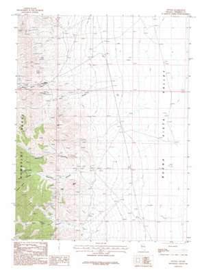
Fitting Topo Map Nevada
To zoom in, hover over the map of Fitting
USGS Topo Quad 40118c1 - 1:24,000 scale
| Topo Map Name: | Fitting |
| USGS Topo Quad ID: | 40118c1 |
| Print Size: | ca. 21 1/4" wide x 27" high |
| Southeast Coordinates: | 40.25° N latitude / 118° W longitude |
| Map Center Coordinates: | 40.3125° N latitude / 118.0625° W longitude |
| U.S. State: | NV |
| Filename: | o40118c1.jpg |
| Download Map JPG Image: | Fitting topo map 1:24,000 scale |
| Map Type: | Topographic |
| Topo Series: | 7.5´ |
| Map Scale: | 1:24,000 |
| Source of Map Images: | United States Geological Survey (USGS) |
| Alternate Map Versions: |
Fitting NV 1987, updated 1988 Download PDF Buy paper map Fitting NV 2011 Download PDF Buy paper map Fitting NV 2014 Download PDF Buy paper map |
1:24,000 Topo Quads surrounding Fitting
> Back to 40118a1 at 1:100,000 scale
> Back to 40118a1 at 1:250,000 scale
> Back to U.S. Topo Maps home
Fitting topo map: Gazetteer
Fitting: Mines
American Canyon Mines elevation 1508m 4947′Bonanza King Mine elevation 1512m 4960′
Cinnabar City Mine elevation 1682m 5518′
Dry Gulch Mines elevation 1513m 4963′
Enterprise Mine elevation 1807m 5928′
Hillside Mine elevation 1552m 5091′
Kaolinite Mine elevation 1678m 5505′
Little Linda Mine elevation 1546m 5072′
Pacific Matchless Mine elevation 1757m 5764′
Pinite Mine elevation 1641m 5383′
South American Canyon Mines elevation 1612m 5288′
Spring Valley Mines elevation 1512m 4960′
Troy Canyon Mines elevation 1575m 5167′
Wabash Mine elevation 1590m 5216′
Fitting: Populated Places
Fitting elevation 1484m 4868′Stevensville (historical) elevation 1445m 4740′
Fitting: Post Offices
Fitting Post Office (historical) elevation 1484m 4868′Fitting: Streams
Indian Creek elevation 1244m 4081′Fitting: Summits
Fossil Hill elevation 1595m 5232′Fitting: Valleys
American Canyon elevation 1414m 4639′Dry Gulch elevation 1432m 4698′
Porcupine Canyon elevation 1748m 5734′
South American Canyon elevation 1450m 4757′
Troy Canyon elevation 1448m 4750′
Fitting digital topo map on disk
Buy this Fitting topo map showing relief, roads, GPS coordinates and other geographical features, as a high-resolution digital map file on DVD:


