Poker Brown Topo Map Nevada
To zoom in, hover over the map of Poker Brown
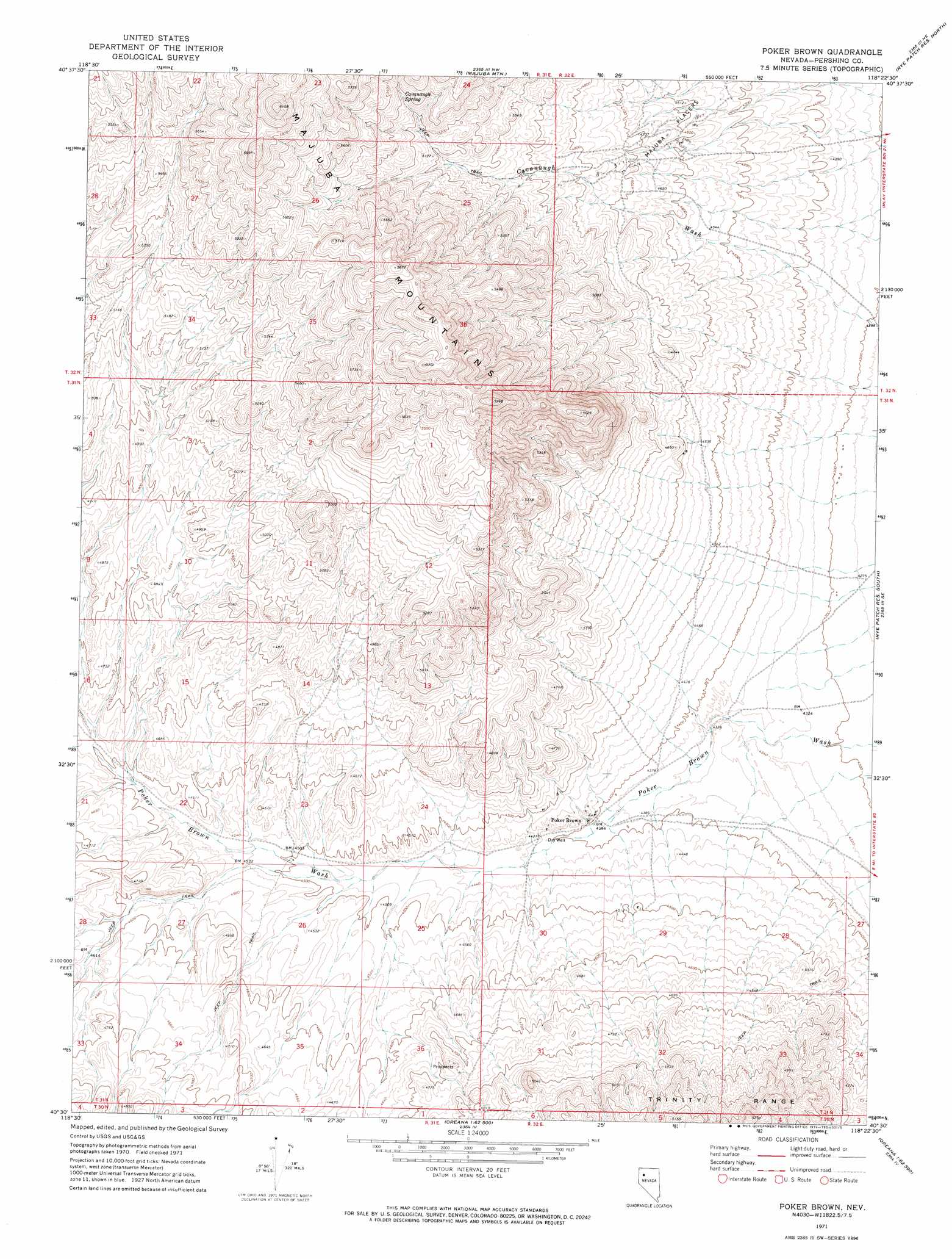
USGS Topo Quad 40118e4 - 1:24,000 scale
| Topo Map Name: | Poker Brown |
| USGS Topo Quad ID: | 40118e4 |
| Print Size: | ca. 21 1/4" wide x 27" high |
| Southeast Coordinates: | 40.5° N latitude / 118.375° W longitude |
| Map Center Coordinates: | 40.5625° N latitude / 118.4375° W longitude |
| U.S. State: | NV |
| Filename: | o40118e4.jpg |
| Download Map JPG Image: | Poker Brown topo map 1:24,000 scale |
| Map Type: | Topographic |
| Topo Series: | 7.5´ |
| Map Scale: | 1:24,000 |
| Source of Map Images: | United States Geological Survey (USGS) |
| Alternate Map Versions: |
Poker Brown NV 1971, updated 1974 Download PDF Buy paper map Poker Brown NV 2011 Download PDF Buy paper map Poker Brown NV 2014 Download PDF Buy paper map |
1:24,000 Topo Quads surrounding Poker Brown
Sulphur |
Sawtooth Knob |
Long Canyon |
Alpha Mountain |
Woody Canyon |
Placerites |
Scossa |
Majuba Mountain |
Rye Patch Res North |
Imlay |
Rocky Canyon |
Poker Brown Gap |
Poker Brown |
Rye Patch Res South |
Star Peak |
Trinity Pass Nw |
Natchez Spring |
Oreana Nw |
Rye Patch Dam |
Congress Canyon |
Trinity Pass |
Poker Brown Spring |
Arabia |
Oreana |
Rochester |
> Back to 40118e1 at 1:100,000 scale
> Back to 40118a1 at 1:250,000 scale
> Back to U.S. Topo Maps home
Poker Brown topo map: Gazetteer
Poker Brown: Mines
Bottomley Mine elevation 1451m 4760′Delta Mine elevation 1394m 4573′
Dice Mine elevation 1429m 4688′
Majuba Placers elevation 1413m 4635′
Owens Circle Mine elevation 1457m 4780′
Poker Brown Mine elevation 1344m 4409′
Rio Grande Mine elevation 1391m 4563′
Valley View Mine elevation 1397m 4583′
Poker Brown: Populated Places
Poker Brown elevation 1342m 4402′Poker Brown: Springs
Cavanaugh Spring elevation 1631m 5351′Poker Brown digital topo map on disk
Buy this Poker Brown topo map showing relief, roads, GPS coordinates and other geographical features, as a high-resolution digital map file on DVD: