Black Rock Point East Topo Map Nevada
To zoom in, hover over the map of Black Rock Point East
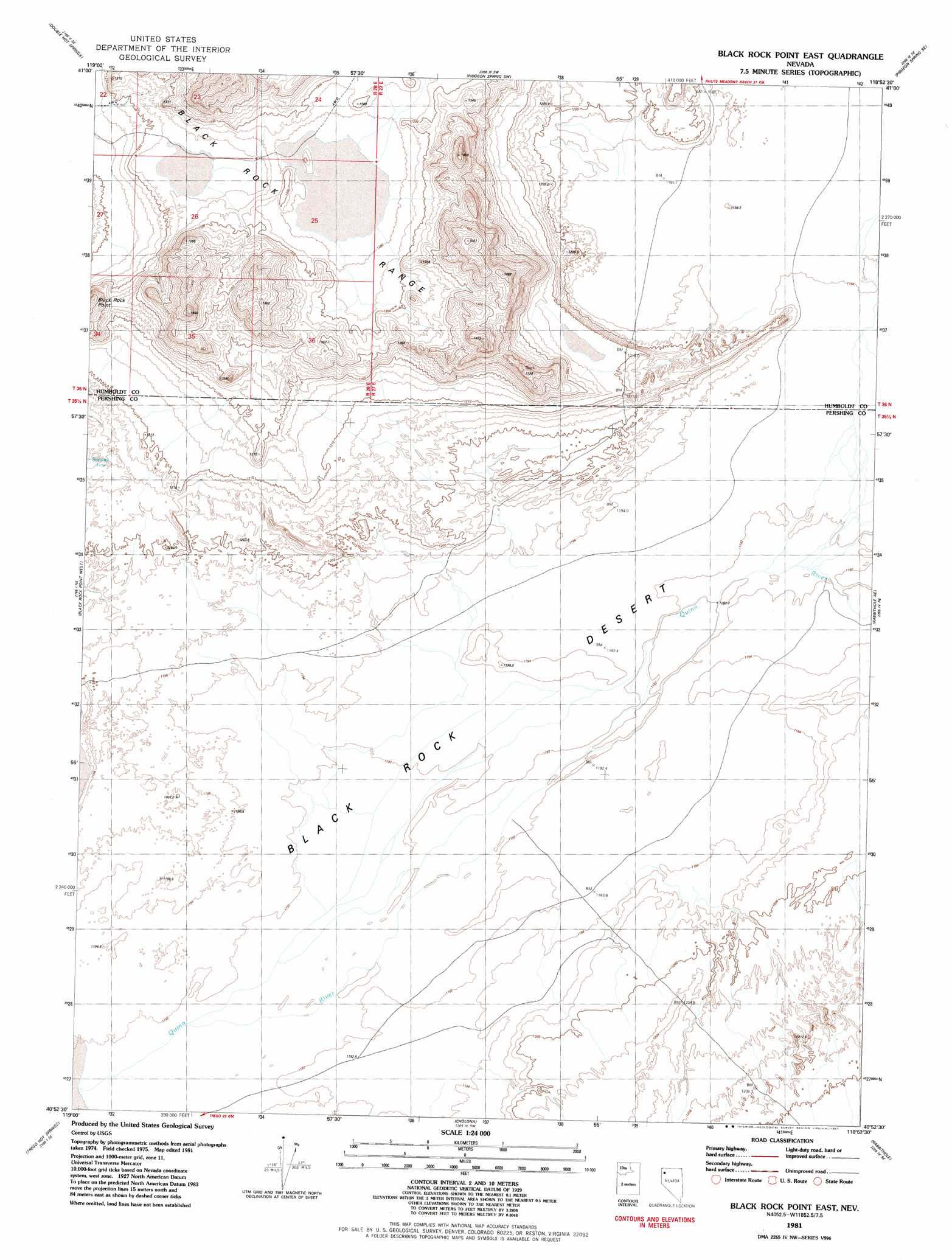
USGS Topo Quad 40118h8 - 1:24,000 scale
| Topo Map Name: | Black Rock Point East |
| USGS Topo Quad ID: | 40118h8 |
| Print Size: | ca. 21 1/4" wide x 27" high |
| Southeast Coordinates: | 40.875° N latitude / 118.875° W longitude |
| Map Center Coordinates: | 40.9375° N latitude / 118.9375° W longitude |
| U.S. State: | NV |
| Filename: | o40118h8.jpg |
| Download Map JPG Image: | Black Rock Point East topo map 1:24,000 scale |
| Map Type: | Topographic |
| Topo Series: | 7.5´ |
| Map Scale: | 1:24,000 |
| Source of Map Images: | United States Geological Survey (USGS) |
| Alternate Map Versions: |
Black Rock Point East NV 1981, updated 1981 Download PDF Buy paper map Black Rock Point East NV 2011 Download PDF Buy paper map Black Rock Point East NV 2014 Download PDF Buy paper map |
1:24,000 Topo Quads surrounding Black Rock Point East
Wagner Springs |
Clapper Creek |
Pidgeon Spring |
Crowbar Spring |
King Lear Peak Nw |
Donnelly Creek |
Double Hot Springs |
Pidgeon Spring Sw |
Pidgeon Spring Se |
Salt Water Spring |
Mormon Dan Peak |
Black Rock Point West |
Black Rock Point East |
Rabbithole Ne |
Floka |
Trego |
Trego Hot Springs |
Cholona |
Rabbithole |
Sulphur |
Dry Mountain Nw |
Dry Mountain |
Sheep Spring |
Dead Horse Canyon Ne |
Placerites |
> Back to 40118e1 at 1:100,000 scale
> Back to 40118a1 at 1:250,000 scale
> Back to U.S. Topo Maps home
Black Rock Point East topo map: Gazetteer
Black Rock Point East: Streams
Jackson Creek Slough elevation 1193m 3914′Black Rock Point East: Summits
Rocky Peak elevation 1501m 4924′Black Rock Point East digital topo map on disk
Buy this Black Rock Point East topo map showing relief, roads, GPS coordinates and other geographical features, as a high-resolution digital map file on DVD: