Tohakum Peak Se Topo Map Nevada
To zoom in, hover over the map of Tohakum Peak Se
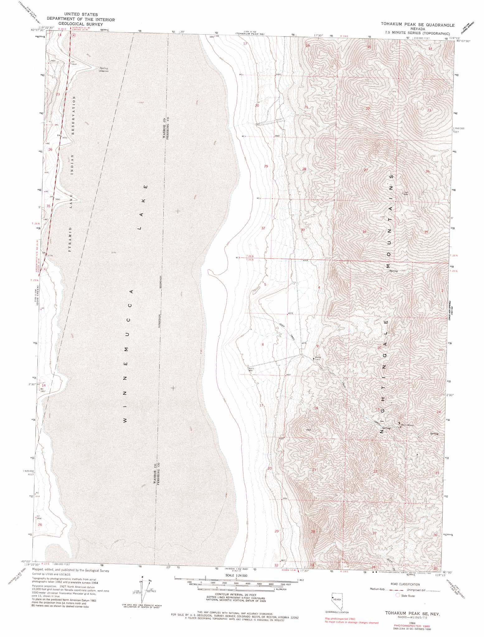
USGS Topo Quad 40119a3 - 1:24,000 scale
| Topo Map Name: | Tohakum Peak Se |
| USGS Topo Quad ID: | 40119a3 |
| Print Size: | ca. 21 1/4" wide x 27" high |
| Southeast Coordinates: | 40° N latitude / 119.25° W longitude |
| Map Center Coordinates: | 40.0625° N latitude / 119.3125° W longitude |
| U.S. State: | NV |
| Filename: | o40119a3.jpg |
| Download Map JPG Image: | Tohakum Peak Se topo map 1:24,000 scale |
| Map Type: | Topographic |
| Topo Series: | 7.5´ |
| Map Scale: | 1:24,000 |
| Source of Map Images: | United States Geological Survey (USGS) |
| Alternate Map Versions: |
Tohakum Peak SE NV 1964, updated 1965 Download PDF Buy paper map Tohakum Peak SE NV 1964, updated 1983 Download PDF Buy paper map Tohakum Peak SE NV 2011 Download PDF Buy paper map Tohakum Peak SE NV 2014 Download PDF Buy paper map |
1:24,000 Topo Quads surrounding Tohakum Peak Se
Fox Canyon |
San Emidio Desert South |
Purgatory Peak |
Jayhawk Well |
Juniper Pass |
Pyramid Ne |
Tohakum Peak Nw |
Tohakum Peak Ne |
Tunnel Spring |
Bob Spring |
Dove Creek |
Tohakum Peak Se |
Sage Hen Spring |
Bluewing Spring |
|
Sutcliffe |
Nixon Nw |
Russell Peak |
Black Warrior Peak |
Telephone Well |
Moses Rock |
Pah Rah Mountain |
Nixon |
Juniper Peak |
Hot Springs Flat |
> Back to 40119a1 at 1:100,000 scale
> Back to 40118a1 at 1:250,000 scale
> Back to U.S. Topo Maps home
Tohakum Peak Se topo map: Gazetteer
Tohakum Peak Se: Lakes
Winnemucca Lake elevation 1150m 3772′Tohakum Peak Se: Mines
M G L Mines elevation 1544m 5065′Tohakum Peak Se: Ranges
Nightingale Mountains elevation 2001m 6564′Tohakum Peak Se: Streams
Dove Creek elevation 1155m 3789′Tohakum Peak Se: Valleys
Sevenmile Canyon elevation 1162m 3812′Tohakum Peak Se digital topo map on disk
Buy this Tohakum Peak Se topo map showing relief, roads, GPS coordinates and other geographical features, as a high-resolution digital map file on DVD: