Spanish Flat Topo Map Nevada
To zoom in, hover over the map of Spanish Flat
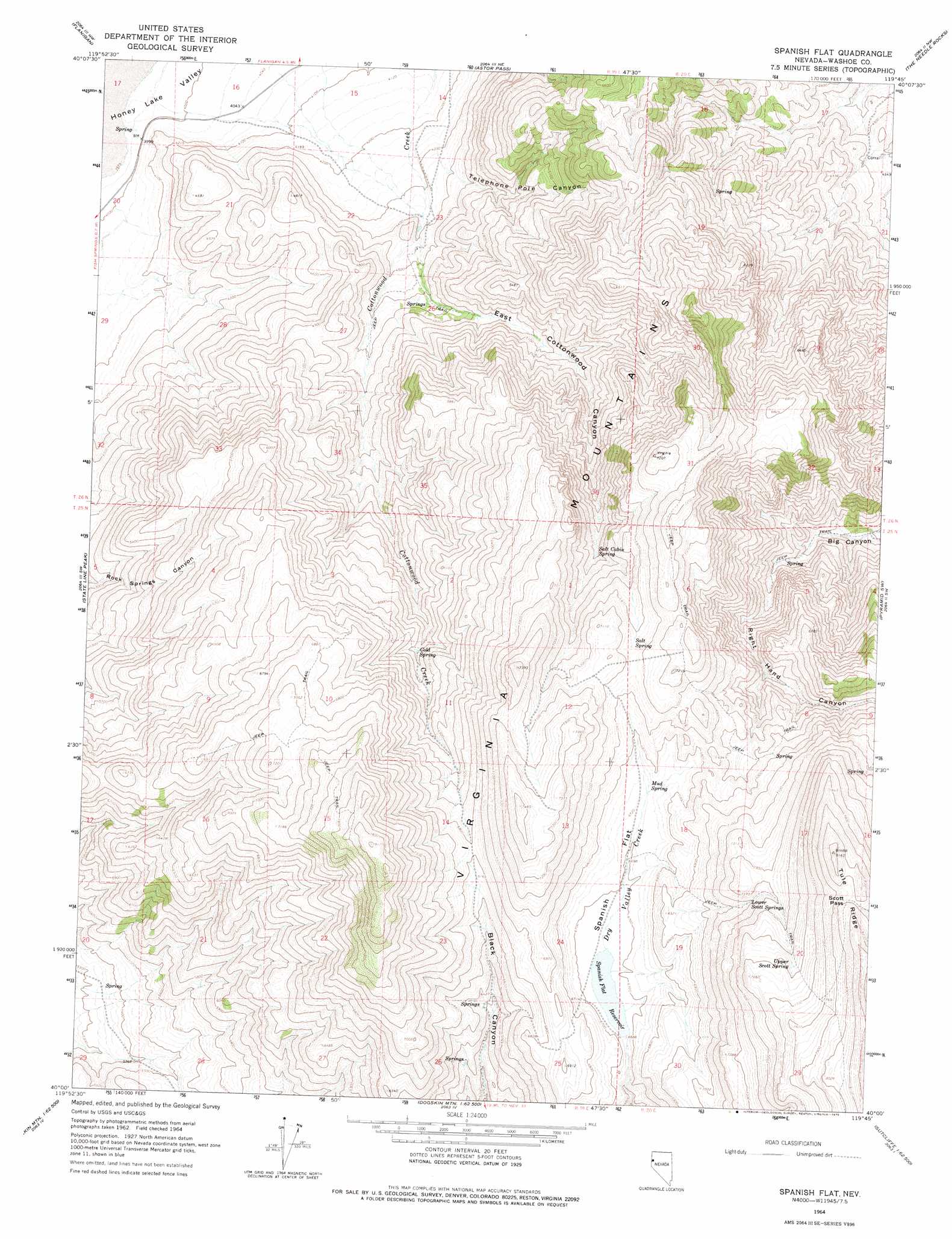
USGS Topo Quad 40119a7 - 1:24,000 scale
| Topo Map Name: | Spanish Flat |
| USGS Topo Quad ID: | 40119a7 |
| Print Size: | ca. 21 1/4" wide x 27" high |
| Southeast Coordinates: | 40° N latitude / 119.75° W longitude |
| Map Center Coordinates: | 40.0625° N latitude / 119.8125° W longitude |
| U.S. State: | NV |
| Filename: | o40119a7.jpg |
| Download Map JPG Image: | Spanish Flat topo map 1:24,000 scale |
| Map Type: | Topographic |
| Topo Series: | 7.5´ |
| Map Scale: | 1:24,000 |
| Source of Map Images: | United States Geological Survey (USGS) |
| Alternate Map Versions: |
Spanish Flat NV 1964, updated 1966 Download PDF Buy paper map Spanish Flat NV 1964, updated 1975 Download PDF Buy paper map Spanish Flat NV 2011 Download PDF Buy paper map Spanish Flat NV 2015 Download PDF Buy paper map |
1:24,000 Topo Quads surrounding Spanish Flat
Spencer Creek |
Parker Canyon |
Sand Pass |
Emerson Pass |
Fox Canyon |
Calneva |
Flanigan |
Astor Pass |
The Needle Rocks |
Pyramid Ne |
Doyle |
State Line Peak |
Spanish Flat |
Pyramid Sw |
|
Constantia |
Dogskin Mountain |
Tule Peak |
Sutcliffe |
|
Beckwourth Pass |
Granite Peak |
Bedell Flat |
Fraser Flat |
Moses Rock |
> Back to 40119a1 at 1:100,000 scale
> Back to 40118a1 at 1:250,000 scale
> Back to U.S. Topo Maps home
Spanish Flat topo map: Gazetteer
Spanish Flat: Dams
Spanish Flat Dam elevation 2038m 6686′Spanish Flat: Flats
Spanish Flat elevation 2046m 6712′Spanish Flat: Gaps
Scott Pass elevation 2438m 7998′Spanish Flat: Ranges
Virginia Mountains elevation 2411m 7910′Spanish Flat: Reservoirs
Spanish Flat Reservoir elevation 2038m 6686′Spanish Flat: Springs
Cold Spring elevation 1810m 5938′Government Trough Spring elevation 1617m 5305′
Lower Scott Springs elevation 2205m 7234′
Mocho Spring Number One elevation 1323m 4340′
Mud Spring elevation 2053m 6735′
Newcome Spring elevation 1623m 5324′
Salt Cabin Spring elevation 1965m 6446′
Salt Spring elevation 2121m 6958′
Upper Scott Spring elevation 2306m 7565′
Spanish Flat: Valleys
East Cottonwood Canyon elevation 1364m 4475′Red Light Canyon elevation 1403m 4603′
Right Hand Canyon elevation 1803m 5915′
Telephone Pole Canyon elevation 1313m 4307′
Spanish Flat digital topo map on disk
Buy this Spanish Flat topo map showing relief, roads, GPS coordinates and other geographical features, as a high-resolution digital map file on DVD: