Tohakum Peak Ne Topo Map Nevada
To zoom in, hover over the map of Tohakum Peak Ne
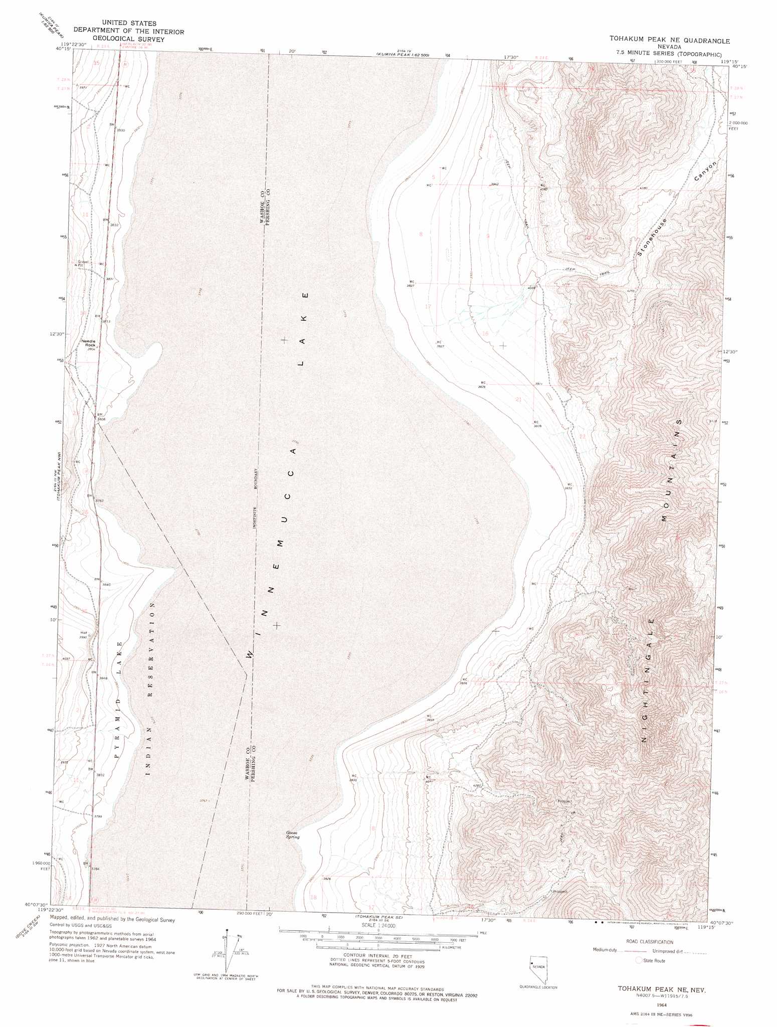
USGS Topo Quad 40119b3 - 1:24,000 scale
| Topo Map Name: | Tohakum Peak Ne |
| USGS Topo Quad ID: | 40119b3 |
| Print Size: | ca. 21 1/4" wide x 27" high |
| Southeast Coordinates: | 40.125° N latitude / 119.25° W longitude |
| Map Center Coordinates: | 40.1875° N latitude / 119.3125° W longitude |
| U.S. State: | NV |
| Filename: | o40119b3.jpg |
| Download Map JPG Image: | Tohakum Peak Ne topo map 1:24,000 scale |
| Map Type: | Topographic |
| Topo Series: | 7.5´ |
| Map Scale: | 1:24,000 |
| Source of Map Images: | United States Geological Survey (USGS) |
| Alternate Map Versions: |
Tohakum Peak NE NV 1964, updated 1965 Download PDF Buy paper map Tohakum Peak NE NV 1964, updated 1975 Download PDF Buy paper map Tohakum Peak NE NV 2011 Download PDF Buy paper map Tohakum Peak NE NV 2014 Download PDF Buy paper map |
1:24,000 Topo Quads surrounding Tohakum Peak Ne
Pah-Rum Peak |
San Emidio Desert North |
Kumiva Peak |
Betty Creek |
Twin Buttes Well |
Fox Canyon |
San Emidio Desert South |
Purgatory Peak |
Jayhawk Well |
Juniper Pass |
Pyramid Ne |
Tohakum Peak Nw |
Tohakum Peak Ne |
Tunnel Spring |
Bob Spring |
Dove Creek |
Tohakum Peak Se |
Sage Hen Spring |
Bluewing Spring |
|
Sutcliffe |
Nixon Nw |
Russell Peak |
Black Warrior Peak |
Telephone Well |
> Back to 40119a1 at 1:100,000 scale
> Back to 40118a1 at 1:250,000 scale
> Back to U.S. Topo Maps home
Tohakum Peak Ne topo map: Gazetteer
Tohakum Peak Ne: Parks
Winnemucca National Wildlife Refuge (historical) elevation 1153m 3782′Tohakum Peak Ne: Pillars
Needle Rock elevation 1175m 3854′Tohakum Peak Ne: Springs
Goose Spring elevation 1153m 3782′Tohakum Peak Ne: Valleys
Groundhog Canyon elevation 1154m 3786′Nugent Canyon elevation 1154m 3786′
Stonehouse Canyon elevation 1211m 3973′
Tohakum Peak Ne digital topo map on disk
Buy this Tohakum Peak Ne topo map showing relief, roads, GPS coordinates and other geographical features, as a high-resolution digital map file on DVD: