Tohakum Peak Nw Topo Map Nevada
To zoom in, hover over the map of Tohakum Peak Nw
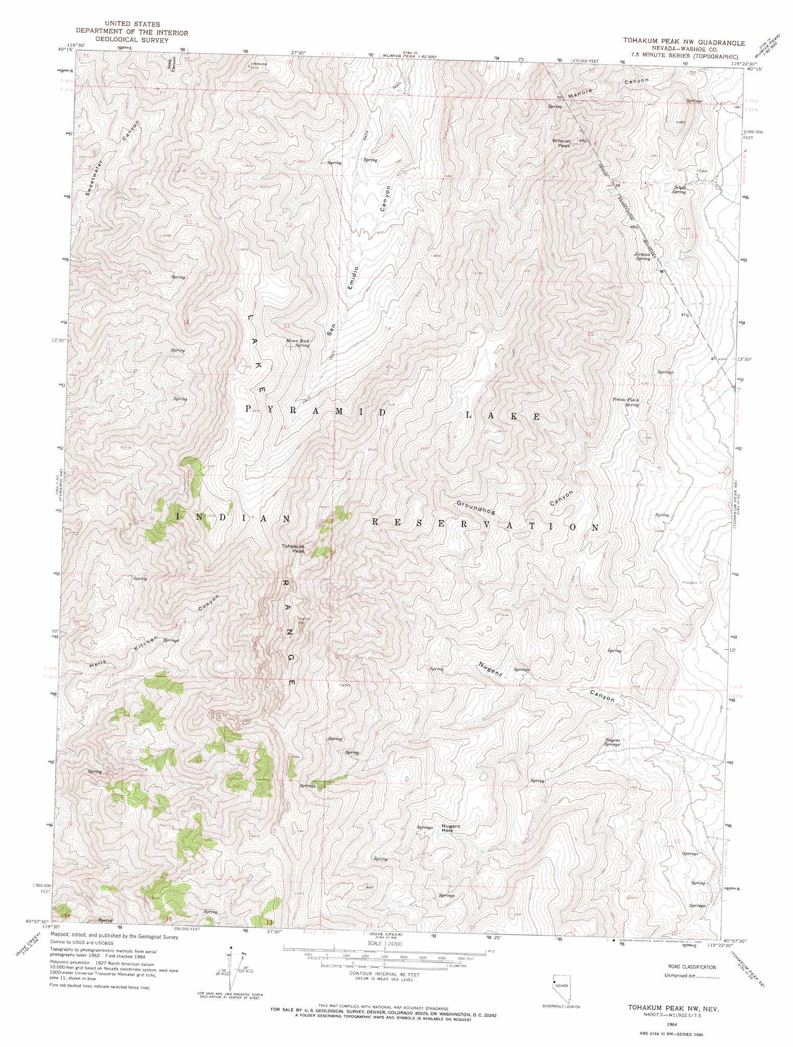
USGS Topo Quad 40119b4 - 1:24,000 scale
| Topo Map Name: | Tohakum Peak Nw |
| USGS Topo Quad ID: | 40119b4 |
| Print Size: | ca. 21 1/4" wide x 27" high |
| Southeast Coordinates: | 40.125° N latitude / 119.375° W longitude |
| Map Center Coordinates: | 40.1875° N latitude / 119.4375° W longitude |
| U.S. State: | NV |
| Filename: | o40119b4.jpg |
| Download Map JPG Image: | Tohakum Peak Nw topo map 1:24,000 scale |
| Map Type: | Topographic |
| Topo Series: | 7.5´ |
| Map Scale: | 1:24,000 |
| Source of Map Images: | United States Geological Survey (USGS) |
| Alternate Map Versions: |
Tohakum Peak NW NV 1964, updated 1965 Download PDF Buy paper map Tohakum Peak NW NV 2011 Download PDF Buy paper map Tohakum Peak NW NV 2014 Download PDF Buy paper map |
1:24,000 Topo Quads surrounding Tohakum Peak Nw
Reynard |
Pah-Rum Peak |
San Emidio Desert North |
Kumiva Peak |
Betty Creek |
Emerson Pass |
Fox Canyon |
San Emidio Desert South |
Purgatory Peak |
Jayhawk Well |
The Needle Rocks |
Pyramid Ne |
Tohakum Peak Nw |
Tohakum Peak Ne |
Tunnel Spring |
Pyramid Sw |
Dove Creek |
Tohakum Peak Se |
Sage Hen Spring |
|
Tule Peak |
Sutcliffe |
Nixon Nw |
Russell Peak |
Black Warrior Peak |
> Back to 40119a1 at 1:100,000 scale
> Back to 40118a1 at 1:250,000 scale
> Back to U.S. Topo Maps home
Tohakum Peak Nw topo map: Gazetteer
Tohakum Peak Nw: Basins
Nugent Hole elevation 1593m 5226′Tohakum Peak Nw: Gaps
Fremont Pass elevation 1823m 5980′Tohakum Peak Nw: Ranges
Lake Range elevation 2433m 7982′Tohakum Peak Nw: Springs
Jackass Spring elevation 1369m 4491′Moses Rock Spring elevation 1927m 6322′
Nugent Springs elevation 1310m 4297′
Potato Patch Spring elevation 1368m 4488′
Schell Spring elevation 1273m 4176′
Tohakum Peak Nw: Summits
Tohakum Peak elevation 2459m 8067′Wildcat Peak elevation 1750m 5741′
Tohakum Peak Nw: Valleys
Manure Canyon elevation 1235m 4051′Tohakum Peak Nw digital topo map on disk
Buy this Tohakum Peak Nw topo map showing relief, roads, GPS coordinates and other geographical features, as a high-resolution digital map file on DVD: