Flanigan Topo Map Nevada
To zoom in, hover over the map of Flanigan
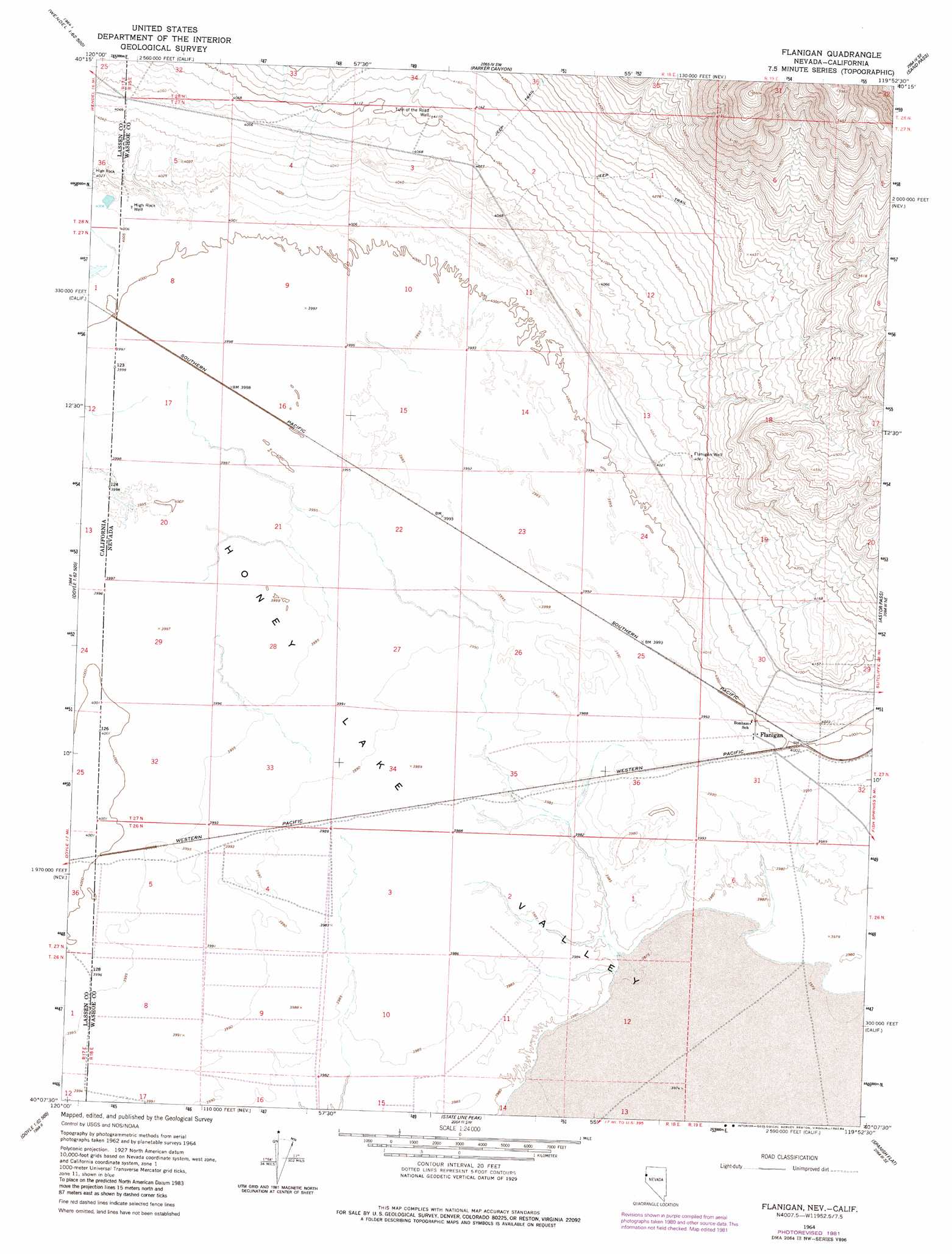
USGS Topo Quad 40119b8 - 1:24,000 scale
| Topo Map Name: | Flanigan |
| USGS Topo Quad ID: | 40119b8 |
| Print Size: | ca. 21 1/4" wide x 27" high |
| Southeast Coordinates: | 40.125° N latitude / 119.875° W longitude |
| Map Center Coordinates: | 40.1875° N latitude / 119.9375° W longitude |
| U.S. States: | NV, CA |
| Filename: | o40119b8.jpg |
| Download Map JPG Image: | Flanigan topo map 1:24,000 scale |
| Map Type: | Topographic |
| Topo Series: | 7.5´ |
| Map Scale: | 1:24,000 |
| Source of Map Images: | United States Geological Survey (USGS) |
| Alternate Map Versions: |
Flanigan NV 1964, updated 1966 Download PDF Buy paper map Flanigan NV 1964, updated 1978 Download PDF Buy paper map Flanigan NV 1964, updated 1982 Download PDF Buy paper map Flanigan NV 1964, updated 1984 Download PDF Buy paper map Flanigan NV 2011 Download PDF Buy paper map Flanigan NV 2014 Download PDF Buy paper map |
1:24,000 Topo Quads surrounding Flanigan
Little Mud Flat |
Bull Flat |
Red Rock Canyon |
Sheepshead Spring |
Reynard |
Wendel |
Spencer Creek |
Parker Canyon |
Sand Pass |
Emerson Pass |
Herlong |
Calneva |
Flanigan |
Astor Pass |
The Needle Rocks |
Mckesick Peak |
Doyle |
State Line Peak |
Spanish Flat |
Pyramid Sw |
Frenchman Lake |
Constantia |
Dogskin Mountain |
Tule Peak |
> Back to 40119a1 at 1:100,000 scale
> Back to 40118a1 at 1:250,000 scale
> Back to U.S. Topo Maps home
Flanigan topo map: Gazetteer
Flanigan: Populated Places
Flanigan elevation 1221m 4005′Flanigan: Post Offices
Flanigan Post Office (historical) elevation 1221m 4005′Flanigan: Wells
Flanigan Well elevation 1237m 4058′High Rock Well elevation 1221m 4005′
Turn of the Road Well elevation 1253m 4110′
Flanigan digital topo map on disk
Buy this Flanigan topo map showing relief, roads, GPS coordinates and other geographical features, as a high-resolution digital map file on DVD: