Salt Marsh Topo Map Nevada
To zoom in, hover over the map of Salt Marsh
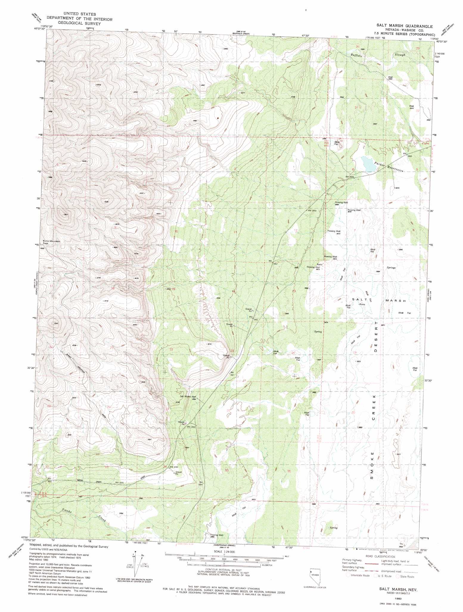
USGS Topo Quad 40119e7 - 1:24,000 scale
| Topo Map Name: | Salt Marsh |
| USGS Topo Quad ID: | 40119e7 |
| Print Size: | ca. 21 1/4" wide x 27" high |
| Southeast Coordinates: | 40.5° N latitude / 119.75° W longitude |
| Map Center Coordinates: | 40.5625° N latitude / 119.8125° W longitude |
| U.S. State: | NV |
| Filename: | o40119e7.jpg |
| Download Map JPG Image: | Salt Marsh topo map 1:24,000 scale |
| Map Type: | Topographic |
| Topo Series: | 7.5´ |
| Map Scale: | 1:24,000 |
| Source of Map Images: | United States Geological Survey (USGS) |
| Alternate Map Versions: |
Salt Marsh NV 1980, updated 1980 Download PDF Buy paper map Salt Marsh NV 2011 Download PDF Buy paper map Salt Marsh NV 2014 Download PDF Buy paper map |
1:24,000 Topo Quads surrounding Salt Marsh
Buckhorn Canyon |
Hole In The Ground |
Eddies Garden |
Poodle Mountain |
Squaw Valley |
Al Shinn Canyon |
Mixie Flat |
Buffalo Creek |
Horse Canyon |
Wall Spring |
Cherry Mountain |
Smoke Creek Ranch |
Salt Marsh |
Hog Spring |
Smith Canyon |
Bull Flat |
Red Rock Canyon |
Sheepshead Spring |
Reynard |
Pah-Rum Peak |
Spencer Creek |
Parker Canyon |
Sand Pass |
Emerson Pass |
Fox Canyon |
> Back to 40119e1 at 1:100,000 scale
> Back to 40118a1 at 1:250,000 scale
> Back to U.S. Topo Maps home
Salt Marsh topo map: Gazetteer
Salt Marsh: Dams
Dewey Parker Dam Number One elevation 1188m 3897′Dewey Parker Dam Number Two elevation 1185m 3887′
Salt Marsh: Flats
Salt Marsh elevation 1179m 3868′Salt Marsh: Reservoirs
Dewey Parker Reservoir elevation 1187m 3894′Dewey Parker Reservoir Number Two elevation 1184m 3884′
Parker Reservoirs elevation 1187m 3894′
Salt Marsh: Springs
Buffalo Spring elevation 1189m 3900′Salt Marsh: Wells
Salt Works Well elevation 1205m 3953′Salt Marsh digital topo map on disk
Buy this Salt Marsh topo map showing relief, roads, GPS coordinates and other geographical features, as a high-resolution digital map file on DVD: