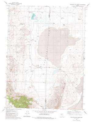
Hualapai Flat South Topo Map Nevada
To zoom in, hover over the map of Hualapai Flat South
USGS Topo Quad 40119g3 - 1:24,000 scale
| Topo Map Name: | Hualapai Flat South |
| USGS Topo Quad ID: | 40119g3 |
| Print Size: | ca. 21 1/4" wide x 27" high |
| Southeast Coordinates: | 40.75° N latitude / 119.25° W longitude |
| Map Center Coordinates: | 40.8125° N latitude / 119.3125° W longitude |
| U.S. State: | NV |
| Filename: | o40119g3.jpg |
| Download Map JPG Image: | Hualapai Flat South topo map 1:24,000 scale |
| Map Type: | Topographic |
| Topo Series: | 7.5´ |
| Map Scale: | 1:24,000 |
| Source of Map Images: | United States Geological Survey (USGS) |
| Alternate Map Versions: |
Hualapai Flat South NV 1980, updated 1984 Download PDF Buy paper map Hualapai Flat South NV 2011 Download PDF Buy paper map Hualapai Flat South NV 2014 Download PDF Buy paper map |
1:24,000 Topo Quads surrounding Hualapai Flat South
> Back to 40119e1 at 1:100,000 scale
> Back to 40118a1 at 1:250,000 scale
> Back to U.S. Topo Maps home
Hualapai Flat South topo map: Gazetteer
Hualapai Flat South: Dams
Fly Reservoir Dam elevation 1223m 4012′Hualapai Flat South: Flats
Hualapai Flat elevation 1217m 3992′Hualapai Flat South: Populated Places
Hot Springs (historical) elevation 1224m 4015′Hualapai Flat South: Post Offices
Hot Springs Post Office (historical) elevation 1224m 4015′Hualapai Flat South: Reservoirs
Fly Reservoir elevation 1223m 4012′Hualapai Flat South: Springs
Barker Springs elevation 1261m 4137′Cottonwood Springs elevation 1223m 4012′
Goose Springs elevation 1208m 3963′
South Springs elevation 1209m 3966′
The Geyser elevation 1225m 4019′
Wards Hot Spring elevation 1220m 4002′
Hualapai Flat South: Streams
Barker Creek elevation 1229m 4032′Cottonwood Creek elevation 1223m 4012′
Granite Creek elevation 1208m 3963′
Little Cottonwood Creek elevation 1205m 3953′
Red Mountain Creek elevation 1205m 3953′
Rock Creek elevation 1219m 3999′
South Willow Creek elevation 1206m 3956′
Hualapai Flat South: Summits
Finley Butte elevation 1251m 4104′Hualapai Flat South: Wells
John Casey Steam Well elevation 1224m 4015′The Geyser Well elevation 1219m 3999′
Hualapai Flat South digital topo map on disk
Buy this Hualapai Flat South topo map showing relief, roads, GPS coordinates and other geographical features, as a high-resolution digital map file on DVD:


