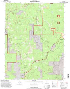
Fredonyer Pass Topo Map California
To zoom in, hover over the map of Fredonyer Pass
USGS Topo Quad 40120c7 - 1:24,000 scale
| Topo Map Name: | Fredonyer Pass |
| USGS Topo Quad ID: | 40120c7 |
| Print Size: | ca. 21 1/4" wide x 27" high |
| Southeast Coordinates: | 40.25° N latitude / 120.75° W longitude |
| Map Center Coordinates: | 40.3125° N latitude / 120.8125° W longitude |
| U.S. State: | CA |
| Filename: | o40120c7.jpg |
| Download Map JPG Image: | Fredonyer Pass topo map 1:24,000 scale |
| Map Type: | Topographic |
| Topo Series: | 7.5´ |
| Map Scale: | 1:24,000 |
| Source of Map Images: | United States Geological Survey (USGS) |
| Alternate Map Versions: |
Fredonyer Pass CA 1980, updated 1980 Download PDF Buy paper map Fredonyer Pass CA 1995, updated 1997 Download PDF Buy paper map Fredonyer Pass CA 1995, updated 1997 Download PDF Buy paper map Fredonyer Pass CA 2012 Download PDF Buy paper map Fredonyer Pass CA 2015 Download PDF Buy paper map |
| FStopo: | US Forest Service topo Fredonyer Pass is available: Download FStopo PDF Download FStopo TIF |
1:24,000 Topo Quads surrounding Fredonyer Pass
> Back to 40120a1 at 1:100,000 scale
> Back to 40120a1 at 1:250,000 scale
> Back to U.S. Topo Maps home
Fredonyer Pass topo map: Gazetteer
Fredonyer Pass: Gaps
Fredonyer Pass elevation 1753m 5751′Fredonyer Pass: Streams
Bear Valley Creek elevation 1430m 4691′East Fork Willard Creek elevation 1473m 4832′
Roxie Peconom Creek elevation 1492m 4895′
West Branch Lights Creek elevation 1394m 4573′
Fredonyer Pass: Summits
Cairn Butte elevation 2224m 7296′Coyote Peak elevation 2321m 7614′
Hamilton Mountain elevation 2237m 7339′
Indicator Peak elevation 2283m 7490′
Fredonyer Pass digital topo map on disk
Buy this Fredonyer Pass topo map showing relief, roads, GPS coordinates and other geographical features, as a high-resolution digital map file on DVD:


