Little Mud Flat Topo Map California
To zoom in, hover over the map of Little Mud Flat
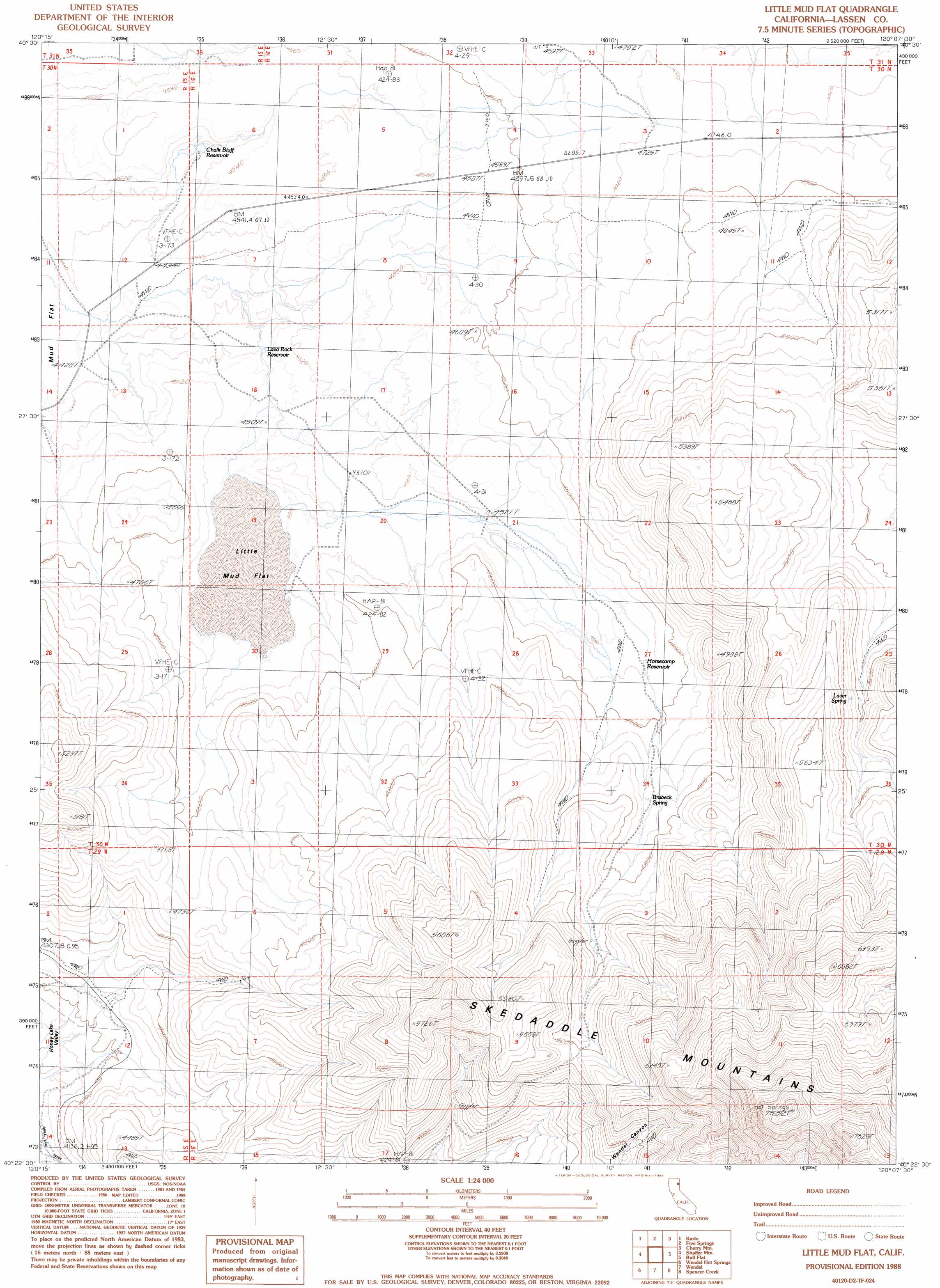
USGS Topo Quad 40120d2 - 1:24,000 scale
| Topo Map Name: | Little Mud Flat |
| USGS Topo Quad ID: | 40120d2 |
| Print Size: | ca. 21 1/4" wide x 27" high |
| Southeast Coordinates: | 40.375° N latitude / 120.125° W longitude |
| Map Center Coordinates: | 40.4375° N latitude / 120.1875° W longitude |
| U.S. State: | CA |
| Filename: | o40120d2.jpg |
| Download Map JPG Image: | Little Mud Flat topo map 1:24,000 scale |
| Map Type: | Topographic |
| Topo Series: | 7.5´ |
| Map Scale: | 1:24,000 |
| Source of Map Images: | United States Geological Survey (USGS) |
| Alternate Map Versions: |
Little Mud Flat CA 1988, updated 1989 Download PDF Buy paper map Little Mud Flat CA 2012 Download PDF Buy paper map Little Mud Flat CA 2015 Download PDF Buy paper map |
1:24,000 Topo Quads surrounding Little Mud Flat
West Of Snowstorm Mountain |
Snowstorm Mountain |
Shinn Mountain |
Al Shinn Canyon |
Mixie Flat |
Petes Valley |
Karlo |
Five Springs |
Cherry Mountain |
Smoke Creek Ranch |
Litchfield |
Shaffer Mountain |
Little Mud Flat |
Bull Flat |
Red Rock Canyon |
Standish |
Wendel Hot Springs |
Wendel |
Spencer Creek |
Parker Canyon |
Stony Ridge |
Milford |
Herlong |
Calneva |
Flanigan |
> Back to 40120a1 at 1:100,000 scale
> Back to 40120a1 at 1:250,000 scale
> Back to U.S. Topo Maps home
Little Mud Flat topo map: Gazetteer
Little Mud Flat: Flats
Little Mud Flat elevation 1368m 4488′Little Mud Flat: Reservoirs
Chalk Bluff Reservoir elevation 1380m 4527′Horsecamp Reservoir elevation 1391m 4563′
Lava Rock Reservoir elevation 1361m 4465′
Mud Flat Reservoir elevation 1382m 4534′
Little Mud Flat: Springs
Brubeck Spring elevation 1439m 4721′Laver Spring elevation 1614m 5295′
Little Mud Flat digital topo map on disk
Buy this Little Mud Flat topo map showing relief, roads, GPS coordinates and other geographical features, as a high-resolution digital map file on DVD: