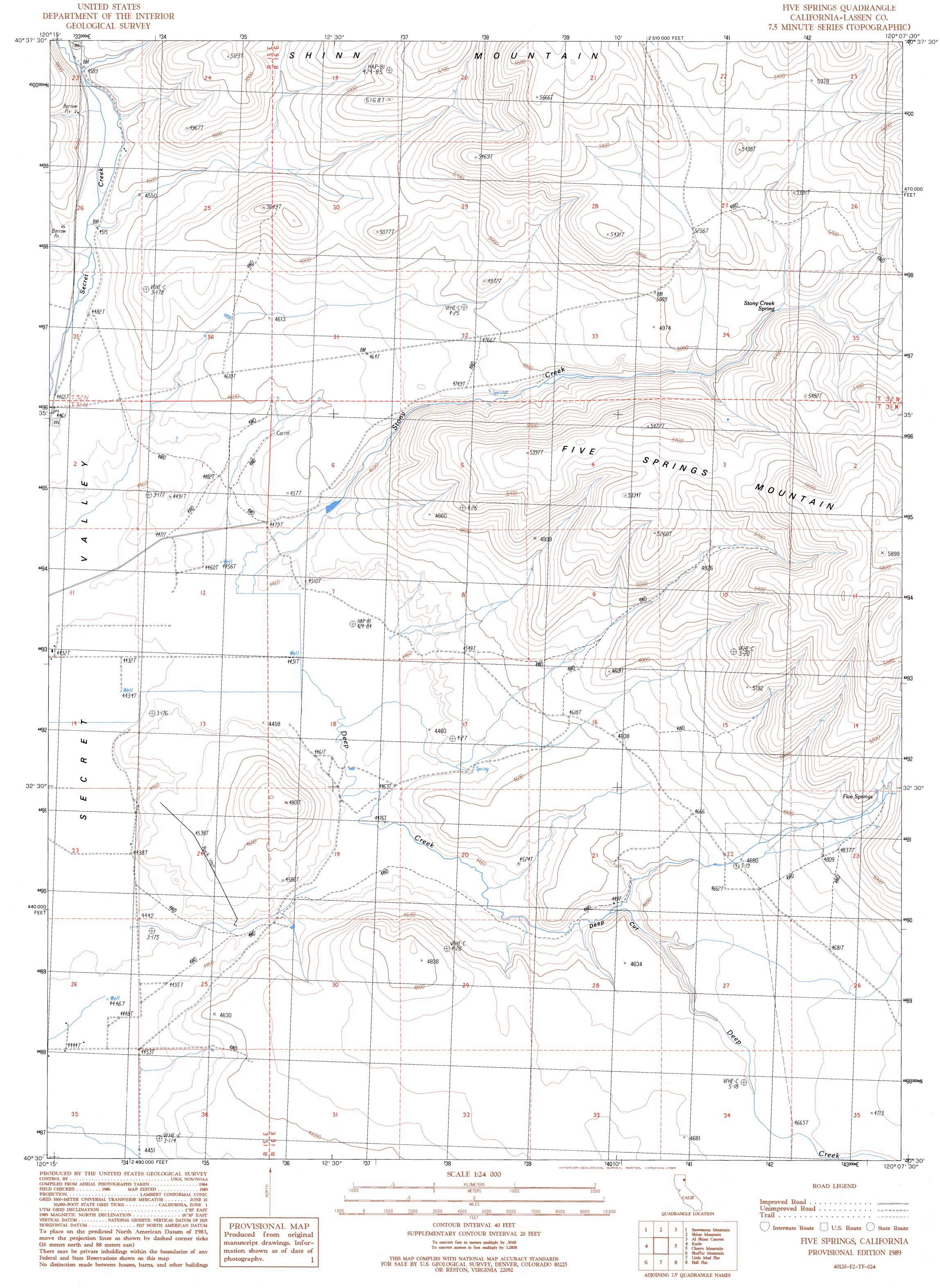
Five Springs Topo Map California
To zoom in, hover over the map of Five Springs
USGS Topo Quad 40120e2 - 1:24,000 scale
| Topo Map Name: | Five Springs |
| USGS Topo Quad ID: | 40120e2 |
| Print Size: | ca. 21 1/4" wide x 27" high |
| Southeast Coordinates: | 40.5° N latitude / 120.125° W longitude |
| Map Center Coordinates: | 40.5625° N latitude / 120.1875° W longitude |
| U.S. State: | CA |
| Filename: | o40120e2.jpg |
| Download Map JPG Image: | Five Springs topo map 1:24,000 scale |
| Map Type: | Topographic |
| Topo Series: | 7.5´ |
| Map Scale: | 1:24,000 |
| Source of Map Images: | United States Geological Survey (USGS) |
| Alternate Map Versions: |
Five Springs CA 1989, updated 1989 Download PDF Buy paper map Five Springs CA 2012 Download PDF Buy paper map Five Springs CA 2015 Download PDF Buy paper map |
1:24,000 Topo Quads surrounding Five Springs
Termo |
Ravendale |
Observation Peak |
Buckhorn Canyon |
Hole In The Ground |
West Of Snowstorm Mountain |
Snowstorm Mountain |
Shinn Mountain |
Al Shinn Canyon |
Mixie Flat |
Petes Valley |
Karlo |
Five Springs |
Cherry Mountain |
Smoke Creek Ranch |
Litchfield |
Shaffer Mountain |
Little Mud Flat |
Bull Flat |
Red Rock Canyon |
Standish |
Wendel Hot Springs |
Wendel |
Spencer Creek |
Parker Canyon |
> Back to 40120e1 at 1:100,000 scale
> Back to 40120a1 at 1:250,000 scale
> Back to U.S. Topo Maps home
Five Springs topo map: Gazetteer
Five Springs: Springs
Five Springs elevation 1532m 5026′Stony Creek Spring elevation 1550m 5085′
Five Springs: Streams
Stony Creek elevation 1356m 4448′Five Springs: Valleys
Deep Cut elevation 1361m 4465′Five Springs digital topo map on disk
Buy this Five Springs topo map showing relief, roads, GPS coordinates and other geographical features, as a high-resolution digital map file on DVD: